1990s Maps of Cecil County, Maryland
Explore 13 historic maps of Cecil County from the 1990s. These maps offer a rare glimpse into what life looked like during the 1990s — showing old roads, neighborhoods, homes, and landmarks that have changed or disappeared over time.
Whether you're researching your family's past, planning a metal detecting trip, or studying how Cecil County's landscape evolved across the 1990s, these high-resolution maps are a powerful tool for exploring the history of this region.
- Focus on a specific era: All maps on this page are from the 1990s, giving you a focused view of this time period.
- See what’s changed: Compare century-old streets, trails, and buildings to today's modern landscape using overlays and satellite layers.
- Research with precision: Use these maps for genealogy, historical research, land use analysis, or educational projects.
- View, download, or print: Maps are fully viewable online in high resolution, and can be downloaded or printed for your own records.
Start exploring Cecil County's history through authentic maps from the 1990s. This is your window into the past.
Cecil County, MD maps
(13)- 1992 Map of Rising Sun, 1993 Print
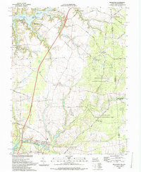
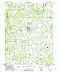 1992 Rising Sun1993 Print · USGSMaryland's northern border country is captured here in the early 1990s, centering on the historic crossroads of Rising Sun. Genealogists and historians can trace the Mason and Dixon Line, the West Nottingham Academy, and local industry at the Wood Chromite Mine.
 - 1992 Map of Bay View, 1993 Print
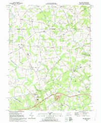 1992 Bay View1993 Print · USGSMaryland and Pennsylvania meet in this early 1990s record of northeastern Cecil County, showing a landscape defined by rolling creeks and rural crossroads. Genealogists and historians can locate Rosebank Cem, Elk Mills, and the historic Covered Bridge near Peacedale.
 - 1992 Map of Newark West, 1993 Print
 1992 Newark West1993 Print · USGSThe borderlands of Maryland, Delaware, and Pennsylvania are shown in the early nineties, centered on the equestrian landscapes of Fair Hill. Trace family roots at the Welsh Tract Ch or locate the Fair Hill Training Center and Elk Mills.3 unique versions available
 - 1992 Map of Elkton, 1993 Print
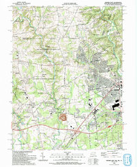
 1992 Elkton1993 Print · USGSMaryland and Delaware meet along this corridor in the early nineties as suburban expansion reaches the historic Cecil County seat. Genealogists can trace family names and sites from Gilpin Cem and Crouch Chapel to the industrial legacy of the Chesapeake and Delaware Canal.
 - 1992 Map of Havre De Grace, 1993 Print
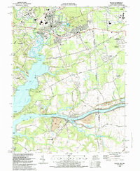
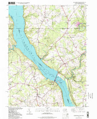
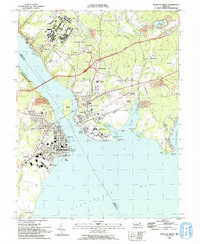 1992 Havre De Grace1993 Print · USGSThe northern reaches of the Chesapeake Bay are frozen in time in the early nineties, documenting the critical river crossings at Havre De Grace and Perryville. Researchers can trace the legacy of the Principio Furnace, locate the Concord Pt Lighthouse, and find family history at Mt Erin Cem or Patterson Cem.
 - 1992 Map of North East, 1993 Print
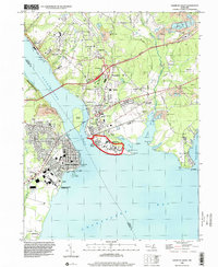
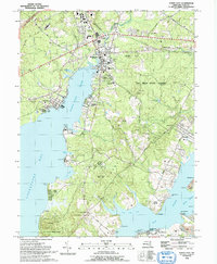 1992 North East1993 Print · USGSCecil County’s coastal landscape is captured here in the early nineties, showing the peninsula between the North East River and Elk River. Researchers can trace local landmarks like The Tome Sch, the Bethel Ch Cem, and the historic waterfront at Old Town Pt Wharf.
 - 1992 Map of Conowingo Dam, 1995 Print
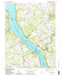 1992 Conowingo Dam1995 Print · USGSThe Susquehanna River valley at the Maryland-Pennsylvania border is shown here during the late twentieth century, centered on the Conowingo Dam. Genealogists and historians can trace family locations near St Patricks Ch, the Mason and Dixon Line, and the old settlement of Rowlandsville.
 - 1993 Map of Cecilton
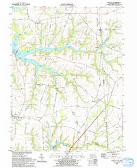 1993 Cecilton1993 Print · USGSThe Maryland-Delaware borderlands near the Sassafras River come into focus in the early nineties, showing a landscape defined by tidal creeks and historic necks. Genealogists and local researchers can trace sites like St Francis Xavier Ch, Bohemia Mills, and the small settlement at Cayots.
 - 1993 Map of Millington
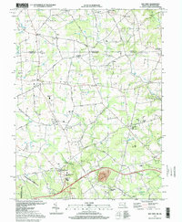
 1993 Millington1993 Print · USGSThe Upper Eastern Shore at the start of the nineties reveals a landscape of river landings and wooded management areas. Trace the quiet crossroads of Massey and Golts or locate family sites at St Clements Ch and Shorewood.
 - 1995 Map of Conowingo Dam, 1999 Print
 1995 Conowingo Dam1999 Print · USGSThe Susquehanna River borderlands in the late twentieth century highlight the massive Conowingo Dam and the historical Mason and Dixon Line. Genealogists and local historians can trace family locations near Darlington, Rowlandsville, and Harmony Chapel.
 - 1997 Map of Bay View, 1999 Print
 1997 Bay View1999 Print · USGSMaryland's northern border with Pennsylvania comes into focus in the late nineties, showcasing a landscape of established crossroads and rural institutions. Genealogists and historians can trace family lines through sites like Mt Olivet Cem, St Johns Ch Cem, and the community of Lombard.
 - 1998 Map of Rising Sun, 2000 Print
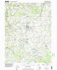 1998 Rising Sun2000 Print · USGSIn the late 1990s, the Maryland-Pennsylvania borderlands remained a mix of historic institutional sites and industrial remnants. Researchers can trace the Mason and Dixon Line through Rising Sun or locate the Wood Chromite Mine and the historic West Nottingham Academy.
 - 1998 Map of Havre De Grace, 2000 Print
 1998 Havre De Grace2000 Print · USGSThe Susquehanna meets the Chesapeake in this late-century study of a vital Maryland junction. Researchers can trace the legacy of the Perry Point VA Medical Center, locate Principio Furnace, and find family names at Patterson Cem or Mt Erin Cem.
End of results
Showing maps 1-13 of 13
Top cities of Cecil County
- Elkton historical maps
- Perryville historical maps
- North East historical maps
- Rising Sun historical maps
- Charlestown historical maps
- Chesapeake City historical maps
See more
Frequently asked questions
- What are the different types of historical maps available for Cecil County?
- What is the oldest map of Cecil County?
- Where can I purchase historical maps of Cecil County for my home or office?
- Where can I download high-res historical maps of Cecil County?
- Are there historical topographic maps available for Cecil County?
- Is there historical aerial imagery available for Cecil County?
- Where are historical maps of Cecil County sourced from?