Old Maps of Rocky Hook, Maryland for Academic Research
Study the evolution of Rocky Hook with 16 high-resolution historic maps. Whether you're teaching, researching, or modeling changes in land use, these maps provide essential visual documentation of urban, environmental, and geographic change.
- Analyze long-term change: Track patterns in development, transportation, and natural features.
- Ideal for environmental or urban studies: Support academic projects with primary historical map data.
- Use in the classroom or lab: Educators and researchers rely on these maps to bring historical context to life.
These maps are a powerful tool for teaching, research, and visualizing how Rocky Hook has changed over the decades.
Rocky Hook, MD maps
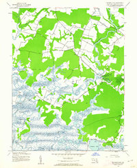
(16)- 1903 Map of Nanticoke
 1903 Nanticoke1903 Print · USGSThe Nanticoke River and Fishing Bay define this era of Eastern Shore life at the opening of the twentieth century. Genealogists can trace family names at waterfront landings like Lewis Ldg. or find early rail connections at Vienna and Mardela Springs.4 unique versions available
 - 1942 Map of Chicamacomico, 1962 Print
 1942 Chicamacomico1962 Print · USGSDorchester County's intricate Eastern Shore waterways are captured here during the early 1940s, showing a world of isolated landings and marshland peninsulas. Genealogists and historians can locate family landmarks like Eagle Hall, the Bestpitch Ferry crossing, and rural congregations at Waters Ch.2 unique versions available
 - 1943 Map of Chicamacomico
 1943 Chicamacomico1943 Print · USGSDorchester County's river-laced landscape is captured here during the early 1940s, showing a world of tidal necks and isolated landings. Researchers can trace the heritage of Bestpitch and Cokeland, or locate family sites near Waters Church and Brick House Ldg.
 - 1946 Map of Salisbury, 1948 Print
 1946 Salisbury1948 Print · USGSThe Delmarva Peninsula in the late nineteen-forties shows a landscape defined by its deep river arteries and emerging coastal defenses. Genealogists and historians can trace rail-connected towns like Federalsburg or locate maritime landmarks such as the Ocean City Seaplane Base and Fort Miles Military Reservation.4 unique versions available
 - 1947 Map of Salisbury, 1948 Print
 1947 Salisbury1948 Print · USGSThe Delmarva Peninsula in the late forties reveals a coastal landscape of maritime defense and growing seaside towns. Trace the post-war footprint of Salisbury, the strategic Fort Miles Military Reservation, and the Ocean City Seaplane Base.
 - 1948 Map of Salisbury, 1951 Print
 1948 Salisbury1951 Print · USGSThe Delmarva Peninsula in the late 1940s is shown here as a busy network of rail-towns and coastal outposts. Researchers can trace the legacy of the Pennsylvania Railroad through inland hubs like Georgetown or the maritime reaches of Crisfield and Cape May.
 - 1957 Map of Salisbury
 1957 Salisbury1957 Print · USGSThe Delmarva Peninsula in the mid-1950s reveals a landscape of coastal defenses and rail-driven commerce. Researchers can trace the Pennsylvania railroad lines or locate historic landmarks like the Fenwick Island Lighthouse and St Martin church.
 - 1961 Map of Salisbury
 1961 Salisbury1961 Print · USGSThe Delmarva Peninsula comes into focus in the early sixties, showing the vital road and rail networks connecting the Chesapeake to the Atlantic. Genealogists and historians can trace family-named landings and coastal landmarks from Crisfield to the Brandywine Shoal Lighthouse.
 - 1965 Map of Salisbury
 1965 Salisbury1965 Print · USGSThe Delmarva Peninsula in the mid-1960s is depicted here as a landscape of coastal defenses and maritime hubs. Genealogists and local historians can trace the foundations of bayside towns like Crisfield and the tactical positioning of the Fort Miles Military Reservation and Cape May Naval Air Station.
 - 1982 Map of Chicamacomico River, 1983 Print
 1982 Chicamacomico River1983 Print · USGSDorchester County's intricate shoreline and tidal marshes are captured here in the late seventies, showing a landscape defined by the Chicamacomico River. Researchers can locate family landmarks like Eagle Hall and Griffith Neck, or trace old landings at Cedar Landing and Brick House Landing.2 unique versions available
 - 1983 Map of Salisbury, 1984 Print
 1983 Salisbury1984 Print · USGSThe Lower Eastern Shore was a landscape of tide and timber in the early eighties, from the bustling streets of Salisbury to the wild coast of Assateague Island. Researchers can trace the rail-and-road network of the Conrail and U S Highway 50 while locating historic centers like Princess Anne and Crisfield.
 - 2011 Map of Chicamacomico River, 2011 Print
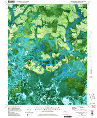
 2011 Chicamacomico River2011 Print · USGSCovers Rocky Hook, including Cedar Landing, Bestpitch, and other nearby areas
 - 2014 Map of Chicamacomico River, 2014 Print
 2014 Chicamacomico River2014 Print · USGSCovers Rocky Hook, including Cedar Landing, Bestpitch, and other nearby areas
 - 2016 Map of Chicamacomico River, 2016 Print
 2016 Chicamacomico River2016 Print · USGSCovers Rocky Hook, including Cedar Landing, Bestpitch, and other nearby areas
 - 2019 Map of Chicamacomico River, 2019 Print
 2019 Chicamacomico River2019 Print · USGSCovers Rocky Hook, including Cedar Landing, Bestpitch, and other nearby areas
 - 2023 Map of Chicamacomico River, 2023 Print
 2023 Chicamacomico River2023 Print · USGSDorchester County, Maryland, is shown here in the 2020s, where the tidal reaches of the Chicamacomico River meet old farm landings. Genealogists can trace family burial sites like the Eagle-Hall Graveyard and Bestpitch Cem among the isolated necks and marshes.
End of results
Showing maps 1-16 of 16
Top cities near Rocky Hook
- Cambridge historical maps
- Federalsburg historical maps
- Hurlock historical maps
- Trappe historical maps
- Preston historical maps
- Sharptown historical maps
See more
Frequently asked questions
- What are the different types of historical maps available for Rocky Hook?
- What is the oldest map of Rocky Hook?
- Where can I purchase historical maps of Rocky Hook for my home or office?
- Where can I download high-res historical maps of Rocky Hook?
- Are there historical topographic maps available for Rocky Hook?
- Is there historical aerial imagery available for Rocky Hook?
- Where are historical maps of Rocky Hook sourced from?