Old Maps of Kent County, Maryland
Explore 179 old maps of Kent County, spanning from 1893 to today. These high-resolution historic maps reveal how streets, neighborhoods, landmarks, and natural features evolved over time — perfect for genealogy, metal detecting, research, and local history exploration.
What you can do with these maps:
- See how Kent County changed over time: Compare historical maps to modern-day views to trace roads, homesites, rail lines & more.
- View detailed metadata: Each map includes creators, publishers, year, scale, and archive source.
- Overlay maps with satellite & LiDAR: Visualize the past alongside modern tools to explore terrain & human change.
- Trusted historical sources: Maps sourced from the USGS, Library of Congress, and other archives.
- Access maps your way: View online, download high-res files, or order prints for personal or research use.
Start exploring old maps of Kent County to uncover forgotten places, hidden landmarks, and the deep history beneath your feet.
Kent County, MD maps
(179)- 1893 Map of North Point
 1893 North Point1893 Print · USGSMaryland's maritime heart is captured here in the late nineteenth century, showing the industrial rise of Steelton and the rural reaches of Anne Arundel. Researchers can trace old landings and light stations like Wilson Wharf, Sandy Pt. Light, and the settlement at Jacob Store.3 unique versions available
 - 1893 Map of Gunpowder
 1893 Gunpowder1893 Print · USGSMaryland's tidewater and interior rail corridors are captured here in the late nineteenth century as industry and agriculture intersected. Genealogists and historians can trace the development of Jerusalem Mills, the historic village of Joppa, and numerous stops along the Maryland Central Railroad.3 unique versions available
 - 1898 Map of Choptank
 1898 Choptank1898 Print · USGSThe Maryland Eastern Shore and its intricate Chesapeake coastline are documented here in the late 1890s. Genealogists can trace family roots in Annapolis or Easton, while maritime historians can locate historic landings such as Corners Wharf and Wye Landing.2 unique versions available
 - 1898 Map of Tolchester
 1898 Tolchester1898 Print · USGSThe upper Chesapeake Bay and its tidal tributaries are shown in the late 1890s, when steamships and railroads still dominated regional commerce. Trace the landings and rail stops that fueled the bay economy, from Buck Neck Landing to Stillpond Sta. and the historic Harford Furnace.
 - 1899 Map of Dover
 1899 Dover1899 Print · USGSDelaware and Maryland river country thrived in the late nineteenth century as a network of landings and rail lines. Trace old wharves at Cassidy Ldg., explore the area around Bohemia Mills, or locate maritime landmarks like Bombay Hook Light.2 unique versions available
 - 1900 Map of Cecilton
 1900 Cecilton1900 Print · USGSUpper Chesapeake life at the turn of the century was defined by the deep tidal necks of the Sassafras River. You can trace old steamboat landings like Wilson Point Whf. and rural rail stops along the Baltimore and Delaware Bay R. R.6 unique versions available
 - 1900 Map of Betterton
 1900 Betterton1900 Print · USGSThe Upper Chesapeake Bay at the turn of the century reveals a landscape of thriving steamboat wharves and primary rail corridors. Local historians can trace early landings and forgotten infrastructure at Harris Wharf, Gales Whf., and the Fishing Battery L.H.6 unique versions available
 - 1901 Map of Chestertown
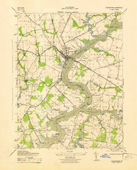
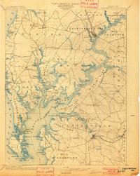 1901 Chestertown1901 Print · USGSThe Eastern Shore of Maryland comes alive in this turn-of-the-century survey of the Chester River and its surrounding necks. Genealogists and historians can trace the early rail lines and numerous river landings like Spaniards Landing, Tolchester Beach, and Leary's Mill Whf.4 unique versions available
 - 1901 Map of Gunpowder
 1901 Gunpowder1901 Print · USGSCoastal Baltimore and Harford Counties are captured here at the turn of the century as the Chesapeake shoreline met a growing rail network. Genealogists and historians can trace old homesteads and landings near Abingdon, Joppa, and the Battle Monument.7 unique versions available
 - 1903 Map of Tolchester
 1903 Tolchester1903 Print · USGSThe upper Chesapeake Bay at the turn of the century shows a bustling maritime landscape where steamship wharves and major rail lines met. Researchers can trace defunct stops like Baldwin Sta. and Clayton Sta. or locate historic landings such as Rockhall Landing and Quaker Wharf.
 - 1904 Map of St. Michaels
 1904 St. Michaels1904 Print · USGSThe Eastern Shore’s tidewater landscape at the start of the twentieth century is defined by its deep estuaries and thriving river towns. Genealogists and historians can trace the old rail lines of the Baltimore and Eastern Shore RR and locate historic landings like Probasco Landing and Skipton Landing.3 unique versions available
 - 1904 Map of North Point
 1904 North Point1904 Print · USGSChesapeake Bay maritime life at the turn of the century is captured here, from industrial waterfronts to rural landings. Genealogists can trace family landmarks and ferry points like Love Point Landing, Sparrow Point, and Skidmore.5 unique versions available
 - 1905 Map of Barclay
 1905 Barclay1905 Print · USGSUpper Delmarva at the start of the twentieth century was a landscape of rail-connected farming towns and river landings. Trace family roots and old property lines near Sudlersville, the Ashland Hayden P O, and the Benedictine Convent.3 unique versions available
 - 1906 Map of Dover
 1906 Dover1906 Print · USGSCentral Delaware and Maryland's Eastern Shore appear at the start of the twentieth century, focused on the bustling rail-and-river economy. Genealogists can trace old family landing sites and crossroads villages like Bohemia Mills, Deakyneville Ldg., and Seven Hickories.3 unique versions available
 - 1908 Map of Tolchester
 1908 Tolchester1908 Print · USGSChesapeake Bay life at the turn of the century centered on a complex network of tidewater landings and strategic railroad lines. Researchers can trace historic family settlements and maritime landmarks like Fort Howard, Harford Furnace, and the Sevenfoot Knoll LH.4 unique versions available
 - 1908 Map of Choptank
 1908 Choptank1908 Print · USGSMaryland's Eastern Shore and the Chesapeake Bay are captured here at the start of the twentieth century, showing a world of steamships and rail. Genealogists can trace family names at St Michaels, Oxford, and waterfront landings like Claiborne or Arundel on the Bay.5 unique versions available
 - 1920 Map of Dover
 1920 Dover1920 Print · USGSThe Maryland and Delaware borderlands at the end of the Great War reveal a landscape of tidewater landings and evolving rail lines. Trace family roots and vanished wharves through Fredericktown, the Mason and Dixon Line, and the Bombay Hook Light.
 - 1920 Map of Chestertown
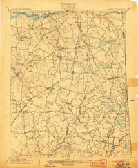
 1920 Chestertown1920 Print · USGSThe Eastern Shore of Maryland in the early twentieth century reveals a world of steamships and shoreline industry. Trace old family landings and rail stops like Learys Mill Whf, Centerville Ldg, and the Maryland and Delaware RR.
 - 1941 Map of Gunpowder
 1941 Gunpowder1941 Print · USGSThe Chesapeake tidewater and the Gunpowder River valley are caught in their pre-war rural state in this early 1940s survey. Researchers can trace the paths of the P.R.R. System and locate historic sites like Harford Furnace and Osbornes Ruins.
 - 1942 Map of Love Point
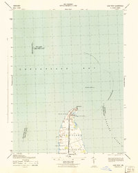 1942 Love Point1942 Print · USGSNorthern Kent Island served as a vital Chesapeake transit hub during the early forties. Trace the rail-to-ferry connection at Love Point Landing and locate landmarks like the Love Point Lighthouse and Cupola Barn.
 - 1942 Map of Swan Point
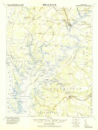
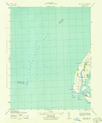 1942 Swan Point1942 Print · USGSKent County's shoreline and the waters of the Chesapeake are captured here in the early 1940s. Genealogists and maritime historians can trace the settlements of Gratitude and Edesville No 5 alongside landmarks like Swan Point and The Haven.
 - 1942 Map of Queenstown, 1961 Print
 1942 Queenstown1961 Print · USGSMaryland's Eastern Shore at the start of the 1940s reveals a landscape shaped by tidal creeks and the rail-and-water economy. Genealogists can trace family footprints near St Peters Ch, Grasonville Cem, and the historic waterfront of Queenstown.3 unique versions available
 - 1943 Map of Rock Hall
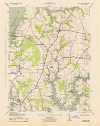 1943 Rock Hall1943 Print · USGSChesapeake Bay maritime life is captured here during the early 1940s, from the bustling docks of Rock Hall to the summer crowds at Tolchester Beach. Genealogists can trace family roots through rural landmarks like Asbury Church, Wesley Chapel, and the small settlement of Edesville.
 - 1943 Map of Chestertown
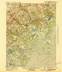
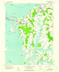
 1943 Chestertown1943 Print · USGSMid-century Kent County life centers on the bustling docks and campuses of the Chestertown waterfront during the early years of the war. Researchers can trace the legacy of rural communities through sites like Bond Chapel, the Pennsylvania railroad line, and numerous landings like Riverside Wharf.
 - 1943 Map of North Point
 1943 North Point1943 Print · USGSThe Chesapeake Bay's maritime approaches are captured here during the 1940s, highlighting the industrial strength of Sparrows Point and the coastal defenses at Fort Howard. Researchers can trace the rail connections at Love Point Landing or explore the mid-century waterfronts of Gibson Island and Bay Shore.
Showing maps 1-25 of 179
Top cities of Kent County
Frequently asked questions
- What are the different types of historical maps available for Kent County?
- What is the oldest map of Kent County?
- Where can I purchase historical maps of Kent County for my home or office?
- Where can I download high-res historical maps of Kent County?
- Are there historical topographic maps available for Kent County?
- Is there historical aerial imagery available for Kent County?
- Where are historical maps of Kent County sourced from?