Old Maps of Bethesda, Maryland for Genealogy
Trace your family roots with 56 historic maps of Bethesda. These high-res maps reveal old neighborhoods, homesites, landmarks, and streets — helping you uncover where your ancestors lived and how the area evolved over time.
- Explore historic neighborhoods: Identify where your relatives may have lived in the 1800s or 1900s.
- Compare maps over time: Trace the changes in streets, buildings, and landmarks for multi-generational research.
- Perfect for genealogy & ancestry research: Used by family historians and researchers to map out lineage and migration.
These maps are an incredible resource for exploring your personal connection to Bethesda's past.
Bethesda, MD maps
(56)- 1890 Map of Mt. Vernon
 1890 Mt. Vernon1890 Print · USGSNorthern Virginia and the capital region appear here in the decade before the turn of the century, showing a landscape of river estates and rail-connected villages. Researchers can trace early property sites and historic river landings from Mt. Vernon to Occoquan and Falls Church.
 - 1891 Map of Mt. Vernon
 1891 Mt. Vernon1891 Print · USGSNorthern Virginia and the D.C. area appear here in the late nineteenth century, as the rail-and-river economy connected rural counties to the capital. Researchers can trace ancestral roots through dozens of local landmarks, including Arlington National Cemetery, the Fox Ferry, and historic towns like Occoquan and Vienna.
 - 1893 Map of Frederick
 1893 Frederick1893 Print · USGSMaryland's Piedmont region at the end of the nineteenth century reveals a landscape defined by the Potomac River and the rise of rail transit. Researchers can trace the path of the Chesapeake and Ohio Canal or locate local hubs like Poolesville and Buckeystown.
 - 1894 Map of Frederick
 1894 Frederick1894 Print · USGSMaryland's Piedmont region in the late nineteenth century was a complex network of river crossings and railway junctions. Researchers can trace the path of the Baltimore & Ohio R. R. past Sugar Loaf Mtn. and locate historic river sites like Nolands Ferry.5 unique versions available
 - 1894 Map of Mt. Vernon, 1904 Print
 1894 Mt. Vernon1904 Print · USGSThe Potomac River valley south of the capital was still largely a landscape of crossroads and rail depots in the late nineteenth century. Genealogists can trace the rural reaches of Fairfax through landmarks like Arlington National Cemetery, Mt. Vernon, and Tyson Cross Roads.6 unique versions available
 - 1897 Map of Mt. Vernon
 1897 Mt. Vernon1897 Print · USGSNorthern Virginia and the Potomac River appear in the late nineteenth century as a landscape of rural crossroads and strategic fortifications. Trace the early footprints of Vienna, Herndon, and Manassas along the path of the Southern R. R.2 unique versions available
 - 1900 Map of Washington
 1900 Washington1900 Print · USGSThe capital region at the turn of the century shows a landscape of river-borne commerce and expanding rail lines. Genealogists and historians can trace defunct transport links like the Shepherd Ferry and early suburbs like North Takoma and Jackson City.2 unique versions available
 - 1908 Map of Rockville
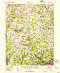
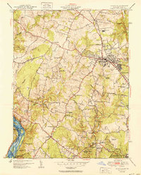
 1908 Rockville1908 Print · USGSMontgomery County was a rural landscape of crossroads and rail towns in the early twentieth century. Genealogists and historians can trace the paths of the Metropolitan Branch and early transit lines like the Georgetown and Rockville Electric Road through towns such as Rockville and Washington Grove.3 unique versions available
 - 1923 Map of Rockville
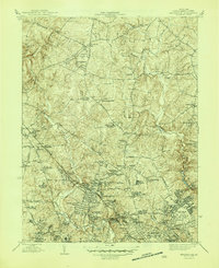
 1923 Rockville1923 Print · USGSMontgomery County was a landscape of rail-linked towns and river valleys in the early twentieth century. Genealogists and historians can trace the foundations of Rockville or search for family-named landmarks like Mt Zion and the path of the Chesapeake and Ohio Canal.4 unique versions available
 - 1944 Map of Rockville, 1955 Print
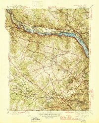
 1944 Rockville1955 Print · USGSCentral Montgomery County is captured here in the mid-1940s as rural agriculture begins to meet suburban growth along the Baltimore and Ohio RR. Genealogists can locate family names at Beall Cem or trace rural settlements like Quince Orchard and Sunshine.
 - 1945 Map of Kensington
 1945 Kensington1945 Print · USGSMontgomery County was transitioning from rural farmlands to a hub of federal and residential development during the mid-forties. Genealogists and local historians can trace family-named sites like Beall Cem and early landmarks including St Marys Cem and the Naval Medical Center.3 unique versions available
 - 1945 Map of Rockville
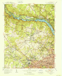
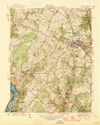 1945 Rockville1945 Print · USGSMontgomery County in the mid-1940s reveals a landscape of growing towns and riverfront heritage. Genealogists and historians can trace the foundations of Rockville, the operations at Congressional Airport, and the quiet reaches of the Chesapeake and Ohio Canal (Abandoned).2 unique versions available
 - 1945 Map of Washington West
 1945 Washington West1945 Print · USGSThe District of Columbia and its surrounding suburbs appear in detail during the mid-forties, capturing the city's growth and its transition to a modern capital. Researchers can trace historic neighborhoods from Tenleytown to Rosslyn and locate landmarks like the Tomb of Unknown Soldier and Rock Creek Cem.
 - 1945 Map of Falls Church
 1945 Falls Church1945 Print · USGSFairfax County and the Potomac River corridor are captured during a period of transition in the mid-1940s. Genealogists and local historians can trace the early footprints of Tysons Crossroads, the route of the Washington and Old Dominion Railroad, and landmarks like Fort Marcy.2 unique versions available
 - 1948 Map of Baltimore
 1948 Baltimore1948 Print · USGSMaryland and Pennsylvania crossroads are captured in the late 1940s, showing a landscape defined by historic rail lines and major military installations. Genealogists can trace family connections in Gettysburg, Westminster, and near the U.S. Naval Academy in Annapolis.2 unique versions available
 - 1948 Map of Washington
 1948 Washington1948 Print · USGSThe Potomac and Chesapeake regions in the late 1940s reveal a landscape of expanding military reach and deep-rooted Tidewater settlements. Trace old rail corridors like the Richmond Fredericksburg & Potomac RR or locate landmarks like the Wakefield Washington Monument and St. Marys College.2 unique versions available
 - 1951 Map of Washington West
 1951 Washington West1951 Print · USGSWashington D.C. and its Maryland and Virginia suburbs appear here in the early fifties, just as the metropolitan area was beginning its massive post-war growth. Researchers can locate vanished streetscapes and institutional landmarks like the U S Soldiers Home, Glenwood Cem, and the historic Washington Cathedral.
 - 1951 Map of Rockville
 1951 Rockville1951 Print · USGSMontgomery County was in the midst of a postwar transition during the early fifties, balancing its rural roots with new suburban growth. Genealogists and historians can trace family landmarks like Scotland Sch, the Congressional Airport, and the Bells Mill site.2 unique versions available
 - 1951 Map of Falls Church
 1951 Falls Church1951 Print · USGSFairfax and Montgomery counties during the post-war era reveal a mix of traditional crossroads and rapid suburban growth along the Potomac River. Genealogists and historians can trace the Washington and Old Dominion Railroad corridor and locate landmarks like Swinks Mill and Oakwood Cem.
 - 1951 Map of Kensington
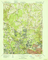 1951 Kensington1951 Print · USGSMontgomery County was transforming into a vital suburban and federal hub in the early fifties. Local historians can trace the growth of Wheaton and Kensington alongside institutions like the Naval Medical Center and Beall Cem.2 unique versions available
 - 1954 Map of Baltimore
 1954 Baltimore1954 Print · USGSThe Mid-Atlantic region in the early fifties shows a landscape of growing suburban centers and heavy rail corridors. Trace mid-century transit networks and military landmarks from the Aberdeen Proving Ground to the Gettysburg National Military Park.
 - 1956 Map of Baltimore
 1956 Baltimore1956 Print · USGSMid-century Maryland and Pennsylvania are captured here during a period of massive suburban and military growth across the Chesapeake region. Genealogists and historians can trace the rail corridors of the Baltimore & Ohio RR and locate landmarks like Fort McHenry or the Aberdeen Proving Ground.
 - 1956 Map of Falls Church, 1958 Print
 1956 Falls Church1958 Print · USGSNorthern Virginia and suburban Maryland are captured in the mid-fifties, showing the region as postwar residential growth began to surge. Researchers can trace the path of the Washington and Old Dominion RR and find historic local sites like Swinks Mill, Odricks Corner, and the Chesapeake and Ohio Canal.2 unique versions available
 - 1956 Map of Washington West, 1958 Print
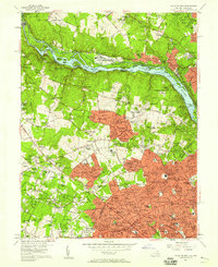
 1956 Washington West1958 Print · USGSMid-century Washington and its Maryland and Virginia suburbs appear here during a transformative era of growth. Genealogists and historians can trace neighborhood development and find landmarks like Arlington National Cemetery, the U S Capitol, and Georgetown University.
 - 1956 Map of Rockville, 1958 Print
 1956 Rockville1958 Print · USGSMid-century Rockville and the surrounding Maryland countryside are captured here during a period of rapid suburbanization and civic growth. Genealogists and local researchers can trace family landmarks and schools including Lincoln Jr High Sch, the historic Scotland community, and the Congressional Airport.2 unique versions available
Showing maps 1-25 of 56
Top cities near Bethesda
- Washington historical maps
- Arlington historical maps
- Alexandria historical maps
- Germantown historical maps
- Silver Spring historical maps
- Gaithersburg historical maps
See more
Top neighborhoods of Bethesda
- Westbard historical maps
- Pooks Hill historical maps
- Battery Park historical maps
- Chevy Chase Terrace historical maps
- Westhaven historical maps
- Kenwood historical maps
See more
Frequently asked questions
- What are the different types of historical maps available for Bethesda?
- What is the oldest map of Bethesda?
- Where can I purchase historical maps of Bethesda for my home or office?
- Where can I download high-res historical maps of Bethesda?
- Are there historical topographic maps available for Bethesda?
- Is there historical aerial imagery available for Bethesda?
- Where are historical maps of Bethesda sourced from?