Old Maps of Woodmoor, Montgomery County for Academic Research
Study the evolution of Woodmoor with 30 high-resolution historic maps. Whether you're teaching, researching, or modeling changes in land use, these maps provide essential visual documentation of urban, environmental, and geographic change.
- Analyze long-term change: Track patterns in development, transportation, and natural features.
- Ideal for environmental or urban studies: Support academic projects with primary historical map data.
- Use in the classroom or lab: Educators and researchers rely on these maps to bring historical context to life.
These maps are a powerful tool for teaching, research, and visualizing how Woodmoor has changed over the decades.
Woodmoor, Montgomery County maps
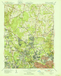
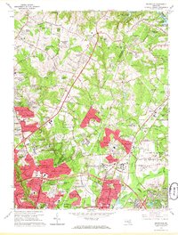
(30)- 1892 Map of Laurel
 1892 Laurel1892 Print · USGSCovers Woodmoor, including Columbia, Silver Spring, and other nearby areas
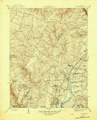
 - 1893 Map of Frederick
 1893 Frederick1893 Print · USGSCovers Woodmoor, including Germantown, Frederick, and other nearby areas
 - 1894 Map of Laurel
 1894 Laurel1894 Print · USGSCovers Woodmoor, including Columbia, Silver Spring, and other nearby areas4 unique versions available
 - 1894 Map of Frederick
 1894 Frederick1894 Print · USGSCovers Woodmoor, including Germantown, Frederick, and other nearby areas5 unique versions available
 - 1897 Map of Laurel
 1897 Laurel1897 Print · USGSCovers Woodmoor, including Columbia, Silver Spring, and other nearby areas
 - 1907 Map of Laurel
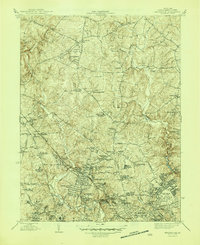
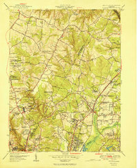
 1907 Laurel1907 Print · USGSCovers Woodmoor, including Columbia, Silver Spring, and other nearby areas3 unique versions available
 - 1908 Map of Patapsco
 1908 Patapsco1908 Print · USGSCovers Woodmoor, including Baltimore, Columbia, and other nearby areas4 unique versions available
 - 1908 Map of Rockville
 1908 Rockville1908 Print · USGSCovers Woodmoor, including Silver Spring, Gaithersburg, and other nearby areas3 unique versions available
 - 1923 Map of Rockville
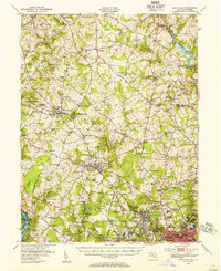
 1923 Rockville1923 Print · USGSCovers Woodmoor, including Silver Spring, Gaithersburg, and other nearby areas4 unique versions available
 - 1926 Map of Laurel
 1926 Laurel1926 Print · USGSCovers Woodmoor, including Columbia, Silver Spring, and other nearby areas4 unique versions available
 - 1942 Map of Laurel
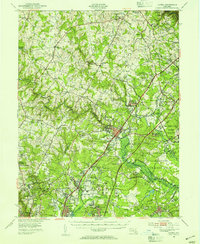
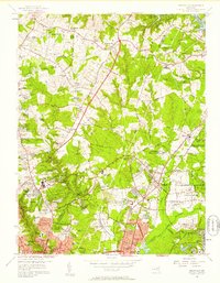
 1942 Laurel1942 Print · USGSCovers Woodmoor, including Columbia, Silver Spring, and other nearby areas
 - 1944 Map of Rockville, 1955 Print
 1944 Rockville1955 Print · USGSCovers Woodmoor, including Silver Spring, Gaithersburg, and other nearby areas
 - 1945 Map of Beltsville
 1945 Beltsville1945 Print · USGSCovers Woodmoor, including Silver Spring, College Park, and other nearby areas3 unique versions available
 - 1945 Map of Kensington
 1945 Kensington1945 Print · USGSCovers Woodmoor, including Silver Spring, Bethesda, and other nearby areas3 unique versions available
 - 1948 Map of Baltimore
 1948 Baltimore1948 Print · USGSCovers Woodmoor, including Baltimore, Columbia, and other nearby areas2 unique versions available
 - 1949 Map of Laurel, 1954 Print
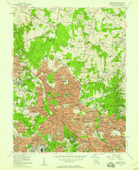
 1949 Laurel1954 Print · USGSCovers Woodmoor, including Columbia, Silver Spring, and other nearby areas2 unique versions available
 - 1951 Map of Kensington
 1951 Kensington1951 Print · USGSCovers Woodmoor, including Silver Spring, Bethesda, and other nearby areas2 unique versions available
 - 1951 Map of Beltsville
 1951 Beltsville1951 Print · USGSCovers Woodmoor, including Silver Spring, College Park, and other nearby areas2 unique versions available
 - 1954 Map of Baltimore
 1954 Baltimore1954 Print · USGSCovers Woodmoor, including Baltimore, Columbia, and other nearby areas
 - 1956 Map of Baltimore
 1956 Baltimore1956 Print · USGSCovers Woodmoor, including Baltimore, Columbia, and other nearby areas
 - 1956 Map of Beltsville, 1958 Print
 1956 Beltsville1958 Print · USGSCovers Woodmoor, including Silver Spring, College Park, and other nearby areas
 - 1956 Map of Kensington, 1958 Print
 1956 Kensington1958 Print · USGSCovers Woodmoor, including Silver Spring, Bethesda, and other nearby areas2 unique versions available
 - 1957 Map of Baltimore, 1964 Print
 1957 Baltimore1964 Print · USGSCovers Woodmoor, including Baltimore, Columbia, and other nearby areas5 unique versions available
 - 1961 Map of Baltimore
 1961 Baltimore1961 Print · USGSCovers Woodmoor, including Baltimore, Columbia, and other nearby areas
 - 1964 Map of Beltsville, 1966 Print
 1964 Beltsville1966 Print · USGSCovers Woodmoor, including Silver Spring, College Park, and other nearby areas5 unique versions available
Showing maps 1-25 of 30
Frequently asked questions
- What are the different types of historical maps available for Woodmoor?
- What is the oldest map of Woodmoor?
- Where can I purchase historical maps of Woodmoor for my home or office?
- Where can I download high-res historical maps of Woodmoor?
- Are there historical topographic maps available for Woodmoor?
- Is there historical aerial imagery available for Woodmoor?
- Where are historical maps of Woodmoor sourced from?