Old Maps of Woodmoor, Montgomery County for Genealogy
Trace your family roots with 30 historic maps of Woodmoor. These high-res maps reveal old neighborhoods, homesites, landmarks, and streets — helping you uncover where your ancestors lived and how the area evolved over time.
- Explore historic neighborhoods: Identify where your relatives may have lived in the 1800s or 1900s.
- Compare maps over time: Trace the changes in streets, buildings, and landmarks for multi-generational research.
- Perfect for genealogy & ancestry research: Used by family historians and researchers to map out lineage and migration.
These maps are an incredible resource for exploring your personal connection to Woodmoor's past.
Woodmoor, Montgomery County maps
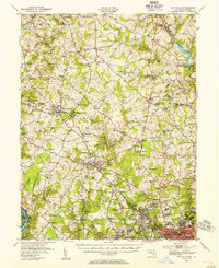
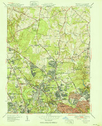
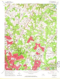
(30)- 1892 Map of Laurel
 1892 Laurel1892 Print · USGSCovers Woodmoor, including Columbia, Silver Spring, and other nearby areas
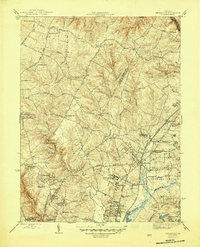
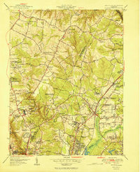
 - 1893 Map of Frederick
 1893 Frederick1893 Print · USGSCovers Woodmoor, including Germantown, Frederick, and other nearby areas
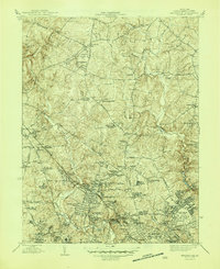
 - 1894 Map of Laurel
 1894 Laurel1894 Print · USGSCovers Woodmoor, including Columbia, Silver Spring, and other nearby areas4 unique versions available
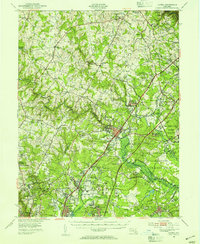
 - 1894 Map of Frederick
 1894 Frederick1894 Print · USGSCovers Woodmoor, including Germantown, Frederick, and other nearby areas5 unique versions available
 - 1897 Map of Laurel
 1897 Laurel1897 Print · USGSCovers Woodmoor, including Columbia, Silver Spring, and other nearby areas
 - 1907 Map of Laurel
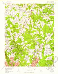
 1907 Laurel1907 Print · USGSCovers Woodmoor, including Columbia, Silver Spring, and other nearby areas3 unique versions available
 - 1908 Map of Patapsco
 1908 Patapsco1908 Print · USGSCovers Woodmoor, including Baltimore, Columbia, and other nearby areas4 unique versions available
 - 1908 Map of Rockville
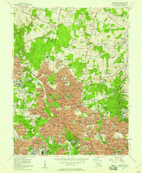
 1908 Rockville1908 Print · USGSCovers Woodmoor, including Silver Spring, Gaithersburg, and other nearby areas3 unique versions available
 - 1923 Map of Rockville
 1923 Rockville1923 Print · USGSCovers Woodmoor, including Silver Spring, Gaithersburg, and other nearby areas4 unique versions available
 - 1926 Map of Laurel
 1926 Laurel1926 Print · USGSCovers Woodmoor, including Columbia, Silver Spring, and other nearby areas4 unique versions available
 - 1942 Map of Laurel
 1942 Laurel1942 Print · USGSCovers Woodmoor, including Columbia, Silver Spring, and other nearby areas
 - 1944 Map of Rockville, 1955 Print
 1944 Rockville1955 Print · USGSCovers Woodmoor, including Silver Spring, Gaithersburg, and other nearby areas
 - 1945 Map of Beltsville
 1945 Beltsville1945 Print · USGSCovers Woodmoor, including Silver Spring, College Park, and other nearby areas3 unique versions available
 - 1945 Map of Kensington
 1945 Kensington1945 Print · USGSCovers Woodmoor, including Silver Spring, Bethesda, and other nearby areas3 unique versions available
 - 1948 Map of Baltimore
 1948 Baltimore1948 Print · USGSCovers Woodmoor, including Baltimore, Columbia, and other nearby areas2 unique versions available
 - 1949 Map of Laurel, 1954 Print
 1949 Laurel1954 Print · USGSCovers Woodmoor, including Columbia, Silver Spring, and other nearby areas2 unique versions available
 - 1951 Map of Kensington
 1951 Kensington1951 Print · USGSCovers Woodmoor, including Silver Spring, Bethesda, and other nearby areas2 unique versions available
 - 1951 Map of Beltsville
 1951 Beltsville1951 Print · USGSCovers Woodmoor, including Silver Spring, College Park, and other nearby areas2 unique versions available
 - 1954 Map of Baltimore
 1954 Baltimore1954 Print · USGSCovers Woodmoor, including Baltimore, Columbia, and other nearby areas
 - 1956 Map of Baltimore
 1956 Baltimore1956 Print · USGSCovers Woodmoor, including Baltimore, Columbia, and other nearby areas
 - 1956 Map of Beltsville, 1958 Print
 1956 Beltsville1958 Print · USGSCovers Woodmoor, including Silver Spring, College Park, and other nearby areas
 - 1956 Map of Kensington, 1958 Print
 1956 Kensington1958 Print · USGSCovers Woodmoor, including Silver Spring, Bethesda, and other nearby areas2 unique versions available
 - 1957 Map of Baltimore, 1964 Print
 1957 Baltimore1964 Print · USGSCovers Woodmoor, including Baltimore, Columbia, and other nearby areas5 unique versions available
 - 1961 Map of Baltimore
 1961 Baltimore1961 Print · USGSCovers Woodmoor, including Baltimore, Columbia, and other nearby areas
 - 1964 Map of Beltsville, 1966 Print
 1964 Beltsville1966 Print · USGSCovers Woodmoor, including Silver Spring, College Park, and other nearby areas5 unique versions available
Showing maps 1-25 of 30
Frequently asked questions
- What are the different types of historical maps available for Woodmoor?
- What is the oldest map of Woodmoor?
- Where can I purchase historical maps of Woodmoor for my home or office?
- Where can I download high-res historical maps of Woodmoor?
- Are there historical topographic maps available for Woodmoor?
- Is there historical aerial imagery available for Woodmoor?
- Where are historical maps of Woodmoor sourced from?