1900s (20th Century) Maps of Airedele, Maryland
Explore 11 historic maps of Airedele from the 1900s (20th Century). These maps offer a rare glimpse into what life looked like during the 1900s — showing old roads, neighborhoods, homes, and landmarks that have changed or disappeared over time.
Whether you're researching your family's past, planning a metal detecting trip, or studying how Airedele's landscape evolved across the 1900s, these high-resolution maps are a powerful tool for exploring the history of this region.
- Focus on a specific era: All maps on this page are from the 1900s, giving you a focused view of this time period.
- See what’s changed: Compare century-old streets, trails, and buildings to today's modern landscape using overlays and satellite layers.
- Research with precision: Use these maps for genealogy, historical research, land use analysis, or educational projects.
- View, download, or print: Maps are fully viewable online in high resolution, and can be downloaded or printed for your own records.
Start exploring Airedele's history through authentic maps from the 1900s. This is your window into the past.
Airedele, MD maps
(11)- 1906 Map of St. Marys
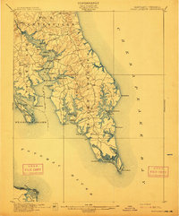
 1906 St. Marys1906 Print · USGSChesapeake Bay and the Potomac River converge in this 1906 survey of the Maryland and Virginia tidewater. Historians can trace the region's maritime heritage through dozens of named landings and islands, from Solomons Id. to the remote reaches of Smith Island.4 unique versions available
 - 1912 Map of Point Lookout
 1912 Point Lookout1912 Print · USGSSouthern St. Mary's County appears here just after the turn of the century, showing a waterfront economy dependent on the river and bay. Genealogists and historians can trace family landings at Broomes Wharf and Miller Wharf or locate old settlements like St Inigoes and Great Mills.2 unique versions available
 - 1937 Map of Point Lookout, 1958 Print
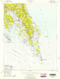 1937 Point Lookout1958 Print · USGSThe tip of St. Mary's County appears here in the late thirties, where the Potomac meets the Chesapeake. Genealogists can trace family footprints through historic landings like Broomes Wharf and settlements such as St Inigoes and Drayden.2 unique versions available
 - 1942 Map of Point Lookout, 1961 Print
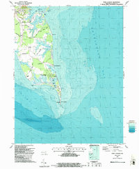
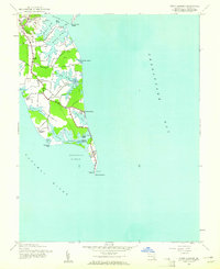 1942 Point Lookout1961 Print · USGSThe tip of St. Mary's County is captured here during the early 1940s at the strategic meeting of the river and the bay. Researchers can trace family sites near Ridge, locate the historic Lighthouse at Point Lookout, or explore the grounds of Camp Brown.2 unique versions available
 - 1943 Map of Point Lookout
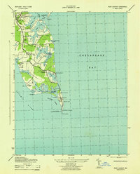 1943 Point Lookout1943 Print · USGSThe tip of St. Mary's County appears here during the height of the Second World War, showing the strategic maritime landscape of the lower Potomac. Genealogists and historians can locate the Point Lookout Lighthouse, the Confederate Monument, and the rural community at Ridge.
 - 1948 Map of Washington
 1948 Washington1948 Print · USGSThe Potomac and Chesapeake regions in the late 1940s reveal a landscape of expanding military reach and deep-rooted Tidewater settlements. Trace old rail corridors like the Richmond Fredericksburg & Potomac RR or locate landmarks like the Wakefield Washington Monument and St. Marys College.2 unique versions available
 - 1957 Map of Washington, 1966 Print
 1957 Washington1966 Print · USGSThe mid-Atlantic region during the mid-fifties and early sixties reveals a landscape of growing suburbs and vital military outposts. Researchers can trace historic river towns and shorelines from Alexandria to the Hooper Islands and St Clements Island.5 unique versions available
 - 1961 Map of Washington
 1961 Washington1961 Print · USGSThe mid-Atlantic region in the late fifties is presented in remarkable detail, from the Blue Ridge foothills to the Chesapeake Eastern Shore. Researchers can trace historic river landings and military sites like Mount Vernon, Fort Belvoir, and Point Lookout.2 unique versions available
 - 1983 Map of Leonardtown, 1984 Print
 1983 Leonardtown1984 Print · USGSSouthern Maryland and the Northern Neck of Virginia are shown in the early eighties as a mosaic of historic tidewater settlements and modern installations. Trace family roots and shoreline changes near St Marys City, Leonardtown, and Colonial Beach.2 unique versions available
 - 1987 Map of Point Lookout
 1987 Point Lookout1987 Print · USGSMaryland's southern tip at the close of the twentieth century shows a landscape where maritime history and state conservation meet. Genealogists and local historians can trace family-named routes like Harry James Road or locate the Point Lookout Confederate Cem and St Michael Ch Cem.
 - 1989 Map of Washington
 1989 Washington1989 Print · USGSThe Potomac River valley and Chesapeake Bay are shown in comprehensive detail during the late 1980s. Genealogists and historians can trace the transition from urban Alexandria to the rural Northern Neck, locating landmarks like Mount Vernon and Stratford Hall.
End of results
Showing maps 1-11 of 11
Top cities near Airedele
- Lexington Park historical maps
- California historical maps
- Wildewood historical maps
- Solomons historical maps
- Drum Point historical maps
- Callaway historical maps
See more
Frequently asked questions
- What are the different types of historical maps available for Airedele?
- What is the oldest map of Airedele?
- Where can I purchase historical maps of Airedele for my home or office?
- Where can I download high-res historical maps of Airedele?
- Are there historical topographic maps available for Airedele?
- Is there historical aerial imagery available for Airedele?
- Where are historical maps of Airedele sourced from?