Old Maps of Crisfield, Maryland
Explore 31 old maps of Crisfield, spanning from 1903 to today. These high-resolution historic maps reveal how streets, neighborhoods, landmarks, and natural features evolved over time — perfect for genealogy, metal detecting, research, and local history exploration.
What you can do with these maps:
- See how Crisfield changed over time: Compare historical maps to modern-day views to trace roads, homesites, rail lines & more.
- View detailed metadata: Each map includes creators, publishers, year, scale, and archive source.
- Overlay maps with satellite & LiDAR: Visualize the past alongside modern tools to explore terrain & human change.
- Trusted historical sources: Maps sourced from the USGS, Library of Congress, and other archives.
- Access maps your way: View online, download high-res files, or order prints for personal or research use.
Start exploring old maps of Crisfield to uncover forgotten places, hidden landmarks, and the deep history beneath your feet.
Crisfield, MD maps
(31)- 1903 Map of Crisfield
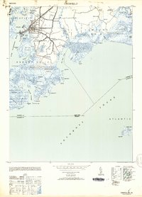
 1903 Crisfield1903 Print · USGSCoastal Somerset County at the turn of the century reveals a landscape defined by the water and the oyster trade. Genealogists and historians can trace old community footprints at Sackertown, Lawsonia, and Parsonville, or locate the Janes Island L.H. and the remote reaches of Smith Island.4 unique versions available
 - 1903 Map of Deal Island
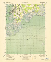
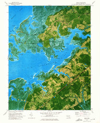
 1903 Deal Island1903 Print · USGSSomerset County's coastal marshes and island communities come to life in this turn-of-the-century survey of the Chesapeake. Genealogists and maritime historians can trace family locations from DEAL ISLAND to Upper Fairmount, and locate early navigation aids like Great Shoals L.H. or the rail terminus at Hopewell.3 unique versions available
 - 1920 Map of Crisfield
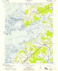
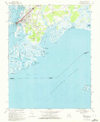
 1920 Crisfield1920 Print · USGSMaryland's seafood capital and the isolated island communities of the Chesapeake are captured just after the First World War. Researchers can trace the waterfront rail lines of the N.Y.P. & N. R.R. or locate ancestral homes in Sackertown, Birdtown, and Ewell.
 - 1942 Map of Marion, 1958 Print
 1942 Marion1958 Print · USGSSomerset County's coastal reaches are documented here during the early war years, highlighting the intricate marshlands and rail-dependent villages. Genealogists can locate family landmarks like Samuel Webster Ch or trace the old rail stops at Marion and Hopewell.2 unique versions available
 - 1943 Map of Crisfield
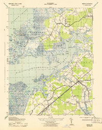
 1943 Crisfield1943 Print · USGSThe seafood capital of the Chesapeake comes to life in the 1940s, showcasing the intricate waterfront and rail infrastructure of Somerset County. Genealogists can trace families in Sackertown and Birdtown or locate the Indian Hammock cemetery.
 - 1943 Map of Marion
 1943 Marion1943 Print · USGSSomerset County's Eastern Shore is captured here in the early 1940s, showing a landscape of tidal marshes and rail-linked villages. Genealogists can locate family-named points and rural congregations like Wayman Church or trace the old Pennsylvania Railroad line near Marion.
 - 1946 Map of Salisbury, 1948 Print
 1946 Salisbury1948 Print · USGSThe Delmarva Peninsula in the late nineteen-forties shows a landscape defined by its deep river arteries and emerging coastal defenses. Genealogists and historians can trace rail-connected towns like Federalsburg or locate maritime landmarks such as the Ocean City Seaplane Base and Fort Miles Military Reservation.4 unique versions available
 - 1946 Map of Eastville, 1971 Print
 1946 Eastville1971 Print · USGSCoastal Virginia and the Outer Banks are captured here during a period of expanding naval and aerospace presence. Researchers can trace the path of the Penn Central railroad through Chincoteague and Modest Town, or locate landmarks like the Wright Brothers National Memorial.
 - 1947 Map of Salisbury, 1948 Print
 1947 Salisbury1948 Print · USGSThe Delmarva Peninsula in the late forties reveals a coastal landscape of maritime defense and growing seaside towns. Trace the post-war footprint of Salisbury, the strategic Fort Miles Military Reservation, and the Ocean City Seaplane Base.
 - 1948 Map of Salisbury, 1951 Print
 1948 Salisbury1951 Print · USGSThe Delmarva Peninsula in the late 1940s is shown here as a busy network of rail-towns and coastal outposts. Researchers can trace the legacy of the Pennsylvania Railroad through inland hubs like Georgetown or the maritime reaches of Crisfield and Cape May.
 - 1953 Map of Crisfield
 1953 Crisfield1953 Print · USGSMaryland's lower Eastern Shore thrives as a maritime and rail center during the early fifties, where the town meets the marsh. Genealogists and historians can trace the streets of Crisfield, locate the Phoenix Church, or explore the waterfront around Somers Cove and Jersey Island.3 unique versions available
 - 1957 Map of Salisbury
 1957 Salisbury1957 Print · USGSThe Delmarva Peninsula in the mid-1950s reveals a landscape of coastal defenses and rail-driven commerce. Researchers can trace the Pennsylvania railroad lines or locate historic landmarks like the Fenwick Island Lighthouse and St Martin church.
 - 1961 Map of Eastville
 1961 Eastville1961 Print · USGSThe Eastern Shore and Outer Banks are captured here in the mid-twentieth century, showing a maritime landscape of lighthouses, rail-linked towns, and naval outposts. Researchers can trace the Pennsylvania Railroad through Parksley or locate historical sites like Chincoteague Field Naval Auxiliary Air Station and Tangier Island.
 - 1961 Map of Salisbury
 1961 Salisbury1961 Print · USGSThe Delmarva Peninsula comes into focus in the early sixties, showing the vital road and rail networks connecting the Chesapeake to the Atlantic. Genealogists and historians can trace family-named landings and coastal landmarks from Crisfield to the Brandywine Shoal Lighthouse.
 - 1965 Map of Salisbury
 1965 Salisbury1965 Print · USGSThe Delmarva Peninsula in the mid-1960s is depicted here as a landscape of coastal defenses and maritime hubs. Genealogists and local historians can trace the foundations of bayside towns like Crisfield and the tactical positioning of the Fort Miles Military Reservation and Cape May Naval Air Station.
 - 1966 Map of Eastville
 1966 Eastville1966 Print · USGSThe Delmarva Peninsula and Outer Banks appear in the mid-sixties, showing a landscape of maritime trade, military outposts, and fishing villages. Researchers can trace the lines of the Norfolk & Southern through Exmore and Parksley or locate historical sites like Fort John Custis and the Janes Island Lighthouse.
 - 1968 Map of Crisfield, 1972 Print
 1968 Crisfield1972 Print · USGSCoastal Somerset County comes alive in this late-sixties survey of the area's intricate marshlands and seafood-processing centers. Genealogists and local historians can trace family-named settlements like Sackertown, Byrdtown, and Mariners or locate local institutions like Phoenix Ch.5 unique versions available
 - 1972 Map of Marion, 1975 Print
 1972 Marion1975 Print · USGSSomerset County’s tidal necks and marshlands are captured in detail during the early seventies as the maritime economy shifted toward recreation and preservation. Researchers can trace family roots through landmarks like St Andrews Ch, the Pennsylvania Central rail line, and the old cemetery at Upper Hill.2 unique versions available
 - 1981 Map of Chincoteague, 1982 Print
 1981 Chincoteague1982 Print · USGSThe Delmarva Eastern Shore at the start of the eighties shows a unique blend of traditional coastal life and modern aerospace technology. Researchers can trace the Penn Central rail line through rural towns like Modest Town and Bloxom or explore the marshlands of the Saxis Marsh Waterfowl Management Area and Refuge.
 - 1983 Map of Salisbury, 1984 Print
 1983 Salisbury1984 Print · USGSThe Lower Eastern Shore was a landscape of tide and timber in the early eighties, from the bustling streets of Salisbury to the wild coast of Assateague Island. Researchers can trace the rail-and-road network of the Conrail and U S Highway 50 while locating historic centers like Princess Anne and Crisfield.
 - 1984 Map of Chincoteague
 1984 Chincoteague1984 Print · USGSThe Virginia Eastern Shore and Delmarva Peninsula are captured here in the mid-1980s, showcasing a landscape of barrier islands and tidewater towns. Researchers can trace the Penn Central rail line through Accomac or locate the Wallops Flight Facility (NASA) and Chincoteague Nat Wildlife Refuge.2 unique versions available
 - 2011 Map of Crisfield, 2011 Print
 2011 Crisfield2011 Print · USGSCovers Crisfield, including Byrdtown, Nelson, and other nearby areas
 - 2011 Map of Marion, 2011 Print
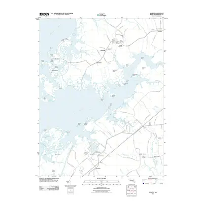 2011 Marion2011 Print · USGSCovers Crisfield, including Upper Fairmount, Hopewell, and other nearby areas
 - 2014 Map of Marion, 2014 Print
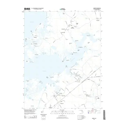 2014 Marion2014 Print · USGSCovers Crisfield, including Upper Fairmount, Hopewell, and other nearby areas
 - 2014 Map of Crisfield, 2014 Print
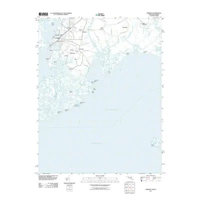
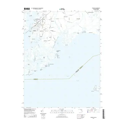 2014 Crisfield2014 Print · USGSCovers Crisfield, including Byrdtown, Nelson, and other nearby areas
Showing maps 1-25 of 31
Top cities near Crisfield
- Princess Anne historical maps
- Parksley historical maps
- Tangier historical maps
- Bloxom historical maps
- Chase Crossing historical maps
- Whitesville historical maps
See more
Top neighborhoods of Crisfield
Frequently asked questions
- What are the different types of historical maps available for Crisfield?
- What is the oldest map of Crisfield?
- Where can I purchase historical maps of Crisfield for my home or office?
- Where can I download high-res historical maps of Crisfield?
- Are there historical topographic maps available for Crisfield?
- Is there historical aerial imagery available for Crisfield?
- Where are historical maps of Crisfield sourced from?