Old Maps of Daugherty Town, Crisfield for Academic Research
Study the evolution of Daugherty Town with 15 high-resolution historic maps. Whether you're teaching, researching, or modeling changes in land use, these maps provide essential visual documentation of urban, environmental, and geographic change.
- Analyze long-term change: Track patterns in development, transportation, and natural features.
- Ideal for environmental or urban studies: Support academic projects with primary historical map data.
- Use in the classroom or lab: Educators and researchers rely on these maps to bring historical context to life.
These maps are a powerful tool for teaching, research, and visualizing how Daugherty Town has changed over the decades.
Daugherty Town, Crisfield maps
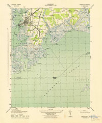
(15)- 1903 Map of Crisfield
 1903 Crisfield1903 Print · USGSCoastal Somerset County at the turn of the century reveals a landscape defined by the water and the oyster trade. Genealogists and historians can trace old community footprints at Sackertown, Lawsonia, and Parsonville, or locate the Janes Island L.H. and the remote reaches of Smith Island.4 unique versions available
 - 1920 Map of Crisfield
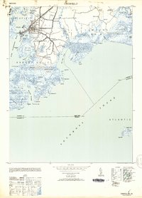
 1920 Crisfield1920 Print · USGSMaryland's seafood capital and the isolated island communities of the Chesapeake are captured just after the First World War. Researchers can trace the waterfront rail lines of the N.Y.P. & N. R.R. or locate ancestral homes in Sackertown, Birdtown, and Ewell.
 - 1943 Map of Crisfield
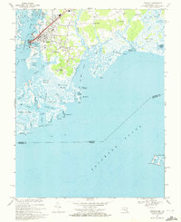
 1943 Crisfield1943 Print · USGSThe seafood capital of the Chesapeake comes to life in the 1940s, showcasing the intricate waterfront and rail infrastructure of Somerset County. Genealogists can trace families in Sackertown and Birdtown or locate the Indian Hammock cemetery.
 - 1946 Map of Eastville, 1971 Print
 1946 Eastville1971 Print · USGSCoastal Virginia and the Outer Banks are captured here during a period of expanding naval and aerospace presence. Researchers can trace the path of the Penn Central railroad through Chincoteague and Modest Town, or locate landmarks like the Wright Brothers National Memorial.
 - 1953 Map of Crisfield
 1953 Crisfield1953 Print · USGSMaryland's lower Eastern Shore thrives as a maritime and rail center during the early fifties, where the town meets the marsh. Genealogists and historians can trace the streets of Crisfield, locate the Phoenix Church, or explore the waterfront around Somers Cove and Jersey Island.3 unique versions available
 - 1961 Map of Eastville
 1961 Eastville1961 Print · USGSThe Eastern Shore and Outer Banks are captured here in the mid-twentieth century, showing a maritime landscape of lighthouses, rail-linked towns, and naval outposts. Researchers can trace the Pennsylvania Railroad through Parksley or locate historical sites like Chincoteague Field Naval Auxiliary Air Station and Tangier Island.
 - 1966 Map of Eastville
 1966 Eastville1966 Print · USGSThe Delmarva Peninsula and Outer Banks appear in the mid-sixties, showing a landscape of maritime trade, military outposts, and fishing villages. Researchers can trace the lines of the Norfolk & Southern through Exmore and Parksley or locate historical sites like Fort John Custis and the Janes Island Lighthouse.
 - 1968 Map of Crisfield, 1972 Print
 1968 Crisfield1972 Print · USGSCoastal Somerset County comes alive in this late-sixties survey of the area's intricate marshlands and seafood-processing centers. Genealogists and local historians can trace family-named settlements like Sackertown, Byrdtown, and Mariners or locate local institutions like Phoenix Ch.5 unique versions available
 - 1981 Map of Chincoteague, 1982 Print
 1981 Chincoteague1982 Print · USGSThe Delmarva Eastern Shore at the start of the eighties shows a unique blend of traditional coastal life and modern aerospace technology. Researchers can trace the Penn Central rail line through rural towns like Modest Town and Bloxom or explore the marshlands of the Saxis Marsh Waterfowl Management Area and Refuge.
 - 1984 Map of Chincoteague
 1984 Chincoteague1984 Print · USGSThe Virginia Eastern Shore and Delmarva Peninsula are captured here in the mid-1980s, showcasing a landscape of barrier islands and tidewater towns. Researchers can trace the Penn Central rail line through Accomac or locate the Wallops Flight Facility (NASA) and Chincoteague Nat Wildlife Refuge.2 unique versions available
 - 2011 Map of Crisfield, 2011 Print
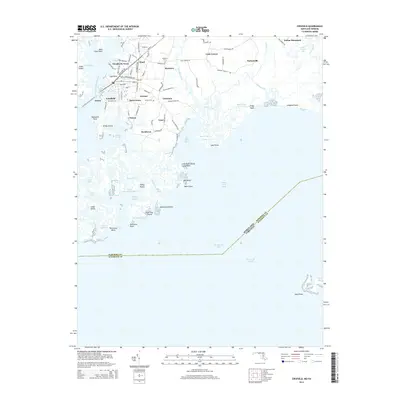
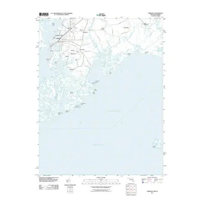 2011 Crisfield2011 Print · USGSCovers Daugherty Town, including Crisfield, Byrdtown, and other nearby areas
 - 2014 Map of Crisfield, 2014 Print
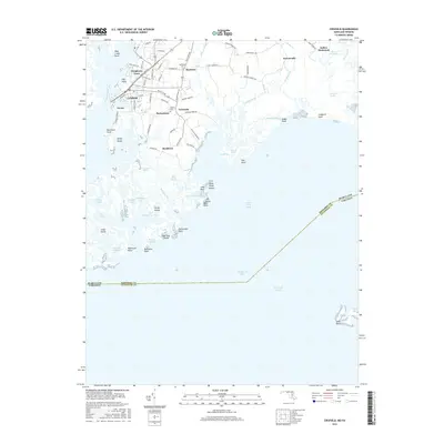
 2014 Crisfield2014 Print · USGSCovers Daugherty Town, including Crisfield, Byrdtown, and other nearby areas
 - 2016 Map of Crisfield, 2016 Print
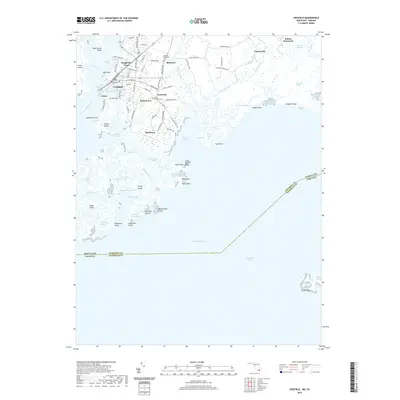
 2016 Crisfield2016 Print · USGSCovers Daugherty Town, including Crisfield, Byrdtown, and other nearby areas
 - 2019 Map of Crisfield, 2019 Print
 2019 Crisfield2019 Print · USGSCovers Daugherty Town, including Crisfield, Byrdtown, and other nearby areas
 - 2023 Map of Crisfield, 2023 Print
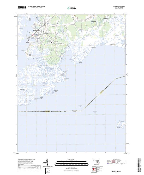 2023 Crisfield2023 Print · USGSCoastal Somerset County in the early twenty-first century remains a world defined by the tide and the marsh. Researchers can trace family ties at the Mariners Methodist Cem or explore the waterfront lanes of Sackertown and Lawsonia.
End of results
Showing maps 1-15 of 15
Top cities near Daugherty Town
- Princess Anne historical maps
- Crisfield historical maps
- Parksley historical maps
- Tangier historical maps
- Bloxom historical maps
- Chase Crossing historical maps
See more
Frequently asked questions
- What are the different types of historical maps available for Daugherty Town?
- What is the oldest map of Daugherty Town?
- Where can I purchase historical maps of Daugherty Town for my home or office?
- Where can I download high-res historical maps of Daugherty Town?
- Are there historical topographic maps available for Daugherty Town?
- Is there historical aerial imagery available for Daugherty Town?
- Where are historical maps of Daugherty Town sourced from?