Old Maps of Rhodes Point, Maryland for Genealogy
Trace your family roots with 15 historic maps of Rhodes Point. These high-res maps reveal old neighborhoods, homesites, landmarks, and streets — helping you uncover where your ancestors lived and how the area evolved over time.
- Explore historic neighborhoods: Identify where your relatives may have lived in the 1800s or 1900s.
- Compare maps over time: Trace the changes in streets, buildings, and landmarks for multi-generational research.
- Perfect for genealogy & ancestry research: Used by family historians and researchers to map out lineage and migration.
These maps are an incredible resource for exploring your personal connection to Rhodes Point's past.
Rhodes Point, MD maps
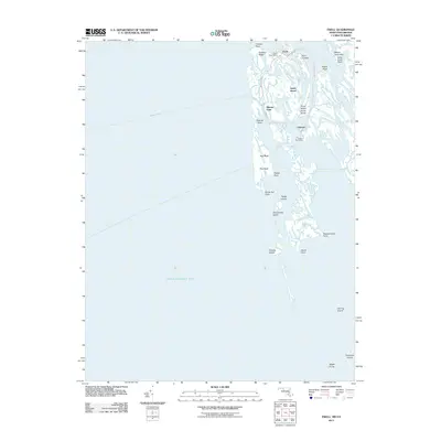
(15)- 1917 Map of Ewell
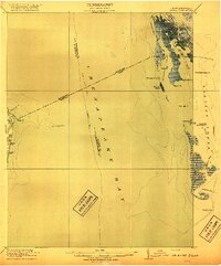 1917 Ewell1917 Print · USGSIsolated island life in the Chesapeake comes into focus during the early twentieth century. Researchers can trace the original footprints of Ewell, Rhodes Point, and Tangier, alongside maritime landmarks like the Smith Point LH and old Steamboat Routes.2 unique versions available
 - 1942 Map of Ewell, 1957 Print
 1942 Ewell1957 Print · USGSSmith Island and its isolated waterman communities are captured here in the early 1940s, split by the Maryland and Virginia state line. Genealogists and historians can trace the small settlements of Ewell, Rhodes Point, and Tylerton alongside cemeteries and the Smith Island Light.
 - 1943 Map of Ewell
 1943 Ewell1943 Print · USGSSmith Island during the early 1940s presents a unique view of Maryland's isolated island communities and their intricate waterborne geography. Local historians can trace the footings of Ewell and Tylerton, or locate landmarks like Smith Island Light and the curiously named Amen Corner.
 - 1943 Map of Richmond, 1972 Print
 1943 Richmond1972 Print · USGSCoastal Virginia and the state capital are shown in detail during the mid-century era of infrastructure expansion. Genealogists and historians can trace the grounds of Richmond Nat Battlefield Park, locate the Yorktown Nat Cem, or follow the many rural routes through Amelia Court House and Tappahannock.
 - 1949 Map of Richmond, 1951 Print
 1949 Richmond1951 Print · USGSCoastal Virginia in the years following World War II remained a landscape of historic river towns and expanding military bases. Genealogists and historians can trace the rail lines of the Southern Ry and locate established landmarks from Camp Lee to the remote reaches of Dragon Swamp.
 - 1959 Map of Richmond
 1959 Richmond1959 Print · USGSMid-century Virginia is captured here at its most vital rail and river junctions, from the capital city to the Chesapeake Bay. Genealogists and historians can trace the development of colonial settlements like Williamsburg and military landmarks including Fort Monroe and Camp Lee.
 - 1964 Map of Richmond
 1964 Richmond1964 Print · USGSCoastal and central Virginia are mapped during the mid-twentieth century, showing the critical intersection of rail, river, and military life. Genealogists can trace family roots through rural county seats like Amelia or find vanished coastal neighborhoods near Phoebus and Hilton Village.
 - 1968 Map of Ewell, 1972 Print
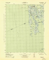
 1968 Ewell1972 Print · USGSSmith Island remains a secluded maritime world in the late sixties, where life revolves around the guts and ditches of the Chesapeake. Genealogists and historians can trace the foundations of Ewell, Rhodes Point, and Tylerton, along with landmarks like Calvary Ch.2 unique versions available
 - 1973 Map of Richmond, 1974 Print
 1973 Richmond1974 Print · USGSThe Virginia Tidewater and Piedmont come alive in the early seventies, showcasing a region defined by its great rivers and massive military installations. Researchers can trace the mid-century growth of Richmond or locate family sites near Amelia Court House and Highland Springs.2 unique versions available
 - 1984 Map of Tappahannock
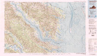 1984 Tappahannock1984 Print · USGSThe Northern Neck and Middle Peninsula of Virginia are captured in detail during the mid-1980s, showcasing the region's deep-rooted maritime and agricultural identity. Genealogists and local historians can trace family locations across the intricate shorelines of the Rappahannock River and settlements like Kilmarnock, Heathsville, and Urbanna.3 unique versions available
 - 2011 Map of Ewell, 2011 Print
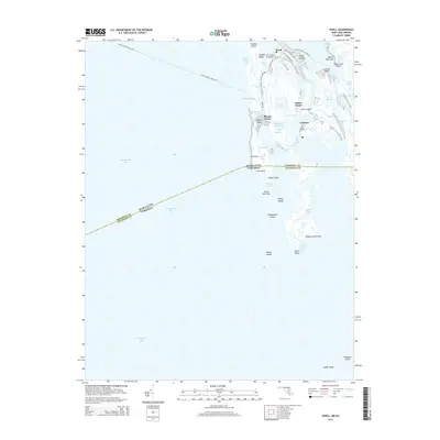
 2011 Ewell2011 Print · USGSCovers Rhodes Point, including Tylerton, Ewell, and other nearby areas
 - 2014 Map of Ewell, 2014 Print
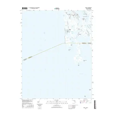
 2014 Ewell2014 Print · USGSCovers Rhodes Point, including Tylerton, Ewell, and other nearby areas
 - 2016 Map of Ewell, 2016 Print
 2016 Ewell2016 Print · USGSCovers Rhodes Point, including Tylerton, Ewell, and other nearby areas
 - 2019 Map of Ewell, 2019 Print
 2019 Ewell2019 Print · USGSCovers Rhodes Point, including Tylerton, Ewell, and other nearby areas
 - 2023 Map of Ewell, 2023 Print
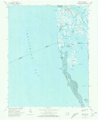
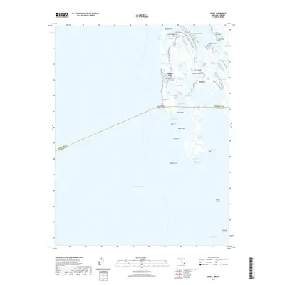
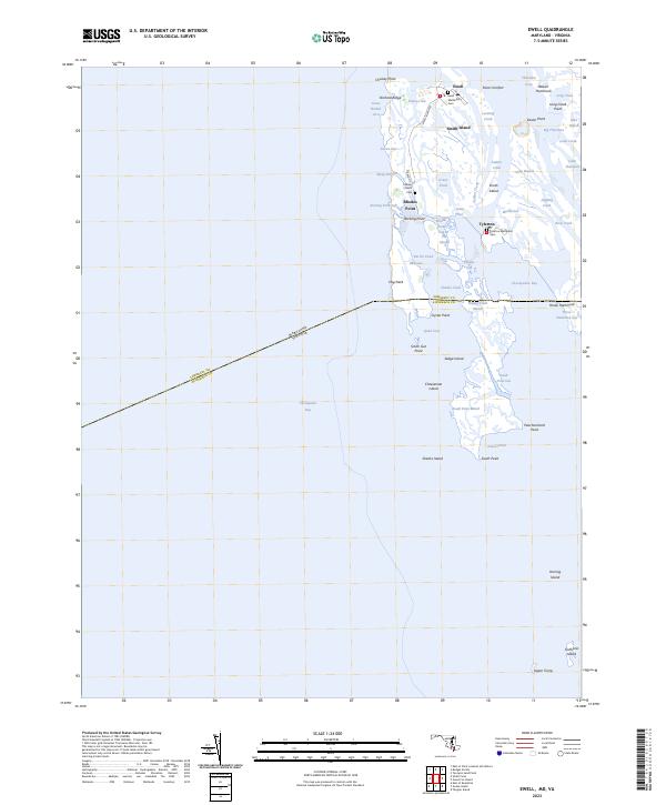 2023 Ewell2023 Print · USGSMaryland's Smith Island is mapped in detail during the early 2020s, showing the resilient settlements and intricate marshlands of the Chesapeake. Genealogists and historians can locate churchyards like Ewell Methodist Cem and isolated landings such as Tylerton and Rhodes Point.
End of results
Showing maps 1-15 of 15
Top cities near Rhodes Point
Frequently asked questions
- What are the different types of historical maps available for Rhodes Point?
- What is the oldest map of Rhodes Point?
- Where can I purchase historical maps of Rhodes Point for my home or office?
- Where can I download high-res historical maps of Rhodes Point?
- Are there historical topographic maps available for Rhodes Point?
- Is there historical aerial imagery available for Rhodes Point?
- Where are historical maps of Rhodes Point sourced from?