Old Maps of Milburn Landing, Maryland for Hiking & Exploration
Hike through history with 16 historic maps of Milburn Landing. Explore old trails, ghost towns, and forgotten backroads — perfect for outdoor adventurers and local explorers.
- Rediscover forgotten places: Map out old mining camps, roads, and footpaths that no longer exist on modern maps.
- Layer with modern tools: Combine with LiDAR or satellite views to plan hikes through historical terrain.
- Made for exploration: Popular among hikers, overlanders, and local history lovers.
Use these maps to find adventure and explore the hidden past of Milburn Landing.
Milburn Landing, MD maps
(16)- 1901 Map of Snow Hill
 1901 Snow Hill1901 Print · USGSSnow Hill and the surrounding Worcester County wetlands are captured at the opening of the twentieth century, when the Pocomoke River was a vital Steamboat Route. Researchers can trace the Waterman culture through historic sites like Public Landing and the railway hubs at Girdletree and Stockton.4 unique versions available
 - 1943 Map of Girdletree
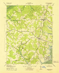 1943 Girdletree1943 Print · USGSCoastal Maryland and Virginia settlements thrive during the war years, linked by the rail line through Girdletree. Genealogists and local historians can trace rural family sites like Klej Grange, the St Pauls School, and the maritime hubs of Greenbackville and Franklin City.
 - 1946 Map of Salisbury, 1948 Print
 1946 Salisbury1948 Print · USGSThe Delmarva Peninsula in the late nineteen-forties shows a landscape defined by its deep river arteries and emerging coastal defenses. Genealogists and historians can trace rail-connected towns like Federalsburg or locate maritime landmarks such as the Ocean City Seaplane Base and Fort Miles Military Reservation.4 unique versions available
 - 1947 Map of Salisbury, 1948 Print
 1947 Salisbury1948 Print · USGSThe Delmarva Peninsula in the late forties reveals a coastal landscape of maritime defense and growing seaside towns. Trace the post-war footprint of Salisbury, the strategic Fort Miles Military Reservation, and the Ocean City Seaplane Base.
 - 1948 Map of Salisbury, 1951 Print
 1948 Salisbury1951 Print · USGSThe Delmarva Peninsula in the late 1940s is shown here as a busy network of rail-towns and coastal outposts. Researchers can trace the legacy of the Pennsylvania Railroad through inland hubs like Georgetown or the maritime reaches of Crisfield and Cape May.
 - 1953 Map of Girdletree
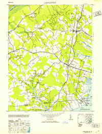 1953 Girdletree1953 Print · USGSThe Maryland-Virginia borderlands on the Eastern Shore are captured here in the early fifties, where rail and tide met. Genealogists can locate family landmarks from Franklin City to Girdletree, including St Pauls School and Spring Hill Cem.2 unique versions available
 - 1957 Map of Salisbury
 1957 Salisbury1957 Print · USGSThe Delmarva Peninsula in the mid-1950s reveals a landscape of coastal defenses and rail-driven commerce. Researchers can trace the Pennsylvania railroad lines or locate historic landmarks like the Fenwick Island Lighthouse and St Martin church.
 - 1961 Map of Salisbury
 1961 Salisbury1961 Print · USGSThe Delmarva Peninsula comes into focus in the early sixties, showing the vital road and rail networks connecting the Chesapeake to the Atlantic. Genealogists and historians can trace family-named landings and coastal landmarks from Crisfield to the Brandywine Shoal Lighthouse.
 - 1965 Map of Salisbury
 1965 Salisbury1965 Print · USGSThe Delmarva Peninsula in the mid-1960s is depicted here as a landscape of coastal defenses and maritime hubs. Genealogists and local historians can trace the foundations of bayside towns like Crisfield and the tactical positioning of the Fort Miles Military Reservation and Cape May Naval Air Station.
 - 1966 Map of Girdletree, 1968 Print
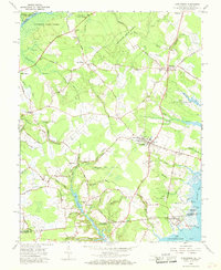 1966 Girdletree1968 Print · USGSThe Maryland-Virginia borderlands of the Eastern Shore come to life in this mid-century survey of the Chincoteague Bay region. Genealogists can trace family footprints across Stockton, Girdletree, and Welbourne, or locate specific sites like the Little Red School and Old Shiloh Cemetery.4 unique versions available
 - 1983 Map of Salisbury, 1984 Print
 1983 Salisbury1984 Print · USGSThe Lower Eastern Shore was a landscape of tide and timber in the early eighties, from the bustling streets of Salisbury to the wild coast of Assateague Island. Researchers can trace the rail-and-road network of the Conrail and U S Highway 50 while locating historic centers like Princess Anne and Crisfield.
 - 2011 Map of Girdletree, 2011 Print
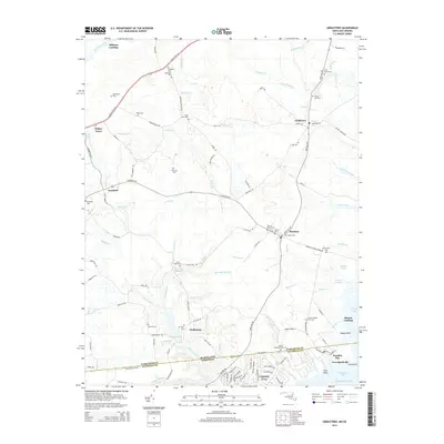
 2011 Girdletree2011 Print · USGSCovers Milburn Landing, including Greenbackville, Goodwill, and other nearby areas
 - 2014 Map of Girdletree, 2014 Print
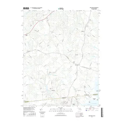
 2014 Girdletree2014 Print · USGSCovers Milburn Landing, including Greenbackville, Goodwill, and other nearby areas
 - 2016 Map of Girdletree, 2016 Print
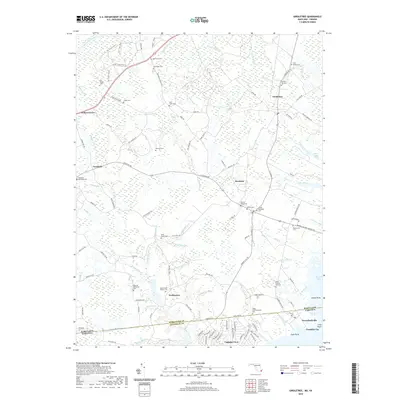
 2016 Girdletree2016 Print · USGSCovers Milburn Landing, including Greenbackville, Goodwill, and other nearby areas
 - 2019 Map of Girdletree, 2019 Print
 2019 Girdletree2019 Print · USGSCovers Milburn Landing, including Greenbackville, Goodwill, and other nearby areas
 - 2023 Map of Girdletree, 2023 Print
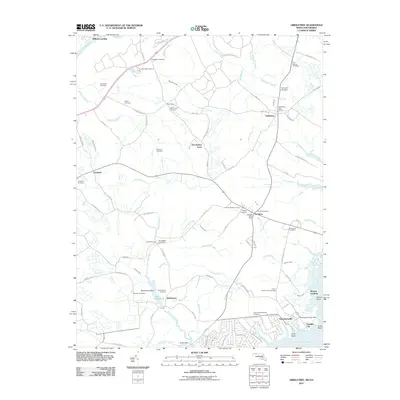
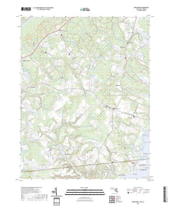 2023 Girdletree2023 Print · USGSThe Maryland and Virginia state line comes to life in this coastal survey, showing the interconnected communities of the Eastern Shore in the early twenty-first century. Researchers can trace numerous local family burial sites like Beth Eden Cem and Mount Hope Baptist Cem or explore the waterfront history of Franklin City.
End of results
Showing maps 1-16 of 16
Top cities near Milburn Landing
- Salisbury historical maps
- Fruitland historical maps
- Pocomoke City historical maps
- Chincoteague historical maps
- Princess Anne historical maps
- Snow Hill historical maps
See more
Frequently asked questions
- What are the different types of historical maps available for Milburn Landing?
- What is the oldest map of Milburn Landing?
- Where can I purchase historical maps of Milburn Landing for my home or office?
- Where can I download high-res historical maps of Milburn Landing?
- Are there historical topographic maps available for Milburn Landing?
- Is there historical aerial imagery available for Milburn Landing?
- Where are historical maps of Milburn Landing sourced from?