Old Maps of Attleboro, Massachusetts for Genealogy
Trace your family roots with 47 historic maps of Attleboro. These high-res maps reveal old neighborhoods, homesites, landmarks, and streets — helping you uncover where your ancestors lived and how the area evolved over time.
- Explore historic neighborhoods: Identify where your relatives may have lived in the 1800s or 1900s.
- Compare maps over time: Trace the changes in streets, buildings, and landmarks for multi-generational research.
- Perfect for genealogy & ancestry research: Used by family historians and researchers to map out lineage and migration.
These maps are an incredible resource for exploring your personal connection to Attleboro's past.
Attleboro, MA maps
(47)- 1885 Map of Taunton
 1885 Taunton1885 Print · USGSTaunton and the surrounding Bristol County townships are shown here during a period of significant industrial and rail expansion. Researchers can trace historic family landmarks and local institutions like the State Hospital for the Insane, Dighton Rock, and the Swansea Factory.
 - 1887 Map of Providence
 1887 Providence1887 Print · USGSProvidence and its surrounding mill towns are captured here at the height of the industrial era. Trace the rail-and-river infrastructure of the Blackstone River through Lorraine Mills, Saylesville, and the Cranston Print Works.
 - 1888 Map of Taunton
 1888 Taunton1888 Print · USGSIn the late nineteenth century, this region of Bristol County was a bustling industrial and rail center. Researchers can trace the extensive Old Colony Railroad network through specialized stops like Britanniaville Station and Cranes Station.
 - 1889 Map of Providence
 1889 Providence1889 Print · USGSProvidence and its industrial corridors thrive at the close of the nineteenth century as a massive rail-and-water network takes shape. Genealogists and historians can trace the foundations of local industry at the Sayles Bleachery or locate long-standing institutions like Friends School and Dexter Asylum.
 - 1893 Map of Taunton
 1893 Taunton1893 Print · USGSTaunton flourished as a rail and manufacturing powerhouse during the late nineteenth century, situated at the nexus of the Old Colony Railroad system. Genealogists and historians can trace the early industrial sites like the Copper Works and Swansea Factory or find local landmarks such as Dighton Rock and the town Almshouse.7 unique versions available
 - 1894 Map of Providence
 1894 Providence1894 Print · USGSThe industrial corridor from Providence to Pawtucket thrives in the 1890s as a hub of rail and river commerce. Genealogists can trace early neighborhood lines and locate vanished institutions like the Dexter Asylum, Sayles Bleachery, and the Butler Hospital.10 unique versions available
 - 1918 Map of Taunton, 1921 Print
 1918 Taunton1921 Print · USGSSoutheastern Massachusetts at the close of the Great War is a dense network of industrial rail lines and riverside villages. You can trace the path of the Old Colony Railroad Main Line or locate local landmarks like the Copper Works and Annawon Rock.
 - 1921 Map of Providence
 1921 Providence1921 Print · USGSProvidence and its industrial satellites are captured here at the height of the rail-and-mill era. Genealogists and historians can trace old neighborhoods and worksites like Sayles Bleachery, the Dexter Asylum, and Lonsdale Station.
 - 1938 Map of Pawtucket, 1941 Print
 1938 Pawtucket1941 Print · USGSIndustrial Rhode Island at the end of the Depression era is defined here by the river towns of the Blackstone Valley. Genealogists can locate several historic burial sites, including Polish Cem and Clarks Cem, or trace early industrial landmarks like Arnolds Mills.
 - 1942 Map of Pawtucket
 1942 Pawtucket1942 Print · USGSThe Blackstone River valley thrives at the start of the 1940s, showcasing a landscape defined by mill towns and extensive rail infrastructure. Researchers can trace the heritage of local communities through landmarks like the Cistercian Monastery, Lonsdale Sta, and the Moshassuck Cem.
 - 1943 Map of Providence
 1943 Providence1943 Print · USGSNarragansett Bay and the industrial Blackstone Valley appear here in the midst of the Second World War. Genealogists and researchers can trace local landmarks like Lonsdale Station, the St Marys Reservoir, and the Rhode Island State Airport.
 - 1943 Map of Attleboro
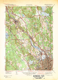
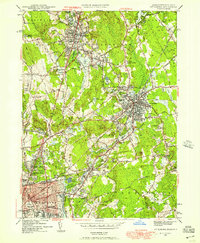
 1943 Attleboro1943 Print · USGSAttleboro and its surrounding mill villages are captured here during the Second World War era. Researchers can trace ancestral roots through sites like the Old Town Hall, Newell Cem, and the specialized Attleboro Springs Sanitarium.3 unique versions available
 - 1944 Map of Pawtucket
 1944 Pawtucket1944 Print · USGSThe industrial corridor of the Blackstone River valley is frozen in time during the mid-1940s, showing the dense rail networks and mill towns of northern Rhode Island. Genealogists and historians can trace family roots through the Moshassuck Cem, find local schools like Garvin Sch, and locate the Cistercian Monastery.3 unique versions available
 - 1944 Map of Norton
 1944 Norton1944 Print · USGSMid-century Bristol County reveals a landscape of emerging industry and military mobilization just before post-war suburbanization. Trace the rail-and-river economy through landmarks like the Copper Works, the campus of Wheaton College, and the sprawling Camp Miles Standish.2 unique versions available
 - 1947 Map of Providence, 1948 Print
 1947 Providence1948 Print · USGSSouthern New England is captured in the mid-1940s, showing a landscape defined by busy industrial ports and expanding military installations. Researchers can trace the rail lines of the N.Y. N.H. & H. RR or locate coastal defenses like Fort Adams and Quonset Point.5 unique versions available
 - 1948 Map of Providence, 1951 Print
 1948 Providence1951 Print · USGSSouthern New England’s coastal reaches are captured here in the late 1940s, from the industrial heart of Providence to the tip of Provincetown. Genealogists and historians can trace rail lines like the Central Vermont Railway and locate active military sites such as Otis Air Force Base and Fort Rodman.
 - 1949 Map of Pawtucket, 1952 Print
 1949 Pawtucket1952 Print · USGSThe Blackstone River valley comes to life in the late 1940s, showing a landscape defined by mill towns and early industrial infrastructure. Genealogists and historians can trace family roots at St James Cem and Moshassuck Cem or locate lost landmarks like Berkeley Airport and the Cistercian Monastery.7 unique versions available
 - 1949 Map of Attleboro, 1957 Print
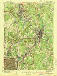
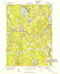
 1949 Attleboro1957 Print · USGSMid-century Bristol County shows a landscape of growing towns and established industry along the Rhode Island border. Genealogists can locate family sites among Woodlawn Cem, Adamsdale Sch, and the La Sallette Seminary.
 - 1951 Map of Norton, 1953 Print
 1951 Norton1953 Print · USGSBristol County in the early fifties showcases a landscape of institutional growth and rail-side industry centered around Norton. Genealogists and researchers can trace local landmarks like Wheaton College, the Copper Works, and the Myles Standish State School.3 unique versions available
 - 1957 Map of Providence
 1957 Providence1957 Print · USGSCoastal New England at the height of the mid-century era shows a landscape shaped by maritime industry and Cold War defense. Genealogists and historians can trace the reach of the New York, New Haven & Hartford RR and locate legacy sites like Fort Adams and Quonset Point Naval Air Station.
 - 1958 Map of Providence
 1958 Providence1958 Print · USGSThe Rhode Island and Massachusetts coastlines are shown in detail during the late 1950s, from the urban cores to the tips of the islands. Researchers can trace the mid-century footprint of Quonset Point Naval Air Station, the defense works at Fort Adams, and the rail network of the New York, New Haven and Hartford RR.
 - 1963 Map of Providence
 1963 Providence1963 Print · USGSSouthern New England's coastal and industrial heartland is captured here in the early sixties, from the Rhode Island mainland to the far reaches of the Cape. Researchers can trace mid-century growth in Providence or locate landmarks on Marthas Vineyard and Nantucket Island.
 - 1964 Map of Norton, 1965 Print
 1964 Norton1965 Print · USGSBristol County's inland villages and institutional landscapes are captured here in the mid-1960s as the region evolved. Researchers can trace the sprawling grounds of Wheaton College, the rail lines of the New York New Haven and Hartford, and numerous local burial sites like Norton Center Cem.3 unique versions available
 - 1964 Map of Attleboro, 1966 Print
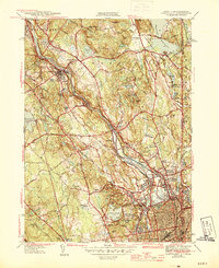
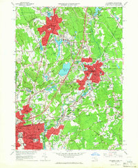 1964 Attleboro1966 Print · USGSThe Attleboro area and the Rhode Island borderlands are shown here in the mid-1960s, a period of established industrial and institutional growth. Genealogists can trace family sites at Mount Hope Cem or North Purchase Cem, and explore schools like Bishop Feehan High Sch.4 unique versions available
 - 1977 Map of Attleboro, 1981 Print
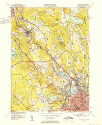
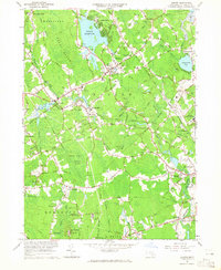
 1977 Attleboro1981 Print · USGSThe industrial and residential landscape of the Massachusetts-Rhode Island border is seen here in the late seventies. Researchers can trace the development of North Attleboro and Attleboro along the path of the Ten Mile River.
Showing maps 1-25 of 47
Top cities near Attleboro
- Providence historical maps
- Brockton historical maps
- Fall River historical maps
- Warwick historical maps
- Cranston historical maps
- Pawtucket historical maps
See more
Top neighborhoods of Attleboro
- Attleborough City historical maps
- Briggs Corner historical maps
- Camp Hebron historical maps
- County Square historical maps
- Dodgeville historical maps
- East Junction historical maps
See more
Frequently asked questions
- What are the different types of historical maps available for Attleboro?
- What is the oldest map of Attleboro?
- Where can I purchase historical maps of Attleboro for my home or office?
- Where can I download high-res historical maps of Attleboro?
- Are there historical topographic maps available for Attleboro?
- Is there historical aerial imagery available for Attleboro?
- Where are historical maps of Attleboro sourced from?