Old Maps of Springfield, Massachusetts
Explore 49 old maps of Springfield, spanning from 1886 to today. These high-resolution historic maps reveal how streets, neighborhoods, landmarks, and natural features evolved over time — perfect for genealogy, metal detecting, research, and local history exploration.
What you can do with these maps:
- See how Springfield changed over time: Compare historical maps to modern-day views to trace roads, homesites, rail lines & more.
- View detailed metadata: Each map includes creators, publishers, year, scale, and archive source.
- Overlay maps with satellite & LiDAR: Visualize the past alongside modern tools to explore terrain & human change.
- Trusted historical sources: Maps sourced from the USGS, Library of Congress, and other archives.
- Access maps your way: View online, download high-res files, or order prints for personal or research use.
Start exploring old maps of Springfield to uncover forgotten places, hidden landmarks, and the deep history beneath your feet.
Springfield, MA maps
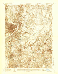
(49)- 1886 Map of Springfield
 1886 Springfield1886 Print · USGSCovers Springfield, including Chicopee, Enfield, and other nearby areas
 - 1887 Map of Palmer
 1887 Palmer1887 Print · USGSCovers Springfield, including Ludlow, East Longmeadow, and other nearby areas
 - 1889 Map of Springfield
 1889 Springfield1889 Print · USGSCovers Springfield, including Chicopee, Enfield, and other nearby areas
 - 1889 Map of Palmer
 1889 Palmer1889 Print · USGSCovers Springfield, including Ludlow, East Longmeadow, and other nearby areas
 - 1893 Map of Springfield
 1893 Springfield1893 Print · USGSCovers Springfield, including Chicopee, Enfield, and other nearby areas
 - 1893 Map of Palmer
 1893 Palmer1893 Print · USGSCovers Springfield, including Ludlow, East Longmeadow, and other nearby areas9 unique versions available
 - 1895 Map of Springfield
 1895 Springfield1895 Print · USGSCovers Springfield, including Chicopee, Enfield, and other nearby areas11 unique versions available
 - 1896 Map of Holyoke
 1896 Holyoke1896 Print · USGSCovers Springfield, including Chicopee, Enfield, and other nearby areas
 - 1897 Map of Holyoke
 1897 Holyoke1897 Print · USGSCovers Springfield, including Chicopee, Enfield, and other nearby areas
 - 1901 Map of Holyoke
 1901 Holyoke1901 Print · USGSCovers Springfield, including Chicopee, Enfield, and other nearby areas4 unique versions available
 - 1908 Map of Ware
 1908 Ware1908 Print · USGSCovers Springfield, including Amherst, Ludlow, and other nearby areas2 unique versions available
 - 1919 Map of Palmer
 1919 Palmer1919 Print · USGSCovers Springfield, including Ludlow, East Longmeadow, and other nearby areas
 - 1920 Map of Springfield
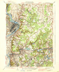
 1920 Springfield1920 Print · USGSCovers Springfield, including Chicopee, Enfield, and other nearby areas
 - 1928 Map of Long Meadow
 1928 Long Meadow1928 Print · USGSCovers Springfield, including Chicopee, Enfield, and other nearby areas
 - 1933 Map of Chicopee
 1933 Chicopee1933 Print · USGSCovers Springfield, including Chicopee, Holyoke, and other nearby areas
 - 1933 Map of Longmeadow
 1933 Longmeadow1933 Print · USGSCovers Springfield, including Chicopee, Enfield, and other nearby areas
 - 1938 Map of Springfield North
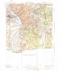
 1938 Springfield North1938 Print · USGSCovers Springfield, including Chicopee, Holyoke, and other nearby areas4 unique versions available
 - 1938 Map of Springfield South
 1938 Springfield South1938 Print · USGSCovers Springfield, including Chicopee, Enfield, and other nearby areas3 unique versions available
 - 1939 Map of Hampden
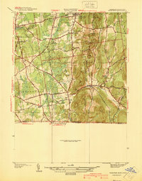
 1939 Hampden1939 Print · USGSCovers Springfield, including East Longmeadow, Wilbraham, and other nearby areas
 - 1939 Map of Ludlow
 1939 Ludlow1939 Print · USGSCovers Springfield, including Ludlow, Wilbraham, and other nearby areas
 - 1939 Map of Springfield South
 1939 Springfield South1939 Print · USGSCovers Springfield, including Chicopee, Enfield, and other nearby areas3 unique versions available
 - 1940 Map of Hampden
 1940 Hampden1940 Print · USGSCovers Springfield, including East Longmeadow, Wilbraham, and other nearby areas2 unique versions available
 - 1942 Map of Ludlow
 1942 Ludlow1942 Print · USGSCovers Springfield, including Ludlow, Wilbraham, and other nearby areas
 - 1942 Map of Hampden
 1942 Hampden1942 Print · USGSCovers Springfield, including East Longmeadow, Wilbraham, and other nearby areas
 - 1942 Map of Ware
 1942 Ware1942 Print · USGSCovers Springfield, including Amherst, Ludlow, and other nearby areas
Showing maps 1-25 of 49
Top cities near Springfield
- Chicopee historical maps
- Enfield historical maps
- Westfield historical maps
- Holyoke historical maps
- Amherst historical maps
- Windsor historical maps
See more
Top neighborhoods of Springfield
- Old Hill historical maps
- Brightwood historical maps
- East Springfield historical maps
- North End historical maps
- Pine Point historical maps
- South End historical maps
See more
Frequently asked questions
- What are the different types of historical maps available for Springfield?
- What is the oldest map of Springfield?
- Where can I purchase historical maps of Springfield for my home or office?
- Where can I download high-res historical maps of Springfield?
- Are there historical topographic maps available for Springfield?
- Is there historical aerial imagery available for Springfield?
- Where are historical maps of Springfield sourced from?