Old Maps of Cohasset, Massachusetts for Metal Detecting
Plan your next treasure hunt with 36 historic maps of Cohasset. Find old homesites, ghost towns, trails, and gathering spots that may be lost to time — perfect for identifying promising metal detecting locations.
- Locate forgotten sites: Uncover places like long-lost settlements, abandoned rail lines, or gathering spots.
- Plan better hunts: Use map overlays combined with LiDAR or satellite views to narrow in on historically rich areas.
- Made for detectorists: Thousands of hobbyists use these maps to discover relics, coins, and hidden history.
Use these historic maps to boost your research and find new opportunities beneath the surface of Cohasset.
Cohasset, MA maps
(36)- 1885 Map of Abington
 1885 Abington1885 Print · USGSCoastal Plymouth County villages and the early rail network are frozen in time just before the turn of the century. Genealogists can trace family footprints from the maritime hubs of Scituate Harbor to inland junctions like Queen Ann Corners and Weymouth Landing.
 - 1888 Map of Abington
 1888 Abington1888 Print · USGSCoastal Plymouth County thrives in the late 1880s as a hub of manufacturing and maritime trade connected by a dense rail network. Genealogists and historians can trace family-named sites like King Oak Hill or industrial landmarks such as the Iron Works and Old Spain.
 - 1892 Map of Boston Bay
 1892 Boston Bay1892 Print · USGSThe outer harbor and North Shore coastline are captured in the late Victorian era, before modern development reshaped the beaches and islands. Genealogists and maritime historians can trace the early rail lines to Revere Beach or locate historic defenses like Fort Warren and the iconic Boston Light.4 unique versions available
 - 1893 Map of Abington
 1893 Abington1893 Print · USGSCoastal and inland Massachusetts thrive at the peak of the rail era, where the Old Colony Railroad links maritime harbors to inland factory towns. You can trace 19th-century village life through local landmarks like Weymouth Landing, Queen Ann Corners, and the Old Oaken Bucket Homestead.9 unique versions available
 - 1903 Map of Boston Bay
 1903 Boston Bay1903 Print · USGSThe Massachusetts North and South Shores are seen here at the turn of the century as a hub of rail-connected maritime life. You can trace the path of old rail divisions to historic coastal landings at Point of Pines, Marblehead, and the naval defenses at Ft. Warren.9 unique versions available
 - 1920 Map of Abington
 1920 Abington1920 Print · USGSThe South Shore was a bustling network of rail and industry at the end of the Great War. You can trace the path of the Hanover Branch and Old Colony RR, or find historic sites like the Old Oaken Bucket Homestead and Weymouth Landing.
 - 1936 Map of Cohasset
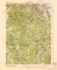
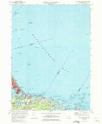
 1936 Cohasset1936 Print · USGSThe South Shore's coastal towns and rail connections are captured here in the mid-1930s. Genealogists and historians can trace family-named sites like the Old Oaken Bucket Homestead or locate the Union Mission Chapel and the Curtis School during the railway era.
 - 1936 Map of Nantasket
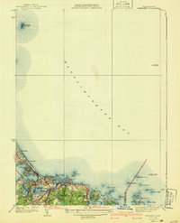
 1936 Nantasket1936 Print · USGSThe Massachusetts coastline near Cohasset and Hingham shows a detailed view of beach resorts and rocky harbors in the mid-1930s. Genealogists can trace family footprints around Atlantic, the Damon Sch, and the offshore Minots Ledge Lighthouse.
 - 1941 Map of Cohasset
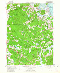
 1941 Cohasset1941 Print · USGSCoastal Plymouth County in the mid-1930s reveals a landscape of tidal harbors, granite hills, and rail-side villages. Genealogists and local historians can trace family-named sites like Kings Landing, the Curtis Sch, and the Old Oaken Bucket Homestead Road.3 unique versions available
 - 1941 Map of Nantasket
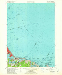
 1941 Nantasket1941 Print · USGSCoastal Plymouth County in the years before the war shows a landscape defined by maritime heritage and seaside growth. Researchers can trace the development of Kenberma, locate the old Patriot Sch, and study the offshore positions of The Graves and the Boston Lightship.3 unique versions available
 - 1947 Map of Cohasset, 1958 Print
 1947 Cohasset1958 Print · USGSThe Massachusetts South Shore is captured here in the late 1940s, balancing its historic seafaring roots with early postwar growth. Researchers can trace family sites from Assinippi to North Scituate, including landmarks like Lawson Tower and the Old Oaken Bucket Homestead.
 - 1948 Map of Boston
 1948 Boston1948 Print · USGSEastern Massachusetts and southern New Hampshire appear at an industrial peak in the late 1940s, just as suburban growth began to accelerate. Genealogists and historians can trace rail lines like the Boston and Albany RR or locate coastal landmarks like Graves Lighthouse and Fort Devens.2 unique versions available
 - 1949 Map of Nantasket, 1958 Print
 1949 Nantasket1958 Print · USGSThe South Shore at mid-century reveals a blend of coastal leisure and vital maritime safety. Genealogists and historians can trace the residential layouts of Kenberma and North Cohasset or locate the storied Minots Ledge Lighthouse.
 - 1956 Map of Boston, 1967 Print
 1956 Boston1967 Print · USGSThe Massachusetts coastline and industrial interior are seen here during the mid-century peak of suburban and highway expansion. Researchers can trace historic harbor defenses like Fort Revere, local landmarks such as Faneuil Hall, and the vast Parker River National Wildlife Refuge.6 unique versions available
 - 1958 Map of Boston
 1958 Boston1958 Print · USGSEastern Massachusetts and southern New Hampshire are shown at the height of the industrial era, before the full expansion of the interstate system. Trace coastal defenses at Fort Warren, historic rail lines like the Boston and Maine, and the development of the Mass. 128 corridor.2 unique versions available
 - 1961 Map of Boston
 1961 Boston1961 Print · USGSThe Massachusetts coastline and its industrial interior are detailed here in the mid-twentieth century, from the Monadnock highlands to Cape Cod. Researchers can trace the rail routes of the Boston and Maine or locate landmarks like Fort Devens and the Wachusett Reservoir.2 unique versions available
 - 1961 Map of Cohasset, 1963 Print
 1961 Cohasset1963 Print · USGSThe South Shore at the start of the sixties reveals a blend of coastal heritage and postwar growth. Local historians can trace family roots through the Old First Parish Cem or locate historic sites like Kings Landing and the Old Oaken Bucket Homestead.2 unique versions available
 - 1961 Map of Nantasket, 1963 Print
 1961 Nantasket1963 Print · USGSThe Massachusetts coastline in the early sixties shows the vibrant seaside life and maritime hazards of the South Shore. Genealogists and local historians can trace family properties near Paragon Park, North Cohasset, and the historic Boston Light.2 unique versions available
 - 1974 Map of Nantasket Beach, 1975 Print
 1974 Nantasket Beach1975 Print · USGSThe South Shore's famous coastal resorts and hazardous shipping lanes are detailed in this mid-seventies survey of the Massachusetts coast. Genealogists and historians can trace the footprint of Paragon Park, the homes of North Cohasset, and the offshore beacons like Boston Light.2 unique versions available
 - 1974 Map of Cohasset, 1976 Print
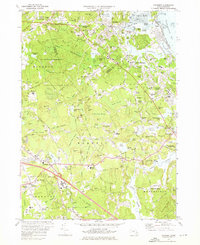 1974 Cohasset1976 Print · USGSCoastal Massachusetts at the height of the 1970s reveals a mix of maritime villages and expanding suburban centers nestled between massive state parklands. Genealogists and historians can trace lineage through First Parish Cem or locate the historic Maryknoll Seminary and Glastonbury Monastery.2 unique versions available
 - 1977 Map of Nantasket Beach, 1980 Print
 1977 Nantasket Beach1980 Print · USGSThe South Shore's coastline in the late seventies is captured here through detailed aerial photography. You can trace the residential patterns of North Cohasset and the fragile peninsula of Nantasket Beach along Straits Pond.
 - 1977 Map of Cohasset, 1980 Print
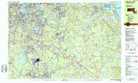
 1977 Cohasset1980 Print · USGSThe South Shore landscape of the late seventies is captured here in literal detail, from the coastline to the inland woods. Researchers can examine the exact layout of settlements like Cohasset, North Scituate, and Greenbush.
 - 1984 Map of Weymouth
 1984 Weymouth1984 Print · USGSCoastal Plymouth and Norfolk Counties are captured here in the mid-eighties, showing the region's transition from a naval hub to a modern suburban corridor. Researchers can trace family sites at Village Cem or explore the massive layout of the South Weymouth Naval Air Station and Wompatuck State Park.2 unique versions available
 - 1984 Map of Hull
 1984 Hull1984 Print · USGSThe South Shore and Boston Harbor islands are captured in detail during the mid-eighties, showing a landscape defined by maritime navigation and coastal defense. Researchers can trace historic fortifications like Fort Warren and Fort Standish or locate family sites in Nantasket Beach and Allerton.
 - 1984 Map of Provincetown, 1986 Print
 1984 Provincetown1986 Print · USGSThe Massachusetts coastline and the tip of Cape Cod appear here during the mid-eighties, highlighting the region's dense coastal settlements and maritime defenses. You can locate family landmarks in Marshfield, trace the grounds of the North Truro Air Force Station, and explore the islands of Boston Harbor like Peddocks Island.2 unique versions available
Showing maps 1-25 of 36
Top cities near Cohasset
- Boston historical maps
- Brockton historical maps
- Quincy historical maps
- Lynn historical maps
- Malden historical maps
- Weymouth historical maps
See more
Top neighborhoods of Cohasset
- Black Rock historical maps
- North Cohasset historical maps
- Beechwood historical maps
- Reeds Corner historical maps
Frequently asked questions
- What are the different types of historical maps available for Cohasset?
- What is the oldest map of Cohasset?
- Where can I purchase historical maps of Cohasset for my home or office?
- Where can I download high-res historical maps of Cohasset?
- Are there historical topographic maps available for Cohasset?
- Is there historical aerial imagery available for Cohasset?
- Where are historical maps of Cohasset sourced from?