Old Maps of Dover, Massachusetts
Explore 69 old maps of Dover, spanning from 1886 to today. These high-resolution historic maps reveal how streets, neighborhoods, landmarks, and natural features evolved over time — perfect for genealogy, metal detecting, research, and local history exploration.
What you can do with these maps:
- See how Dover changed over time: Compare historical maps to modern-day views to trace roads, homesites, rail lines & more.
- View detailed metadata: Each map includes creators, publishers, year, scale, and archive source.
- Overlay maps with satellite & LiDAR: Visualize the past alongside modern tools to explore terrain & human change.
- Trusted historical sources: Maps sourced from the USGS, Library of Congress, and other archives.
- Access maps your way: View online, download high-res files, or order prints for personal or research use.
Start exploring old maps of Dover to uncover forgotten places, hidden landmarks, and the deep history beneath your feet.
Dover, MA maps
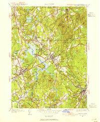
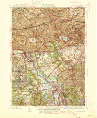
(69)- 1886 Map of Dedham
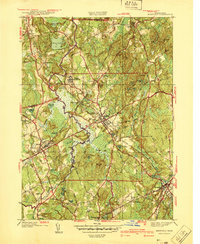
 1886 Dedham1886 Print · USGSNorfolk County and its neighbors are captured here in the late nineteenth century as the rail networks expanded across eastern Massachusetts. Local historians can trace the routes of the Old Colony Railroad and find early village sites like Furnace Village and Sharon Heights.
 - 1886 Map of Framingham
 1886 Framingham1886 Print · USGSMiddlesex County emerges as a bustling hub of rail transit and water infrastructure at the close of the 1800s. Genealogists and historians can trace family locations near the Mass. State Muster Grounds, the State Prison, or the historic Wayside Inn.
 - 1887 Map of Franklin
 1887 Franklin1887 Print · USGSNorfolk County at the peak of the industrial rail era shows a complex landscape of mill villages and expanding transit lines. Trace the development of City Mills, follow the Old Colony R. R. Wrentham Branch, or locate old landmarks like Burnt Swamp Corner.
 - 1889 Map of Franklin
 1889 Franklin1889 Print · USGSThe industrial and rail hubs of Norfolk County are detailed in the late 1880s, documenting a time of rapid growth for mill towns and village centers. Researchers can trace historic station stops and hamlets like City Mills, Unionville, and Whitney Sta.
 - 1889 Map of Framingham
 1889 Framingham1889 Print · USGSThe Framingham and Concord region flourished as a late nineteenth-century rail and industrial hub. Genealogists and historians can trace the early layouts of Saxonville, the American Powder Co., and the Mass. State Muster Grounds.
 - 1893 Map of Franklin
 1893 Franklin1893 Print · USGSEastern Massachusetts at the close of the nineteenth century was a landscape of busy rail junctions and riverside mill towns. Researchers can trace the era's industrial footprint through sites like City Mills, Medfield Junc., and the isolated Burnt Swamp Corner.8 unique versions available
 - 1893 Map of Boston
 1893 Boston1893 Print · USGSGreater Boston and the Massachusetts coast are captured here in the late nineteenth century as streetcar suburbs and rail lines redefined the region. Trace family roots and local history across old neighborhoods like Washington Village, coastal landmarks like Fort Independence, and the sprawling Middlesex Fells.4 unique versions available
 - 1894 Map of Dedham
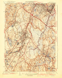
 1894 Dedham1894 Print · USGSGreater Boston's southern suburbs emerge during the late nineteenth century as a dense network of railroad lines and water-powered industrial centers. Genealogists and historians can trace old neighborhoods from Readville and Endicott to the heights of Great Blue Hill.10 unique versions available
 - 1894 Map of Framingham
 1894 Framingham1894 Print · USGSMiddlesex County in the late nineteenth century is a landscape of thriving rail depots and literary landmarks. Genealogists and historians can trace the foundations of local life at the Wayside Inn, the State Prison, and the Mass. State Muster Grounds.11 unique versions available
 - 1903 Map of Boston
 1903 Boston1903 Print · USGSThe Greater Boston area and its sprawling rail-and-river network are captured here at the turn of the century. Genealogists and historians can trace neighborhood blocks, the grounds of Tufts College, and military landmarks like Ft. Winthrop and Ft. Independence.13 unique versions available
 - 1918 Map of Framingham
 1918 Framingham1918 Print · USGSEastern Massachusetts is seen here as a bustling rail-and-river corridor during the early twentieth century. Genealogists and historians can trace old property lines and landmarks like the Wayside Inn, the State Prison, and Nine Acre Corner.2 unique versions available
 - 1919 Map of Dedham
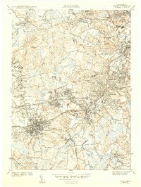
 1919 Dedham1919 Print · USGSNorfolk County at the close of the Great War reveals a landscape defined by the Blue Hills Reservation and a dense network of industrial rail lines. Genealogists and historians can trace old neighborhood boundaries in Readville and Islington or locate lost trackside stops along the Old Colony RR.
 - 1919 Map of Franklin
 1919 Franklin1919 Print · USGSEastern Massachusetts at the end of the Great War was a landscape defined by its river-powered mill towns and expanding rail corridors. Genealogists and local historians can trace family roots through industrial hamlets like City Mills, Unionville, and Sheldonville.2 unique versions available
 - 1921 Map of Franklin, 1942 Print
 1921 Franklin1942 Print · USGSThe Charles River valley was a network of bustling rail junctions and mill villages in the years following the Great War. You can trace the development of towns like Franklin and Medway or locate smaller centers such as City Mills and Unionville.
 - 1936 Map of Norwood
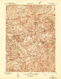
 1936 Norwood1936 Print · USGSNorfolk County in the mid-1930s shows a landscape of busy rail corridors and river-powered industry centered on the Neponset River. Genealogists and historians can trace neighborhood growth through local landmarks like Plumptonville, the Colburn Sch, and the Norwood Central Sta.
 - 1940 Map of Medfield
 1940 Medfield1940 Print · USGSMedfield and the surrounding Charles River valley appear here just before the Second World War, showing a landscape of small villages and large institutional grounds. Researchers can trace the old rail beds of the New York New Haven and Hartford and find local landmarks like Schoolhouse No 14 and the Medfield State Hospital.2 unique versions available
 - 1941 Map of Norwood
 1941 Norwood1941 Print · USGSNorfolk County during the mid-1930s shows a landscape of growing town centers and industrial rail corridors along the Neponset River. Researchers can trace local landmarks like the Sharon Sanitorium, Highland Cem, and the specialized Norfolk County Agricultural Sch.3 unique versions available
 - 1943 Map of Boston
 1943 Boston1943 Print · USGSGreater Boston and its southern suburbs appear here during the mobilization of the early 1940s. Genealogists and historians can trace the early footprints of Commonwealth Airport, military sites like Fort Winthrop, and local institutions such as Pondville State Hospital.
 - 1943 Map of Natick
 1943 Natick1943 Print · USGSMiddlesex and Norfolk Counties are shown here during the early 1940s as suburban growth began to surround historic town centers. Researchers can trace family sites near Wellesley College, find old burials at South Cem, and follow the Boston and Maine rail lines.5 unique versions available
 - 1944 Map of Newton
 1944 Newton1944 Print · USGSThe western suburbs of Boston thrive in the mid-1940s, defined by the winding Charles River and a dense network of rail lines. Genealogists and local historians can trace family plots and parish boundaries at Newton Cem, St Gabriels Monastery, and the Christian Science Sanatorium.
 - 1945 Map of Medfield, 1954 Print
 1945 Medfield1954 Print · USGSThe Charles River valley and its rail-connected towns appear here during the mid-forties. Genealogists and historians can trace family locations near Medfield State Hospital, Farm St Sta, and Vine Lake Cem.3 unique versions available
 - 1946 Map of Medfield
 1946 Medfield1946 Print · USGSPost-war Norfolk County is captured here just as local rail service and institutional life centered on the Medfield State Hospital remained vital. Trace family lands near Pine Hill Cem or follow the New Haven and Hartford RR through Medfield Junction.2 unique versions available
 - 1946 Map of Newton
 1946 Newton1946 Print · USGSNewton and the western Boston suburbs are captured in the mid-1940s, showcasing a landscape of established estates, institutions, and rail lines. You can trace early 20th-century neighborhoods and landmarks like the Chestnut Hill Reservoir, Boston College, and Needham Junction.3 unique versions available
 - 1946 Map of Norwood, 1958 Print
 1946 Norwood1958 Print · USGSNorfolk County during the postwar expansion era reveals a landscape shaped by the Neponset River and thriving rail corridors. Researchers can trace the development of local centers like Islington and East Walpole or locate landmarks such as the Norwood Airfield and Colburn Sch.
 - 1947 Map of Norwood
 1947 Norwood1947 Print · USGSPost-war Norfolk County centers on the busy rail-and-river corridor of the late forties. Researchers can trace the neighborhood growth of Islington and East Walpole or locate family markers at Fairview Cemetery and Highland Cem.
Showing maps 1-25 of 69
Top cities near Dover
- Boston historical maps
- Cambridge historical maps
- Brockton historical maps
- Quincy historical maps
- Newton historical maps
- Somerville historical maps
See more
Top neighborhoods of Dover
Frequently asked questions
- What are the different types of historical maps available for Dover?
- What is the oldest map of Dover?
- Where can I purchase historical maps of Dover for my home or office?
- Where can I download high-res historical maps of Dover?
- Are there historical topographic maps available for Dover?
- Is there historical aerial imagery available for Dover?
- Where are historical maps of Dover sourced from?