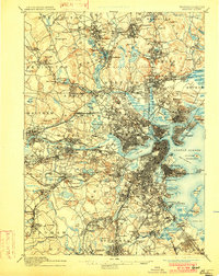
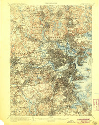
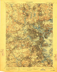
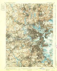
1903 Map of Boston
USGS Topo · Published 1903This historical map portrays the area of Boston in 1903, primarily covering Suffolk County as well as portions of Middlesex County, Essex County, and Norfolk County. Featuring a scale of 1:62500, this map provides a highly detailed snapshot of the terrain, roads, buildings, counties, and historical landmarks in the Boston region at the time. Published in 1903, it is one of 13 known editions of this map due to revisions or reprints.
Find a feature on this map
193 named features on this map. Tap any name to fly to it.
Don’t see what you’re looking for? This feature index may not catch every label — zoom into the map to look around manually.
Map Details
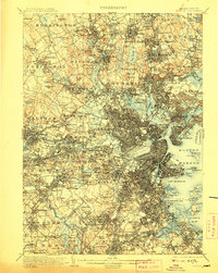
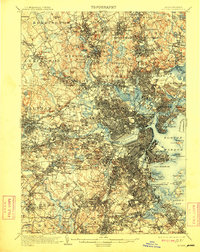
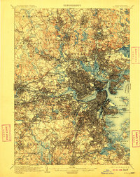
Editions of this 1903 Boston Map
13 editions found
1903 edition
15.8 x 19.9 inches
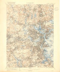
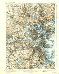
1905 edition
15.8 x 19.8 inches
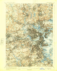
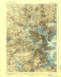
1907 edition
15.8 x 19.8 inches
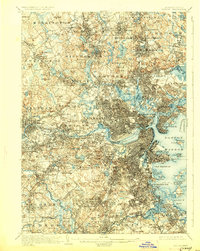
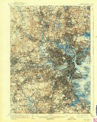
1909 edition
15.8 x 19.8 inches
1910 edition
15.8 x 19.8 inches
1912 edition
15.8 x 19.8 inches
1918 edition
16.59 x 19.91 inches
1925 edition
15.8 x 19.8 inches
1928 edition
15.8 x 19.8 inches
1931 edition
15.8 x 19.7 inches
1931 edition
15.8 x 19.8 inches
1939 edition
15.8 x 19.8 inches
1942 edition
15.8 x 19.8 inches
Historical Maps of Dover Through Time
9 maps found