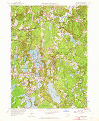
1960s Maps of Pembroke, Massachusetts
Explore 3 historic maps of Pembroke from the 1960s. These maps offer a rare glimpse into what life looked like during the 1960s — showing old roads, neighborhoods, homes, and landmarks that have changed or disappeared over time.
Whether you're researching your family's past, planning a metal detecting trip, or studying how Pembroke's landscape evolved across the 1960s, these high-resolution maps are a powerful tool for exploring the history of this region.
- Focus on a specific era: All maps on this page are from the 1960s, giving you a focused view of this time period.
- See what’s changed: Compare century-old streets, trails, and buildings to today's modern landscape using overlays and satellite layers.
- Research with precision: Use these maps for genealogy, historical research, land use analysis, or educational projects.
- View, download, or print: Maps are fully viewable online in high resolution, and can be downloaded or printed for your own records.
Start exploring Pembroke's history through authentic maps from the 1960s. This is your window into the past.
Pembroke, MA maps
(3)- 1961 Map of Boston
 1961 Boston1961 Print · USGSThe Massachusetts coastline and its industrial interior are detailed here in the mid-twentieth century, from the Monadnock highlands to Cape Cod. Researchers can trace the rail routes of the Boston and Maine or locate landmarks like Fort Devens and the Wachusett Reservoir.2 unique versions available
 - 1961 Map of Duxbury, 1963 Print
 1961 Duxbury1963 Print · USGSThe Plymouth County coast in the early sixties reveals a landscape rich in Pilgrim history and maritime tradition. Trace early colonial roots at the John Alden House, the Standish Monument, and the iconic Plymouth Lighthouse on Gurnet Point.
 - 1962 Map of Hanover, 1964 Print
 1962 Hanover1964 Print · USGSPlymouth County in the early sixties reveals a landscape of sprawling cranberry bogs and growing residential villages nestled between major glacial ponds. Genealogists and historians can locate family landmarks like Briggs Cem, the First Baptist Ch, and old rail points at Winslows Crossing and Curtis Crossing.2 unique versions available
End of results
Showing maps 1-3 of 3
Top cities near Pembroke
- Boston historical maps
- Brockton historical maps
- Quincy historical maps
- Plymouth historical maps
- Taunton historical maps
- Weymouth historical maps
See more
Top neighborhoods of Pembroke
- East Pembroke historical maps
- Golden Ring Camp historical maps
- Mayflower Grove historical maps
- North Pembroke historical maps
- Oakland Square historical maps
- Oldham Village historical maps
See more
Frequently asked questions
- What are the different types of historical maps available for Pembroke?
- What is the oldest map of Pembroke?
- Where can I purchase historical maps of Pembroke for my home or office?
- Where can I download high-res historical maps of Pembroke?
- Are there historical topographic maps available for Pembroke?
- Is there historical aerial imagery available for Pembroke?
- Where are historical maps of Pembroke sourced from?