Old Maps of Gardner, Massachusetts for Metal Detecting
Plan your next treasure hunt with 55 historic maps of Gardner. Find old homesites, ghost towns, trails, and gathering spots that may be lost to time — perfect for identifying promising metal detecting locations.
- Locate forgotten sites: Uncover places like long-lost settlements, abandoned rail lines, or gathering spots.
- Plan better hunts: Use map overlays combined with LiDAR or satellite views to narrow in on historically rich areas.
- Made for detectorists: Thousands of hobbyists use these maps to discover relics, coins, and hidden history.
Use these historic maps to boost your research and find new opportunities beneath the surface of Gardner.
Gardner, MA maps
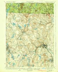
(55)- 1887 Map of Winchendon
 1887 Winchendon1887 Print · USGSNorth-central Massachusetts and the New Hampshire borderlands are captured here during a peak era of rail expansion and water-powered industry. Researchers can trace historic mill sites and depot locations such as Powers Mills, Pequoig Station, and the busy rail junction at Baldwinville.
 - 1887 Map of Fitchburg
 1887 Fitchburg1887 Print · USGSThe hills of Worcester County were a beehive of rail and industry when this survey was conducted. Trace the original routes of the Fitchburg Railroad and find long-established local centers like Wachusett Village, Converse Ville, and Rollstone Hill.
 - 1889 Map of Fitchburg
 1889 Fitchburg1889 Print · USGSNorth-central Massachusetts and southern New Hampshire are captured here in the late Victorian era as industry and rail expanded. Genealogists can trace family homesteads near Whitmanville or locate specific rail depots like Ashburnham Junction and Westminster Station.
 - 1890 Map of Winchendon
 1890 Winchendon1890 Print · USGSThe Worcester County borderlands at the end of the 19th century reveal a complex landscape of mill villages and hilltop commons. Researchers can trace the early industrial footprint at Powers Mills, find the rail junction at Pequoig Station, and locate the ancestral centers of Royalston Center or Templeton Center.
 - 1893 Map of Fitchburg
 1893 Fitchburg1893 Print · USGSNorth-central Massachusetts at the close of the nineteenth century was a complex network of industrial valley towns and highland rail junctions. You can trace the path of the Cheshire Railroad as it winds past Lake Monomonac or explore the early street layouts of Fitchburg and Leominster.7 unique versions available
 - 1894 Map of Winchendon
 1894 Winchendon1894 Print · USGSNorth-central Massachusetts and the New Hampshire border are captured here during a peak era of rail-driven industry. Genealogists and historians can trace the development of mill villages and family landmarks like Powers Mills, Baldwinville, and the Cheshire Railroad.6 unique versions available
 - 1931 Map of Fitchburg
 1931 Fitchburg1931 Print · USGSThe Massachusetts and New Hampshire border region was a network of mill villages and mountain ridges in the early thirties. Genealogists and historians can locate rural landmarks like School No 8, the High Bridge, and the Boston and Maine rail line.
 - 1935 Map of Fitchburg
 1935 Fitchburg1935 Print · USGSThe industrial corridor and border hills of north-central Massachusetts and southern New Hampshire are captured here in the mid-1930s. Trace the intricate rail networks of the Old Colony Railroad and find local landmarks like School No 8 or Rollstone Hill.3 unique versions available
 - 1935 Map of Winchendon
 1935 Winchendon1935 Print · USGSIn the mid-1930s, the border between Massachusetts and New Hampshire was defined by busy rail corridors and small mill towns. Researchers can trace family-named sites and industrial infrastructure from Athol Center to Pequoig Station and the rural School No 1.4 unique versions available
 - 1936 Map of Fitchburg
 1936 Fitchburg1936 Print · USGSNorthwestern Massachusetts and southern New Hampshire are shown here during the mid-1930s, featuring a mature network of rail lines and industrial river towns. Genealogists can locate family landmarks like School No 9 or trace the early paths of the Fitchburg Railroad and Old Colony Railroad Fitchburg Branch.2 unique versions available
 - 1942 Map of Keene
 1942 Keene1942 Print · USGSCheshire County at the start of the war shows a landscape of busy river valleys and upland farms. You can trace the path of the Boston & Maine RR through towns like Westmoreland and find old district landmarks like Sch No 10 or the Rand Cem.
 - 1943 Map of Fitchburg
 1943 Fitchburg1943 Print · USGSSouthern New Hampshire and northern Massachusetts are captured during the war years, showing a landscape of river-powered mill towns and mountain trails. You can trace family roots in Peterboro, locate the historic Groton School, or study the rail lines of the Boston & Maine RR.
 - 1946 Map of Gardner
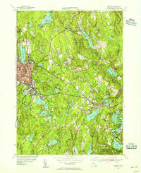
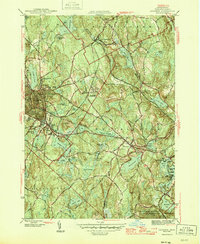 1946 Gardner1946 Print · USGSMid-century Worcester County comes alive in this survey of the region's industrial and rail corridors. Trace the path of the Boston and Maine RR through manufacturing centers and find local landmarks like Heywood Memorial Hospital and Mt Pleasant Cem.2 unique versions available
 - 1946 Map of Ashburnham
 1946 Ashburnham1946 Print · USGSMid-century Worcester County and the New Hampshire border region are captured here in the years just after the war. Genealogists and hikers can trace the original Boston and Maine RR line, locate the Meeting House, or explore the slopes of Mount Watatic.2 unique versions available
 - 1946 Map of Templeton
 1946 Templeton1946 Print · USGSTempleton and the surrounding Worcester County townships are shown just after the war when rail lines and textile-era villages still defined the local landscape. Researchers can trace historic sites like the Fernald State School, Gardner Landing Field, and the Baptist Common Cem.2 unique versions available
 - 1948 Map of Boston
 1948 Boston1948 Print · USGSEastern Massachusetts and southern New Hampshire appear at an industrial peak in the late 1940s, just as suburban growth began to accelerate. Genealogists and historians can trace rail lines like the Boston and Albany RR or locate coastal landmarks like Graves Lighthouse and Fort Devens.2 unique versions available
 - 1948 Map of Albany, 1951 Print
 1948 Albany1951 Print · USGSThe Hudson and Connecticut River valleys are captured here in the late 1940s, showing the vital rail and water corridors of the Northeast. You can trace the Boston and Maine tracks past Mt Greylock or locate early settlements like Great Barrington and Bennington.
 - 1950 Map of Ashburnham, 1952 Print
 1950 Ashburnham1952 Print · USGSMid-century Worcester County comes to life as a landscape of interconnected glacial lakes and upland ridges during the postwar years. Genealogists and local historians can trace the foundations of Ashburnham, Lane Village, and the remote Old North Ashburnham Sta.4 unique versions available
 - 1953 Map of Fitchburg
 1953 Fitchburg1953 Print · USGSMid-century Worcester County comes to life during a period of steady growth and established rail commerce. Local historians can trace family roots at Prospect Hill Cemetery or explore the development of Blackburne Village and the Fitchburg Leominster Airport.
 - 1954 Map of Gardner, 1955 Print
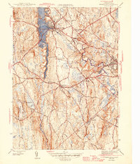
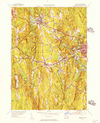
 1954 Gardner1955 Print · USGSThe industrial and lakeside character of Worcester County comes alive in the mid-fifties, showing the rail-connected settlements before modern highway expansion. Genealogists and historians can trace the developments around Gardner, from the corridors of the Boston and Maine to local landmarks like Woodside Cem and Academy Hill.3 unique versions available
 - 1954 Map of Templeton, 1956 Print
 1954 Templeton1956 Print · USGSCentral Massachusetts reveals its mid-century industrial and institutional roots in this map of the Templeton area. Trace the legacy of rail and river through Baldwinsville and Otter River, or find family landmarks like Greenlawn Cem and the Fernald State Sch.3 unique versions available
 - 1956 Map of Boston, 1967 Print
 1956 Boston1967 Print · USGSThe Massachusetts coastline and industrial interior are seen here during the mid-century peak of suburban and highway expansion. Researchers can trace historic harbor defenses like Fort Revere, local landmarks such as Faneuil Hall, and the vast Parker River National Wildlife Refuge.6 unique versions available
 - 1956 Map of Albany, 1968 Print
 1956 Albany1968 Print · USGSThe industrial heart of the Northeast is revealed in the mid-1950s, from the Hudson Valley to the Connecticut River. Researchers can trace the legacy of the Quabbin Reservoir, locate Westover Air Force Base, or follow the Rutland RR through the Green Mountains.2 unique versions available
 - 1957 Map of Albany
 1957 Albany1957 Print · USGSThe Tri-State region and Connecticut River Valley are captured here during a period of significant postwar growth and infrastructure expansion. Genealogists and historians can trace the rail-and-river economy through landmarks like the Boston and Maine railroad, Quabbin Reservoir, and Westover Air Force Base.
 - 1958 Map of Boston
 1958 Boston1958 Print · USGSEastern Massachusetts and southern New Hampshire are shown at the height of the industrial era, before the full expansion of the interstate system. Trace coastal defenses at Fort Warren, historic rail lines like the Boston and Maine, and the development of the Mass. 128 corridor.2 unique versions available
Showing maps 1-25 of 55
Top cities near Gardner
- Leominster historical maps
- Fitchburg historical maps
- Holden historical maps
- Athol historical maps
- Winchendon historical maps
- Lunenburg historical maps
See more
Top neighborhoods of Gardner
Frequently asked questions
- What are the different types of historical maps available for Gardner?
- What is the oldest map of Gardner?
- Where can I purchase historical maps of Gardner for my home or office?
- Where can I download high-res historical maps of Gardner?
- Are there historical topographic maps available for Gardner?
- Is there historical aerial imagery available for Gardner?
- Where are historical maps of Gardner sourced from?