Old Maps of Petersham, Massachusetts for Genealogy
Trace your family roots with 93 historic maps of Petersham. These high-res maps reveal old neighborhoods, homesites, landmarks, and streets — helping you uncover where your ancestors lived and how the area evolved over time.
- Explore historic neighborhoods: Identify where your relatives may have lived in the 1800s or 1900s.
- Compare maps over time: Trace the changes in streets, buildings, and landmarks for multi-generational research.
- Perfect for genealogy & ancestry research: Used by family historians and researchers to map out lineage and migration.
These maps are an incredible resource for exploring your personal connection to Petersham's past.
Petersham, MA maps
(93)- 1887 Map of Warwick
 1887 Warwick1887 Print · USGSUpper Massachusetts and the New Hampshire border at the close of the nineteenth century reveal a landscape of river-powered industry and rail-connected villages. Researchers can trace the path of the Fitchburg R.R. through Millers Falls or locate early river crossings like Munns Ferry.
 - 1887 Map of Belchertown
 1887 Belchertown1887 Print · USGSThe Swift River valley is shown here in the late 1880s, before the landscape was transformed. Researchers can trace the original rail lines of the Boston & Albany R. R. and locate the lost streets of Enfield, Greenwich, and Prescott.
 - 1887 Map of Winchendon
 1887 Winchendon1887 Print · USGSNorth-central Massachusetts and the New Hampshire borderlands are captured here during a peak era of rail expansion and water-powered industry. Researchers can trace historic mill sites and depot locations such as Powers Mills, Pequoig Station, and the busy rail junction at Baldwinville.
 - 1887 Map of Barre
 1887 Barre1887 Print · USGSWorcester County at the turn of the century shows a landscape defined by the convergence of rail lines and river power. Genealogists and local researchers can trace the early industrial footprints of Old Furnace, Parkers Mills, and the rail junction at Cold Brook Springs.
 - 1889 Map of Barre
 1889 Barre1889 Print · USGSWorcester County in the late nineteenth century is a landscape of thriving mill villages and intersecting rail lines. Trace the industrial roots of Gilbertville and Old Furnace or locate family homesteads near Mandell and Nichewaug.
 - 1889 Map of Warwick
 1889 Warwick1889 Print · USGSFranklin County in the late 1880s was defined by its busy rail junctions and river valleys. Genealogists and historians can trace the development of Orange and Northfield, or locate vanished rail stops like Gill Station and Wendell Depot along the Fitchburg Railroad.
 - 1890 Map of Belchertown
 1890 Belchertown1890 Print · USGSThe Swift River valley is seen here in the late nineteenth century, long before the creation of the Quabbin Reservoir. Genealogists and local historians can trace the vanished streets of Enfield, Greenwich, and North Dana, or follow the old Boston & Albany R. R. line.
 - 1890 Map of Winchendon
 1890 Winchendon1890 Print · USGSThe Worcester County borderlands at the end of the 19th century reveal a complex landscape of mill villages and hilltop commons. Researchers can trace the early industrial footprint at Powers Mills, find the rail junction at Pequoig Station, and locate the ancestral centers of Royalston Center or Templeton Center.
 - 1893 Map of Belchertown
 1893 Belchertown1893 Print · USGSThe Swift River valley is shown here in the 1890s, years before the landscape was fundamentally altered. Genealogists can trace family homes and rail routes through Enfield, Prescott, North Dana, and the Boston & Albany R R.8 unique versions available
 - 1894 Map of Winchendon
 1894 Winchendon1894 Print · USGSNorth-central Massachusetts and the New Hampshire border are captured here during a peak era of rail-driven industry. Genealogists and historians can trace the development of mill villages and family landmarks like Powers Mills, Baldwinville, and the Cheshire Railroad.6 unique versions available
 - 1894 Map of Warwick
 1894 Warwick1894 Print · USGSNorthern Massachusetts and New Hampshire borderlands are captured here in the late nineteenth century, showing a landscape shaped by the Millers River. Researchers can trace the path of the Central Vermont Railroad and find early settlements like Wendell Depot and Northfield.6 unique versions available
 - 1894 Map of Barre
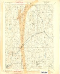 1894 Barre1894 Print · USGSWorcester County in the late nineteenth century is defined here by its bustling river towns and the convergence of two major rail lines. Researchers can trace ancestral roots through family-named landmarks like Hawes Hill or explore the early industrial layout of Old Furnace and Barre Plains.7 unique versions available
 - 1908 Map of Ware
 1908 Ware1908 Print · USGSCentral Massachusetts at the turn of the century reveals the Swift River Valley decades before the Quabbin Reservoir changed the landscape forever. Trace the lost footprints of Enfield and Dana, or follow the Central Vermont RR through Greenwich Village and Ware.2 unique versions available
 - 1935 Map of Warwick
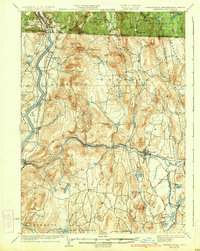 1935 Warwick1935 Print · USGSUpper Massachusetts and the Tri-State borderlands thrive during the mid-thirties as rail corridors and river valleys connect mountain villages. Researchers can trace the Central Vermont Ry through Northfield or locate family landmarks like Barrows Cem and Barber Sch.2 unique versions available
 - 1935 Map of Winchendon
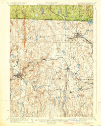 1935 Winchendon1935 Print · USGSIn the mid-1930s, the border between Massachusetts and New Hampshire was defined by busy rail corridors and small mill towns. Researchers can trace family-named sites and industrial infrastructure from Athol Center to Pequoig Station and the rural School No 1.4 unique versions available
 - 1937 Map of Orange
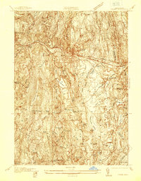 1937 Orange1937 Print · USGSThe Millers River valley and the Franklin-Worcester county line are captured here in the late thirties. Researchers can trace the Boston and Maine Railroad through Orange or locate family sites like Wilbur Cem and Morse Village Sch.
 - 1941 Map of Orange
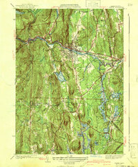 1941 Orange1941 Print · USGSFranklin County in the early 1940s reveals a transition from the industrial Millers River valley to the rural highlands above the Quabbin Reservoir. Local researchers can trace family landmarks like the Morse Village Sch, Jones Cem, and the old rail siding at Wendell Depot.3 unique versions available
 - 1942 Map of Keene
 1942 Keene1942 Print · USGSCheshire County at the start of the war shows a landscape of busy river valleys and upland farms. You can trace the path of the Boston & Maine RR through towns like Westmoreland and find old district landmarks like Sch No 10 or the Rand Cem.
 - 1942 Map of Ware
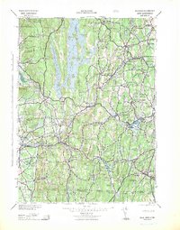 1942 Ware1942 Print · USGSCentral Massachusetts and the Connecticut border are captured here during the early years of the war, just as the landscape was being reshaped by the Quabbin Reservoir. Researchers can trace rail-era industry and local landmarks like the Lead Mine and the Bald Peak Hospital.
 - 1944 Map of Winsor Dam
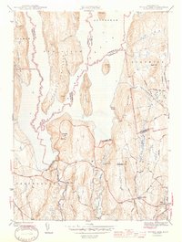 1944 Winsor Dam1944 Print · USGSIn the early 1940s, the Swift River Valley was recently transformed into a critical water resource for Massachusetts. Local historians can trace the new shoreline and legacy sites like the Quabbin Park Cem, Winsor Dam, and the hilltop Lookout on Quabbin Hill.3 unique versions available
 - 1944 Map of Quabbin Reservoir
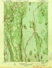 1944 Quabbin Reservoir1944 Print · USGSCentral Massachusetts undergoes a total transformation in the early forties as the valley fills to create a massive water system. Trace former upland settlements like North Prescott and prominent landmarks like Soapstone Hill and the Baffle Dam.3 unique versions available
 - 1946 Map of Barre
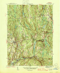 1946 Barre1946 Print · USGSWorcester County's industrial and forest lands are captured in the 1940s as the Ware River corridor served both local mills and regional water needs. Genealogists and historians can trace rail lines like the Boston and Albany Railroad and locate local landmarks such as Glen Valley Cem and the Fairgrounds.2 unique versions available
 - 1946 Map of Petersham
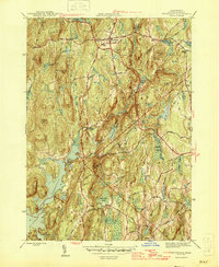 1946 Petersham1946 Print · USGSPetersham and the surrounding Worcester County uplands are documented here just after the war as the region's watershed began its modern era. Genealogists and local historians can trace family-named sites and rural crossroads like Bassets Corner, Nichewaug, and the eastern shores of the Quabbin Reservoir.2 unique versions available
 - 1946 Map of Templeton
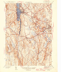 1946 Templeton1946 Print · USGSTempleton and the surrounding Worcester County townships are shown just after the war when rail lines and textile-era villages still defined the local landscape. Researchers can trace historic sites like the Fernald State School, Gardner Landing Field, and the Baptist Common Cem.2 unique versions available
 - 1946 Map of Athol
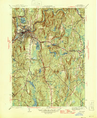 1946 Athol1946 Print · USGSPost-war Worcester County comes into focus as a landscape of river-driven industry and upland forestry. Researchers can trace historic family burial sites at Silver Lake Cem or explore the academic legacy of the Administration Bldg Harvard Forest.2 unique versions available
Showing maps 1-25 of 93
Top cities near Petersham
- Gardner historical maps
- Ludlow historical maps
- Belchertown historical maps
- Palmer historical maps
- Spencer historical maps
- Athol historical maps
See more
Top neighborhoods of Petersham
- Burrage Corner historical maps
- Nichewaug historical maps
- Bassets Corner historical maps
- Dana Commons historical maps
Frequently asked questions
- What are the different types of historical maps available for Petersham?
- What is the oldest map of Petersham?
- Where can I purchase historical maps of Petersham for my home or office?
- Where can I download high-res historical maps of Petersham?
- Are there historical topographic maps available for Petersham?
- Is there historical aerial imagery available for Petersham?
- Where are historical maps of Petersham sourced from?