1980s Maps of Baraga County, Michigan
Explore 30 historic maps of Baraga County from the 1980s. These maps offer a rare glimpse into what life looked like during the 1980s — showing old roads, neighborhoods, homes, and landmarks that have changed or disappeared over time.
Whether you're researching your family's past, planning a metal detecting trip, or studying how Baraga County's landscape evolved across the 1980s, these high-resolution maps are a powerful tool for exploring the history of this region.
- Focus on a specific era: All maps on this page are from the 1980s, giving you a focused view of this time period.
- See what’s changed: Compare century-old streets, trails, and buildings to today's modern landscape using overlays and satellite layers.
- Research with precision: Use these maps for genealogy, historical research, land use analysis, or educational projects.
- View, download, or print: Maps are fully viewable online in high resolution, and can be downloaded or printed for your own records.
Start exploring Baraga County's history through authentic maps from the 1980s. This is your window into the past.
Baraga County, MI maps
(30)- 1984 Map of Glovers Corner, 1985 Print
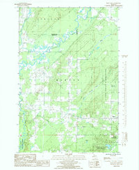
 1984 Glovers Corner1985 Print · USGSThe Upper Peninsula shoreline during the early 1980s reveals a landscape of protected forests and isolated outposts. Trace the winding paths of the Huron River and Little Huron River past landmarks like Bald Mountain and Glovers Corner.
 - 1984 Map of McComb Corner, 1985 Print
 1984 McComb Corner1985 Print · USGSUpper Peninsula wilderness at the edge of Baraga and Marquette Counties is captured here in the early 1980s. Genealogists and local historians can trace remote outposts like McComb Corner and Erickson Camp, or follow the path of the Old RR Grade through the forest.
 - 1984 Map of Skanee North, 1985 Print
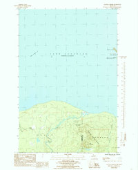
 1984 Skanee North1985 Print · USGSThe tip of the Abbaye Peninsula reaches into Lake Superior during the 1980s, showcasing a landscape of dense state forest and rugged shoreline. Researchers can trace the layout of Skanee, locating the local Marina and Cem near Huron Bay.
 - 1984 Map of Aura, 1985 Print
 1984 Aura1985 Print · USGSThe Abbaye Peninsula in the mid-1980s reveals a quiet landscape of coastal harbors and Ojibwa heritage lands. Genealogists and local historians can trace the rural layout of Aura and locate landmarks like Silver Falls, Pikes Peak, and Snug Harbor.
 - 1984 Map of Portage Entry, 1986 Print
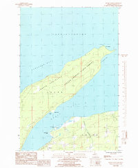
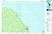
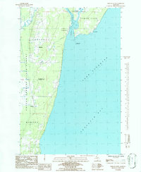 1984 Portage Entry1986 Print · USGSKeweenaw Bay and the strategic canal entrance at Jacobsville are captured in this mid-eighties survey. Genealogists and local historians can trace the foundations of Jacobsville and Klingville, locate the Portage Entry Lighthouse, and find the historic Crebassa Latitude Post.
 - 1984 Map of Keweenaw Bay NE, 1986 Print
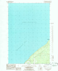 1984 Keweenaw Bay NE1986 Print · USGSThe eastern edge of Keweenaw Bay meets the timberlands of the Upper Peninsula in the mid-eighties. Trace the shoreline of the Abbaye Peninsula and the wooded reaches of the Copper Country State Forest.
 - 1985 Map of Mountain Lake
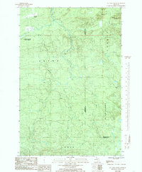
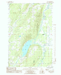
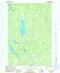
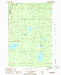
 1985 Mountain Lake1985 Print · USGSUpper Peninsula wilderness and high peaks define this 1980s survey of the Marquette and Baraga county line. Researchers can trace the drainage of the Salmon Trout River and locate remote landmarks like Dodge City, Mountain Lake, and Mummy Mountain.
 - 1985 Map of Otter Lake
 1985 Otter Lake1985 Print · USGSThe Copper Country wilderness comes into focus in the mid-1980s, showing a landscape defined by the winding Sturgeon River and the forested border of Baraga County. Researchers can trace the rural communities of Tapiola and Askel or follow the old industrial grades through the Copper State Forest.
 - 1985 Map of L'Anse
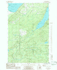
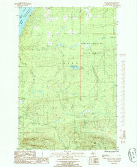
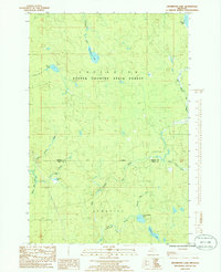
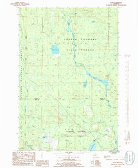
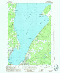 1985 L'Anse1985 Print · USGSThe southern shores of Lake Superior's Keweenaw Bay come into focus in the mid-1980s, highlighting the industrial and tribal lands of Baraga County. Trace the development of L'Anse and Pequaming or find family landmarks like the Assinins mission and Zeba.
 - 1985 Map of Bulldog Lake
 1985 Bulldog Lake1985 Print · USGSThe wilderness of the Upper Peninsula is documented here in the mid-1980s, showing a land of vast forest reserves and glacial lakes. You can trace the remote Dead River Headwater and the boundaries of the Cyrus H McCormick Experimental Forest.
 - 1985 Map of Bear Town
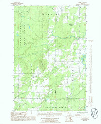
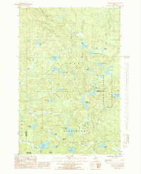
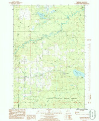
 1985 Bear Town1985 Print · USGSUpper Peninsula forests and winding river valleys dominate this mid-eighties record of Baraga County. Researchers can trace the path of the Old RR Grade and the Trading Strip through the L'Anse Indian Reservation and the town of Baraga.
 - 1985 Map of Skanee South
 1985 Skanee South1985 Print · USGSUpper Peninsula timberlands and the shores of Huron Bay are captured in the mid-1980s as modern surveying reached this remote coastline. You can locate the summit of Mount Arvon, the settlement at Skanee, and the many branches of the Slate River.
 - 1985 Map of Pelkie
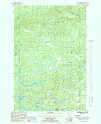
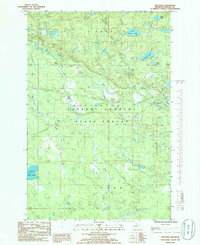
 1985 Pelkie1985 Print · USGSUpper Peninsula life in the mid-1980s is captured here as small communities like Pelkie and Alston thrive near the confluence of the Sturgeon River. Researchers can trace old routes like the West Grade or locate landmarks like Limestone Mountain.
 - 1985 Map of Mount Curwood
 1985 Mount Curwood1985 Print · USGSUpper Peninsula wilderness in Baraga County is captured here in the mid-1980s, centered on the heights of Mount Curwood. Trace the remote water systems of the Copper Country State Forest including Camp 10 Lake, Loon Lake, and the winding Peshekee River.
 - 1985 Map of Summit Lake
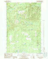
 1985 Summit Lake1985 Print · USGSThe Michigan Upper Peninsula wilderness is captured here in the mid-1980s, showcasing the high-country lake chains of the Baraga and Marquette border. Researchers can trace the secluded Boniface Camp and the protected reaches of the Cyrus H. Mc Cormick Experimental Forest.2 unique versions available
 - 1985 Map of Marquette
 1985 Marquette1985 Print · USGSThe iron mining country of Michigan's Upper Peninsula is shown here during the mid-1980s as industrial transport networks connected the interior to the coast. Researchers can trace historic rail lines like the Soo Line and Ls&I or locate local landmarks like Holy Cross Cem and Northern Michigan University.3 unique versions available
 - 1985 Map of Drummond Lake, 1986 Print
 1985 Drummond Lake1986 Print · USGSThe Upper Peninsula forestlands at the Baraga and Iron county line come into focus in the mid-1980s, showing a landscape of timber and isolated homesteads. Researchers can locate the precise coordinates of Fox Farm, Drummond Lake, and the remote Copper Country State Forest.
 - 1985 Map of Sidnaw, 1986 Print
 1985 Sidnaw1986 Print · USGSThe community of Sidnaw and the surrounding timberlands of the Ottawa National Forest are captured here in the mid-1980s. Local history researchers can trace the old Sid RR Grade, explore the edges of the L'Anse Indian Reservation, and locate family camps near St George Lake.
 - 1985 Map of Marten Lake, 1986 Print
 1985 Marten Lake1986 Print · USGSThe Upper Peninsula wilderness near the Houghton and Iron County line is captured here in the mid-1980s. Trace the remote waters of Lake Sainte Kathryn, locate the Roadside Spring by Kunze Lake, and explore the glacial landscape of the Ottawa National Forest.
 - 1985 Map of Ned Lake, 1986 Print
 1985 Ned Lake1986 Print · USGSThe Upper Peninsula wilderness at the border of Baraga and Iron counties is documented here in the mid-eighties, centered on the Copper Country State Forest. Naturalists and locals can trace the intricate waterways of Ned Lake, Shank Lake, and the remote Fence River.
 - 1985 Map of Vermilac, 1986 Print
 1985 Vermilac1986 Print · USGSBaraga County's interior forest lands are captured in the mid-1980s, showing a landscape defined by water and timber management. Researchers can trace the drainage patterns of Worm Lake and the Sturgeon River or locate the small settlement of Vermilac.
 - 1985 Map of Baraga Plains, 1986 Print
 1985 Baraga Plains1986 Print · USGSUpper Peninsula forest lands and the Baraga Plains appear here as they were managed in the mid-eighties. Genealogists and local researchers can locate the Prison Farm or trace the waterways of Ogemaw Creek and Ogemaw Falls.
 - 1985 Map of Tunis, 1986 Print
 1985 Tunis1986 Print · USGSUpper Peninsula wilderness in the 1980s is captured here as it straddles the Baraga and Iron County lines. Researchers can trace remote forest outposts like Tunis and Park Siding among the extensive wetlands of Net River Flooding.
 - 1985 Map of Nestoria, 1986 Print
 1985 Nestoria1986 Print · USGSIn the mid-eighties, this portion of Baraga County remained a quiet expanse of the Copper Country State Forest centered on the junction at Nestoria. Researchers can map the intricate water systems of the Sturgeon River, locate local landmarks like Tioga Falls, and trace the path of the Pelkie road.
 - 1985 Map of Covington, 1986 Print
 1985 Covington1986 Print · USGSThe Baraga County timberlands near Covington and Watton are captured here in the mid-1980s. Local researchers can trace river networks from Tibbetts Falls to Worm Lake or locate specific landmarks like the local Cem and Ski Lift.
Showing maps 1-25 of 30
Frequently asked questions
- What are the different types of historical maps available for Baraga County?
- What is the oldest map of Baraga County?
- Where can I purchase historical maps of Baraga County for my home or office?
- Where can I download high-res historical maps of Baraga County?
- Are there historical topographic maps available for Baraga County?
- Is there historical aerial imagery available for Baraga County?
- Where are historical maps of Baraga County sourced from?