2020s Maps of Baraga County, Michigan
Explore 31 historic maps of Baraga County from the 2020s. These maps offer a rare glimpse into what life looked like during the 2020s — showing old roads, neighborhoods, homes, and landmarks that have changed or disappeared over time.
Whether you're researching your family's past, planning a metal detecting trip, or studying how Baraga County's landscape evolved across the 2020s, these high-resolution maps are a powerful tool for exploring the history of this region.
- Focus on a specific era: All maps on this page are from the 2020s, giving you a focused view of this time period.
- See what’s changed: Compare century-old streets, trails, and buildings to today's modern landscape using overlays and satellite layers.
- Research with precision: Use these maps for genealogy, historical research, land use analysis, or educational projects.
- View, download, or print: Maps are fully viewable online in high resolution, and can be downloaded or printed for your own records.
Start exploring Baraga County's history through authentic maps from the 2020s. This is your window into the past.
Baraga County, MI maps
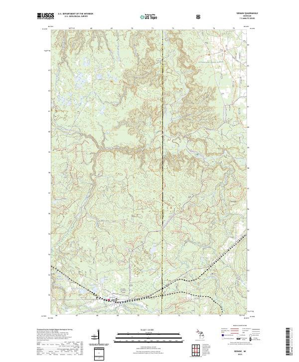
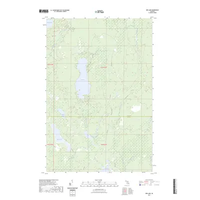
(31)- 2023 Map of Pelkie, 2023 Print
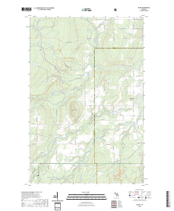 2023 Pelkie2023 Print · USGSThe Upper Peninsula settlements of Pelkie, Elo, and Alston are captured in the 2020s as they bridge their timber and farming roots. Researchers can trace family history at Pelkie Cem or explore the wooded slopes of Limestone Mtn.
 - 2023 Map of Nelson Lake, 2023 Print
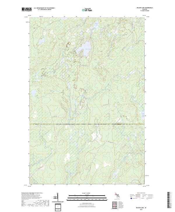 2023 Nelson Lake2023 Print · USGSThe wooded highlands of Baraga and Iron counties are captured here in the early 2020s, showing a landscape defined by the East Branch Fence River. Researchers can trace remote forest access via Fence River Rd and locate secluded water bodies like Nelson Lake and Fence Lake.
 - 2023 Map of Vermilac, 2023 Print
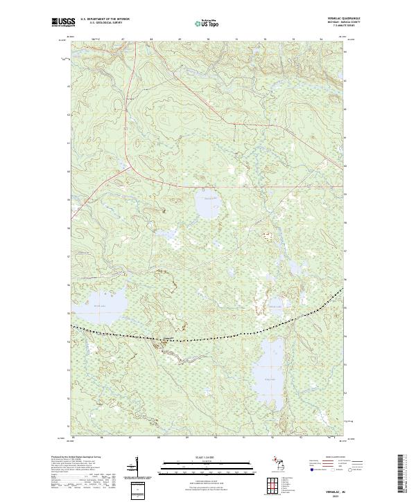 2023 Vermilac2023 Print · USGSBaraga County's interior and the Vermilac area are shown here during the early twenty-first century. Outdoor enthusiasts and local historians can trace the North Country National Scenic Trl past landmarks like Canyon Falls and King Lake.
 - 2023 Map of Skanee North, 2023 Print
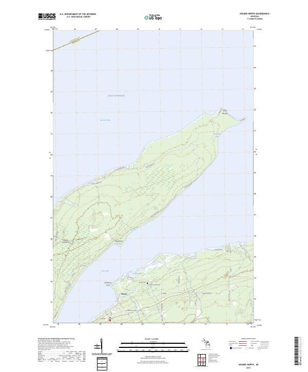 2023 Skanee North2023 Print · USGSThe northern tip of Michigan's Baraga County is captured here in the early twenty-first century, showing the remote character of the Abbaye Peninsula. Genealogists and historians can trace family-named roads near the settlement of Skanee and locate the Skanee Cem or Lighthouse Point.
 - 2023 Map of Keweenaw Bay NE, 2023 Print
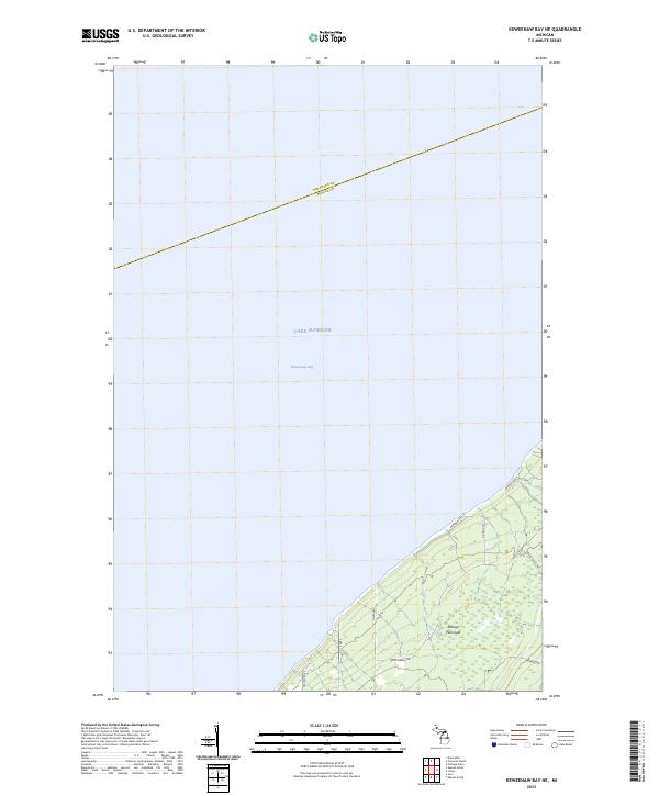 2023 Keweenaw Bay NE2023 Print · USGSCoastal Baraga County is defined by the reaching arm of the Abbaye Peninsula as it extends into the waters of Lake Superior. Researchers can trace remote shoreline access and local landmarks along Point-Abbaye Rd, Whiskey Rd, and Reeds Pointers.
 - 2023 Map of Herman, 2023 Print
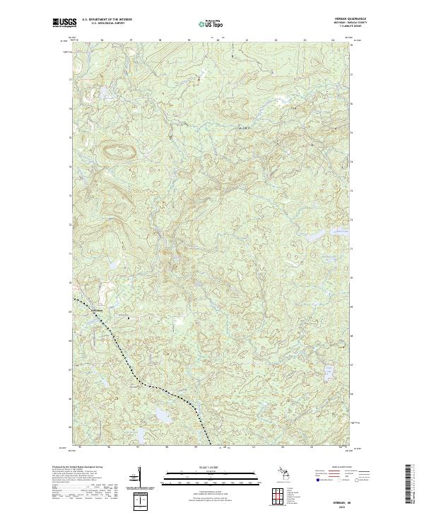 2023 Herman2023 Print · USGSThe community of Herman sits amidst the dense forests and cascading waters of Baraga County in the 2020s. Researchers can locate family sites near Herman Cem or trace the winding paths of the Silver River past Harley Falls and Upper Silver River Falls.
 - 2023 Map of Mount Curwood, 2023 Print
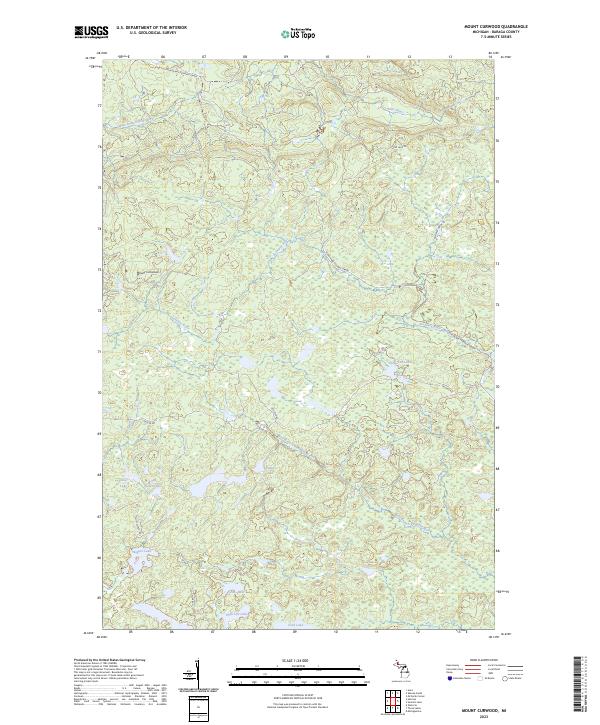 2023 Mount Curwood2023 Print · USGSUpper Peninsula timber and transit history converge in the Michigamme Highlands during the early twenty-first century. Researchers can trace the legacy of the Huron Bay-Peshekee Grade near Mount Curwood and explore the remote shores of Camp Ten Lake.
 - 2023 Map of L'Anse, 2023 Print
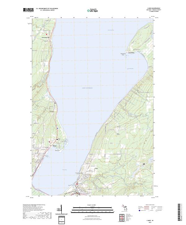 2023 L'Anse2023 Print · USGSThe shores of Baraga County come alive in this survey of the Keweenaw Bay area, capturing the modern layout of these historic Lake Superior settlements. Genealogists and local historians can locate several burial sites including Assinins Cem and Pinery Indian Cem, or trace the waterfront near Pequaming.
 - 2023 Map of Summit Lake, 2023 Print
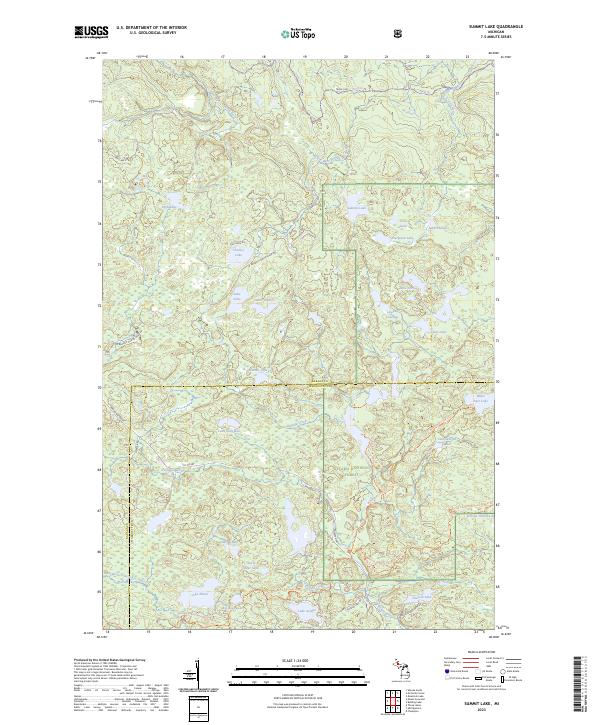 2023 Summit Lake2023 Print · USGSThe northern woods of Baraga and Marquette counties are captured here in the early twenty-first century. Genealogists and hikers can trace old logging routes like the Huron Bay Grade and explore the remote McCormick Wilderness.
 - 2023 Map of Mountain Lake, 2023 Print
 2023 Mountain Lake2023 Print · USGSThe Huron Mountains take center stage in this 2023 survey of the Michigan backcountry. You can trace the complex network of mountain summits and river systems from Mount Ida and Trout Mountain to the waters of Forty Foot Falls and Lumberman Bay.
 - 2023 Map of Michigamme, 2023 Print
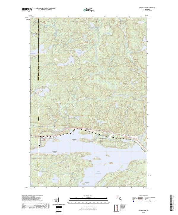 2023 Michigamme2023 Print · USGSUpper Peninsula lake life and northwoods geography converge at Michigamme in this contemporary record of the shoreline and its islands. Genealogists and researchers can locate Lakeview Cem and trace landmarks like Sundstrum Island or the Huron Bay Grade.
 - 2023 Map of Drummond Lake, 2023 Print
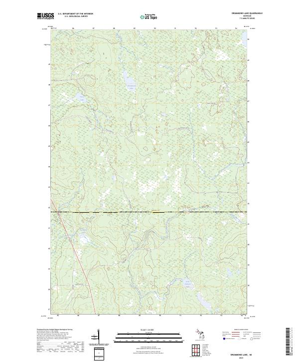 2023 Drummond Lake2023 Print · USGSThe borderlands of Baraga and Iron Counties are shown here in the 2020s, dominated by Northwoods wetlands and river systems. Trace the winding paths of the East Branch Net River and Murphy River past Drummond Lake and Little Pickerel Lake.
 - 2023 Map of McComb Corner, 2023 Print
 2023 McComb Corner2023 Print · USGSThe northern wilderness along the Baraga and Marquette county line is defined by the complex river systems of the Huron Mountains. Hikers and cartography enthusiasts can trace the numerous cascades along the West Branch Huron River, including Big Ericks Falls and Letherby Falls.
 - 2023 Map of Alberta, 2023 Print
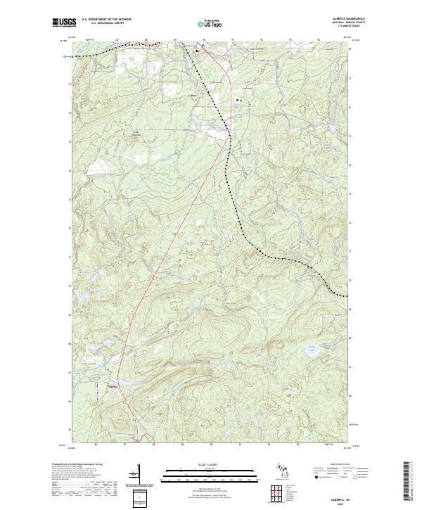 2023 Alberta2023 Print · USGSSettled along the south shore of L'Anse Bay, this area shows the rugged river systems and small settlements of the Upper Peninsula. Researchers can locate L'Anse Township Cem and trace the many cascades along the Falls River, including Power Dam Falls.
 - 2023 Map of Nestoria, 2023 Print
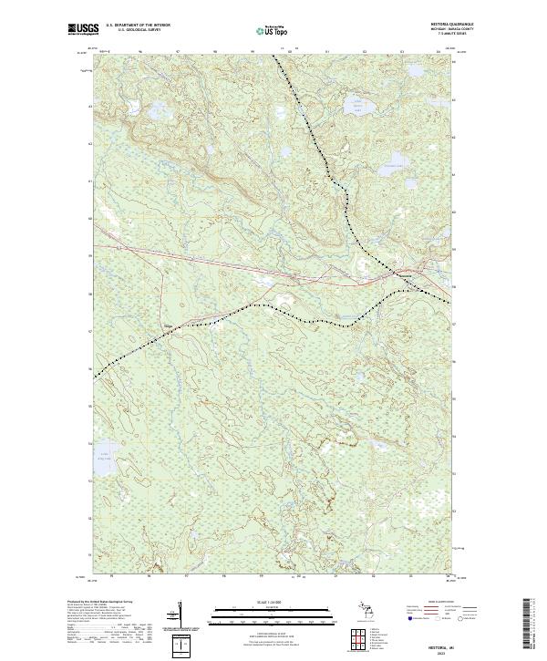 2023 Nestoria2023 Print · USGSBaraga County's timbered highlands are captured in the early 2020s, showing the intersection of Michigan's wilderness trails and river systems. You can trace the path of the North Country National Scenic Trail as it crosses through Nestoria and Tioga, passing numerous landmarks like Tioga Falls.
 - 2023 Map of Bulldog Lake, 2023 Print
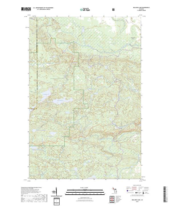 2023 Bulldog Lake2023 Print · USGSThe Upper Peninsula’s interior wilderness is documented here in the early twenty-first century, spanning the rugged border between Baraga and Marquette counties. Outdoor historians can trace the North Country National Scenic Trl past Lake Raymond and the remote Yellow Dog Falls.
 - 2023 Map of Covington, 2023 Print
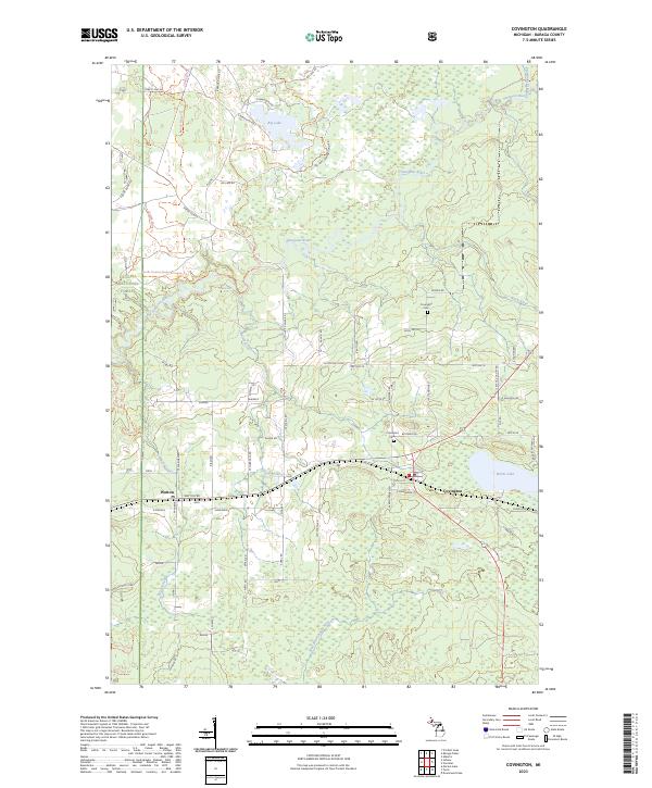 2023 Covington2023 Print · USGSUpper Peninsula history comes alive in this survey of Baraga County, where the Sturgeon River winds past clusters of family-named settlements. Genealogists can trace property locations near Covington, Watton, and the Covington Cem, as well as legacy sites like Syrjala and Kauranen.
 - 2023 Map of Tunis, 2023 Print
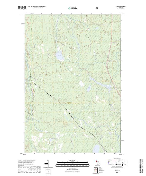 2023 Tunis2023 Print · USGSUpper Peninsula timberlands and wetlands are documented in this recent survey of the Baraga and Iron County border. Researchers can trace the water network from May Lake to the West Branch Net River and locate the small settlement of Tunis.
 - 2023 Map of Three Lakes, 2023 Print
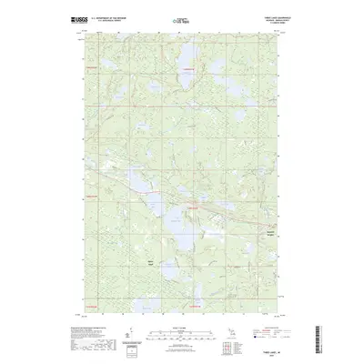 2023 Three Lakes2023 Print · USGSThe Baraga County woods and waters are captured here in the early 2020s, centered on the lakeside communities of Three Lakes and Imperial Heights. Map collectors and outdoorsmen can trace the North Country National Scenic Trail as it passes through the pristine Craig Lake State Park and past Pea Soup Lake.
 - 2023 Map of Portage Entry, 2023 Print
 2023 Portage Entry2023 Print · USGSThe Keweenaw Peninsula meets the lake at this modern survey of the Portage River's mouth and the surrounding wetlands. Genealogists and local historians can trace family-named areas like Korhonen and Helberg alongside the coastal settlements of Jacobsville and White City.
 - 2023 Map of Marten Lake, 2023 Print
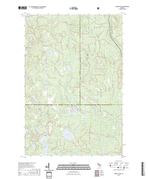 2023 Marten Lake2023 Print · USGSUpper Peninsula wilderness at the junction of Houghton, Baraga, and Iron counties is detailed in this recent survey. Trace the protected Ontonagon Wild and Scenic River and find remote landmarks like Lake Sainte Kathryn and Norway Lake.
 - 2023 Map of Sidnaw, 2023 Print
 2023 Sidnaw2023 Print · USGSIn the heart of the Upper Peninsula, this area shows the intersection of forest management and remote settlement during the 2020s. Researchers can locate the Sidnaw Cem, trace the Sturgeon River through its wilderness gorge, and find Prickett-Grooms Field.
 - 2023 Map of Ned Lake, 2023 Print
 2023 Ned Lake2023 Print · USGSUpper Peninsula timberlands and glacial lakes are detailed here as they appeared in the early 2020s. Researchers can trace remote backcountry routes like The B Grade and locate secluded water bodies such as Shank Lake and Ned Lake.
 - 2023 Map of Aura, 2023 Print
 2023 Aura2023 Print · USGSCoastal Baraga County at the start of the 2020s shows a landscape defined by the Abbay Peninsula and its numerous waterfalls. Trace local family history and geographic landmarks from Aura to the Slate River Falls, Middle Silver River Falls, and Aura Cem.
 - 2023 Map of Otter Lake, 2023 Print
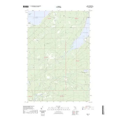
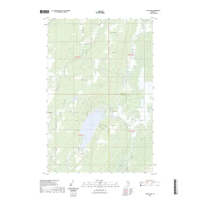 2023 Otter Lake2023 Print · USGSHoughton and Baraga counties are captured here in the early 2020s, showcasing a landscape of winding rivers and remote rural settlements. Researchers can locate family landmarks and burial sites like Kargi Cem and Askel Cem near the shores of Otter Lake.
Showing maps 1-25 of 31
Frequently asked questions
- What are the different types of historical maps available for Baraga County?
- What is the oldest map of Baraga County?
- Where can I purchase historical maps of Baraga County for my home or office?
- Where can I download high-res historical maps of Baraga County?
- Are there historical topographic maps available for Baraga County?
- Is there historical aerial imagery available for Baraga County?
- Where are historical maps of Baraga County sourced from?