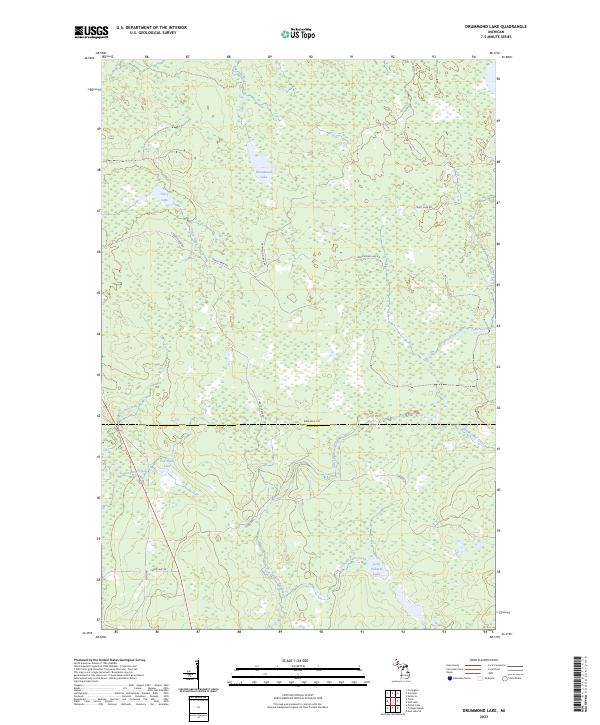
2023 Map of Drummond Lake
USGS Topo · Published 2023About this map
Drummond Lake sits at the heart of this Northwoods landscape on the boundary between Baraga and Iron Counties. The terrain is defined by a dense network of hydrologic features, where the East Branch Net River and Murphy River drain the surrounding timberlands. Small, isolated bodies of water like Little Pickerel Lake, Tracy Lake, and Fox Farm Lake are connected by narrow tributaries including Shank Lake Creek and County Line Creek.
Find a feature on this map
22 named features on this map. Tap any name to fly to it.
Don’t see what you’re looking for? This feature index may not catch every label — zoom into the map to look around manually.
Map Details
Editions of this 2023 Drummond Lake Map
This is the sole edition of this map. No revisions or reprints were ever made.
Other maps of this area
1895 · Ned Lake
USGS Topo · 1:62,500
1895 · Perch Lake
USGS Topo · 1:62,500
1954 · Perch Lake
USGS Topo · 1:62,500
1954 · Sidnaw
USGS Topo · 1:62,500
1955 · Ned Lake
USGS Topo · 1:62,500
1955 · Herman
USGS Topo · 1:62,500

1958 · Iron River
USGS Topo · 1:250,000
1960 · Iron River
USGS Topo · 1:250,000
1961 · Iron River
USGS Topo · 1:250,000
1967 · Iron River
USGS Topo · 1:250,000