
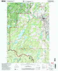
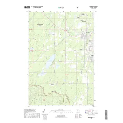
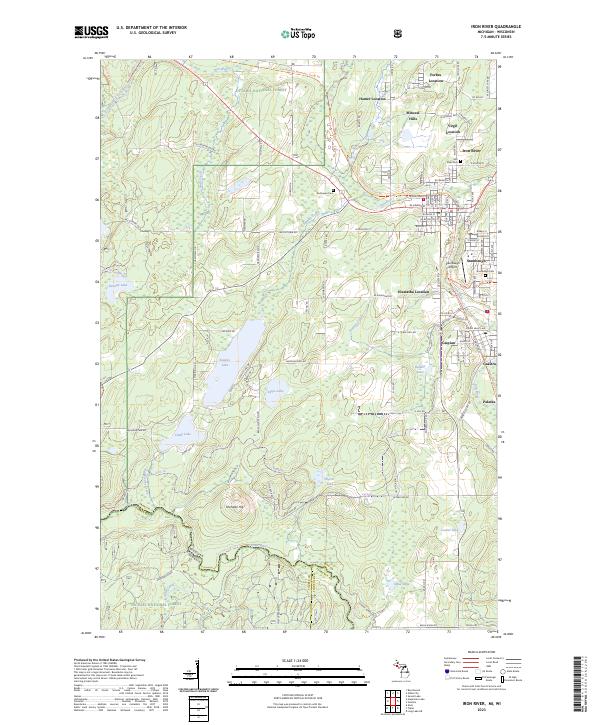
1960 Map of Iron River
USGS Topo · Published 1960About this map
Ontonagon and the Copper Country of the Upper Peninsula appear during a period of industrial transition, where the White Pine Mine stands as a primary center of activity. The map illustrates a landscape defined by its timber and mineral resources, characterized by the sprawling Ottawa National Forest and the Porcupine Mountains State Park along the shores of Lake Superior. A complex network of railroads, including the Milwaukee Road, Soo Line, and the Duluth South Shore and Atlantic, connects remote settlements like Bruce Crossing and Trout Creek to the industrial ports of Keweenaw Bay.
Find a feature on this map
189 named features on this map. Tap any name to fly to it.
Don’t see what you’re looking for? This feature index may not catch every label — zoom into the map to look around manually.
Map Details
Editions of this 1960 Iron River Map
This is the sole edition of this map. No revisions or reprints were ever made.
Historical Maps of Lac du Flambeau Through Time
14 maps found
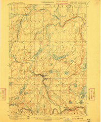
1898 Iron River
Iron County, MI
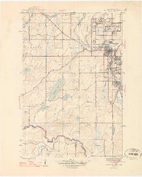
1944 Iron River
Iron County, MI
1946 Iron River
Iron County, MI
1958 Iron River
Iron County, MI
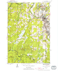
1960 Iron River
Iron County, MI

1961 Iron River
Iron County, MI

1967 Iron River
Iron County, MI

1989 Iron River
Iron County, MI
1999 Iron River
Iron County, MI
2011 Iron River
Iron County, MI
2014 Iron River
Iron County, MI
2017 Iron River
Iron County, MI
2019 Iron River
Iron County, MI
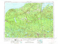
2023 Iron River
Iron County, MI