2020s Maps of Yankee Springs Township, Michigan
Explore 4 historic maps of Yankee Springs Township from the 2020s. These maps offer a rare glimpse into what life looked like during the 2020s — showing old roads, neighborhoods, homes, and landmarks that have changed or disappeared over time.
Whether you're researching your family's past, planning a metal detecting trip, or studying how Yankee Springs Township's landscape evolved across the 2020s, these high-resolution maps are a powerful tool for exploring the history of this region.
- Focus on a specific era: All maps on this page are from the 2020s, giving you a focused view of this time period.
- See what’s changed: Compare century-old streets, trails, and buildings to today's modern landscape using overlays and satellite layers.
- Research with precision: Use these maps for genealogy, historical research, land use analysis, or educational projects.
- View, download, or print: Maps are fully viewable online in high resolution, and can be downloaded or printed for your own records.
Start exploring Yankee Springs Township's history through authentic maps from the 2020s. This is your window into the past.
Yankee Springs Township, MI maps
(4)- 2023 Map of Cloverdale, 2023 Print
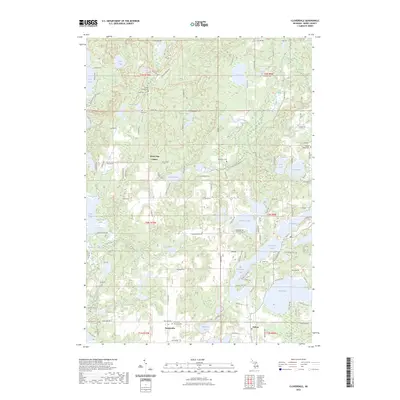 2023 Cloverdale2023 Print · USGSBarry County's lake country is captured here during the early twenty-first century, showing the enduring rural character of southern Michigan. Family historians can locate several burial grounds like McCallum Cem and Jesuit Cem or trace the CK&S Trl near Cloverdale Lake.
 - 2023 Map of Middleville, 2023 Print
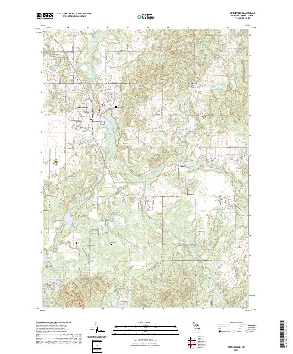 2023 Middleville2023 Print · USGSMiddleville and the surrounding Barry County countryside appear here in the early 2020s, centered on the winding Thornapple River. Genealogists can locate several local burial sites like Bowerman Cem and Rutland Cem or trace family land near the village of Irving.
 - 2023 Map of Bowens Mill, 2023 Print
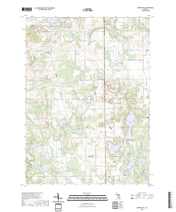 2023 Bowens Mill2023 Print · USGSAllegan and Barry counties at the dawn of the 2020s reveal a landscape of deep-rooted rural settlements and extensive lake systems. Researchers can trace family history through local landmarks like Bowens Mill, Saints Cyril and Methodius Catholic Cem, and Hooker Cem.
 - 2023 Map of Orangeville, 2023 Print
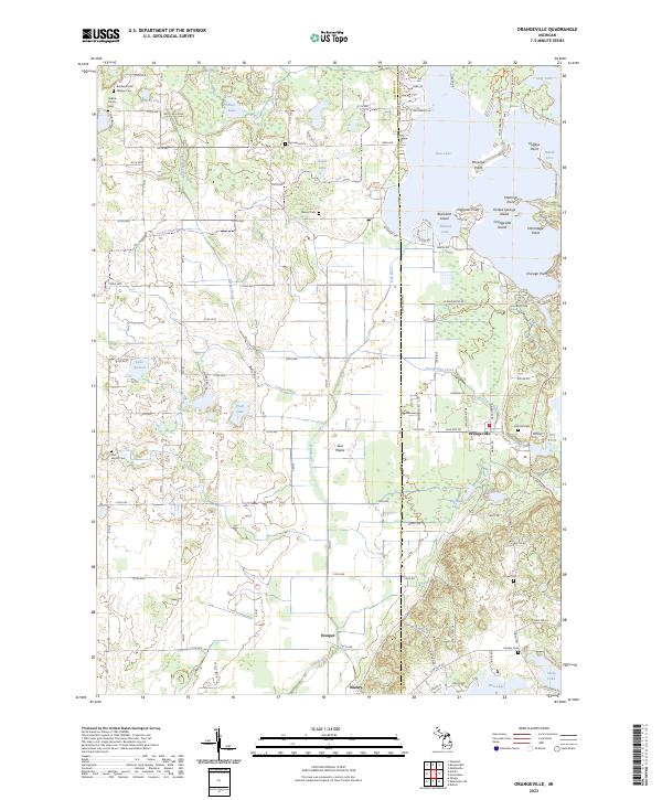 2023 Orangeville2023 Print · USGSOrangeville and the Gun River valley are shown in contemporary detail along the Allegan and Barry county line. Genealogists can locate numerous family burial sites like Selkirk Family Cem and the Bradley Indian Mission Cem.
End of results
Showing maps 1-4 of 4
Top cities near Yankee Springs Township
- Wyoming historical maps
- Kentwood historical maps
- Gaines Charter Township historical maps
- Byron Township historical maps
- Cascade Charter Township historical maps
- Hastings historical maps
See more
Top neighborhoods of Yankee Springs Township
Frequently asked questions
- What are the different types of historical maps available for Yankee Springs Township?
- What is the oldest map of Yankee Springs Township?
- Where can I purchase historical maps of Yankee Springs Township for my home or office?
- Where can I download high-res historical maps of Yankee Springs Township?
- Are there historical topographic maps available for Yankee Springs Township?
- Is there historical aerial imagery available for Yankee Springs Township?
- Where are historical maps of Yankee Springs Township sourced from?