Old Maps of Emmett Charter Township, Michigan for Metal Detecting
Plan your next treasure hunt with 36 historic maps of Emmett Charter Township. Find old homesites, ghost towns, trails, and gathering spots that may be lost to time — perfect for identifying promising metal detecting locations.
- Locate forgotten sites: Uncover places like long-lost settlements, abandoned rail lines, or gathering spots.
- Plan better hunts: Use map overlays combined with LiDAR or satellite views to narrow in on historically rich areas.
- Made for detectorists: Thousands of hobbyists use these maps to discover relics, coins, and hidden history.
Use these historic maps to boost your research and find new opportunities beneath the surface of Emmett Charter Township.
Emmett Charter Township, MI maps
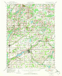
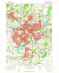
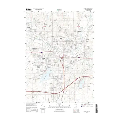
(36)- 1918 Map of Battle Creek
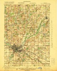 1918 Battle Creek1918 Print · USGSThe Battle Creek area thrived as a rail and industrial hub during the First World War. Genealogists can trace family footprints across rural schoolhouses like Little Brick School and settlements like Ceresco or Bellevue.4 unique versions available
 - 1918 Map of Union City
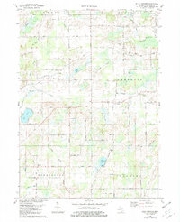
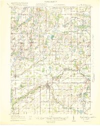 1918 Union City1918 Print · USGSSettled along the forks of the St. Joseph River during the First World War, this region shows a landscape of rail-connected towns and country schoolhouses. Genealogists can trace family footprints at Stanley Corners or find old homesteads near the German Lutheran Church and Mershon School.3 unique versions available
 - 1943 Map of Battle Creek
 1943 Battle Creek1943 Print · USGSBattle Creek and the surrounding Calhoun County countryside are shown during the early years of the Second World War. Genealogists and local historians can locate dozens of country schoolhouses like Cobblestone Sch and trace the Grand Trunk Railway through Bellevue and Ceresco.
 - 1947 Map of Ceresco, 1955 Print
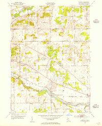 1947 Ceresco1955 Print · USGSCalhoun County, Michigan, is captured here in the years following World War II, showing a landscape of small river towns and family farms. Researchers can trace dozens of rural schoolhouses and historic burial grounds like Cobblestone Sch and Ceresco Cem along the Kalamazoo River.
 - 1947 Map of Battle Creek, 1955 Print
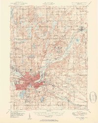
 1947 Battle Creek1955 Print · USGSBattle Creek and its surrounding townships thrive in this mid-century survey as a hub of industry, medicine, and education. Genealogists can trace family footprints across dozens of local landmarks like Holy Star Cem, School No 2, and the Sanitarium.
 - 1947 Map of Union City, 1972 Print
 1947 Union City1972 Print · USGSThe St. Joseph River valley in the late 1940s is shown here at its rural peak, shortly after the war. Family historians can trace ancestral sites through dozens of local landmarks like Morgan Cem, Cobblestone Sch, and Burlington Sta.2 unique versions available
 - 1950 Map of Battle Creek
 1950 Battle Creek1950 Print · USGSBattle Creek and its surrounding townships thrive in the early post-war years as a vital hub of Michigan industry and aviation. Genealogists and historians can trace family roots through numerous country schools like Cobblestone Sch and cemeteries such as Oak Hill Cem.3 unique versions available
 - 1950 Map of Union City
 1950 Union City1950 Print · USGSBranch and Calhoun counties are captured here in the mid-century, showcasing a landscape of riverside towns and agricultural hamlets. Researchers can trace family history through numerous rural landmarks like Burr Oak Cem, Newton Ch, and the Burlington Sta rail stop.2 unique versions available
 - 1958 Map of Grand Rapids, 1973 Print
 1958 Grand Rapids1973 Print · USGSSouthern Michigan at the peak of the postwar era shows a landscape of burgeoning cities and new interstate highways. Trace family roots and regional growth in Grand Rapids, Battle Creek, and the glacial lake country around Gun Lake or Gull Lake.2 unique versions available
 - 1961 Map of Grand Rapids
 1961 Grand Rapids1961 Print · USGSSouthern Michigan at the dawn of the 1960s reveals a region shaped by major river systems and a robust rail network. Trace mid-century industrial growth and land use from Grand Rapids to the Fort Custer Military Reservation and Gun Lake.
 - 1961 Map of Ceresco, 1962 Print
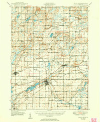
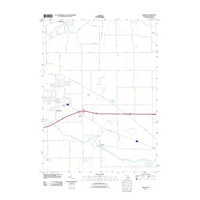
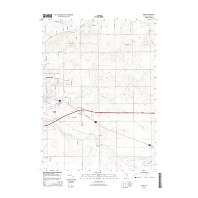
 1961 Ceresco1962 Print · USGSCalhoun County's river-and-rail corridor is documented here in the early sixties, showing the transition from rural townships to growing residential pockets. Researchers can trace local heritage at Ceresco, Red Brick Sch, and several old burial grounds like Austin Cem.3 unique versions available
 - 1961 Map of Battle Creek, 1962 Print
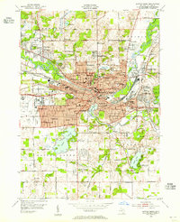
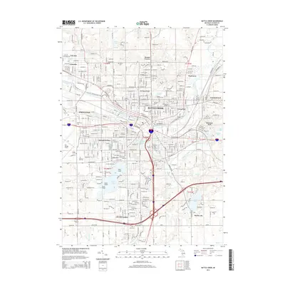
 1961 Battle Creek1962 Print · USGSBattle Creek and its burgeoning suburbs are caught in a moment of significant mid-century growth. Genealogists and researchers can trace local institutions and family-named landmarks like Oak Hill Cemetery, Kimball Sanatorium, and Beadle Lake Sch.3 unique versions available
 - 1962 Map of Grand Rapids
 1962 Grand Rapids1962 Print · USGSMid-century Southern Michigan is mapped here at a time of massive growth, showing the expanding urban footprints of Grand Rapids and Lansing. Researchers can trace the legacy of the Grand Trunk Western RR, find historic boundaries of the Fort Custer Military Reservation, or locate sporting camps around Gun Lake.2 unique versions available
 - 1982 Map of Ellis Corners
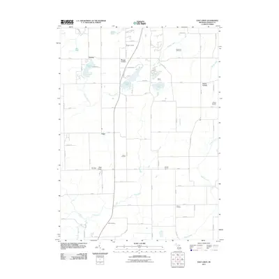
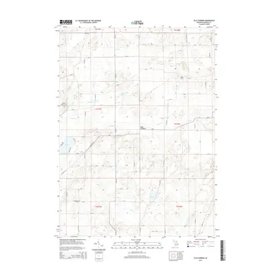
 1982 Ellis Corners1982 Print · USGSCentral Calhoun County in the early eighties shows a landscape of glacial lakes and quiet agricultural townships. Genealogists can trace family names through the Houston Cem or locate community hubs like Ellis Corners and Fredonia Holiness Ch.
 - 1982 Map of East Leroy
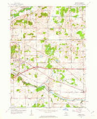
 1982 East Leroy1982 Print · USGSThe rural landscape south of Battle Creek is detailed in the early eighties, showing a community defined by its township grids and natural drainage. Genealogists can locate family burial sites at Mather Cem and Walker Cem or trace the path of the Old RR Grade.
 - 1982 Map of Kalamazoo, 1983 Print
 1982 Kalamazoo1983 Print · USGSThe Kalamazoo River valley in the early eighties shows a landscape of growing suburban centers and heavy rail infrastructure. Genealogists and researchers can trace the limits of Kalamazoo and Battle Creek or locate landmarks like Fort Custer National Cemetery and Gull Lake.
 - 2011 Map of Battle Creek, 2011 Print
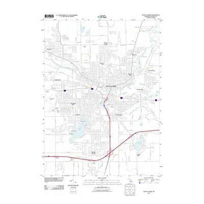 2011 Battle Creek2011 Print · USGSCovers Emmett Charter Township, including Battle Creek, Springfield, and other nearby areas
 - 2011 Map of East Leroy, 2011 Print
 2011 East Leroy2011 Print · USGSCovers Emmett Charter Township, including Battle Creek, Burlington Township, and other nearby areas
 - 2011 Map of Ceresco, 2011 Print
 2011 Ceresco2011 Print · USGSCovers Emmett Charter Township, including Wattles Park, Ceresco, and other nearby areas
 - 2011 Map of Ellis Corners, 2011 Print
 2011 Ellis Corners2011 Print · USGSCovers Emmett Charter Township, including Burlington Township, Tekonsha Township, and other nearby areas
 - 2014 Map of Battle Creek, 2014 Print
 2014 Battle Creek2014 Print · USGSCovers Emmett Charter Township, including Battle Creek, Springfield, and other nearby areas
 - 2014 Map of Ceresco, 2014 Print
 2014 Ceresco2014 Print · USGSCovers Emmett Charter Township, including Wattles Park, Ceresco, and other nearby areas
 - 2014 Map of East Leroy, 2014 Print
 2014 East Leroy2014 Print · USGSCovers Emmett Charter Township, including Battle Creek, Burlington Township, and other nearby areas
 - 2014 Map of Ellis Corners, 2014 Print
 2014 Ellis Corners2014 Print · USGSCovers Emmett Charter Township, including Burlington Township, Tekonsha Township, and other nearby areas
 - 2017 Map of Battle Creek, 2017 Print
 2017 Battle Creek2017 Print · USGSCovers Emmett Charter Township, including Battle Creek, Springfield, and other nearby areas
Showing maps 1-25 of 36
Top cities near Emmett Charter Township
- Battle Creek historical maps
- Marshall historical maps
- Springfield historical maps
- Assyria historical maps
- Olivet historical maps
- Bellevue historical maps
See more
Top neighborhoods of Emmett Charter Township
- Sunrise Heights historical maps
- Wattles Park historical maps
- Brownlee Park historical maps
- Beadle Lake historical maps
Frequently asked questions
- What are the different types of historical maps available for Emmett Charter Township?
- What is the oldest map of Emmett Charter Township?
- Where can I purchase historical maps of Emmett Charter Township for my home or office?
- Where can I download high-res historical maps of Emmett Charter Township?
- Are there historical topographic maps available for Emmett Charter Township?
- Is there historical aerial imagery available for Emmett Charter Township?
- Where are historical maps of Emmett Charter Township sourced from?