2020s Maps of Waverly Township, Michigan
Explore 6 historic maps of Waverly Township from the 2020s. These maps offer a rare glimpse into what life looked like during the 2020s — showing old roads, neighborhoods, homes, and landmarks that have changed or disappeared over time.
Whether you're researching your family's past, planning a metal detecting trip, or studying how Waverly Township's landscape evolved across the 2020s, these high-resolution maps are a powerful tool for exploring the history of this region.
- Focus on a specific era: All maps on this page are from the 2020s, giving you a focused view of this time period.
- See what’s changed: Compare century-old streets, trails, and buildings to today's modern landscape using overlays and satellite layers.
- Research with precision: Use these maps for genealogy, historical research, land use analysis, or educational projects.
- View, download, or print: Maps are fully viewable online in high resolution, and can be downloaded or printed for your own records.
Start exploring Waverly Township's history through authentic maps from the 2020s. This is your window into the past.
Waverly Township, MI maps
(6)- 2023 Map of Afton, 2023 Print
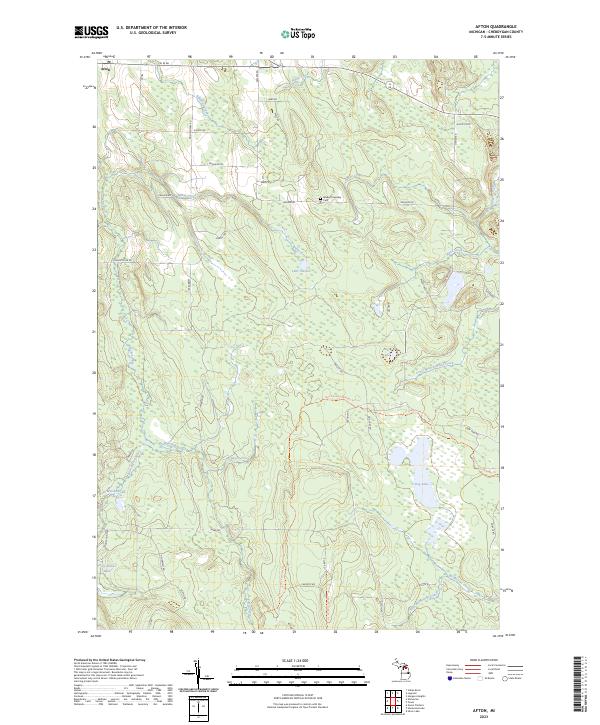 2023 Afton2023 Print · USGSThe settlement of Afton and the surrounding Cheboygan County backcountry are documented here in the early 2020s. Genealogists and hikers can trace the Walker Township Cem or follow the long-distance High Country Pathway Trl through the forests.
 - 2023 Map of Onaway, 2023 Print
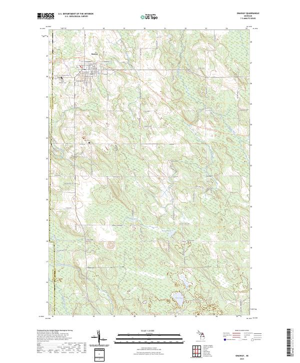 2023 Onaway2023 Print · USGSOnaway and the surrounding Presque Isle timberlands are captured here in the modern era. Genealogists and local historians can locate Elmwood Cem, Allis Cem, and the path of the North Eastern State Trl along the Black River.
 - 2023 Map of Legrand, 2023 Print
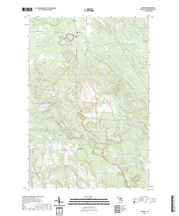 2023 Legrand2023 Print · USGSCheboygan County’s river-fed woodlands are documented in detail during the early 2020s, centered on the settlement of Legrand. Family historians can locate family-named markers like Johnson Grave or trace the North Eastern State Trl and Devereaux Lake.
 - 2023 Map of Black Lake Bluffs, 2023 Print
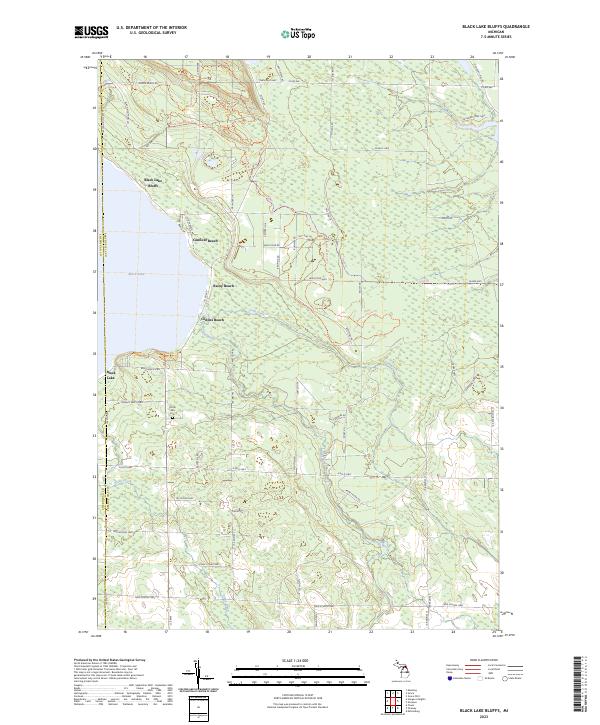 2023 Black Lake Bluffs2023 Print · USGSPresque Isle County's eastern lakefront and timbered interior are documented here in recent years as the region balances shoreline living with vast forest tracts. Researchers can locate the North Allis Cem and trace seasonal routes like Black Lake Route Trl and Bummers Roost Trl.
 - 2023 Map of Tower, 2023 Print
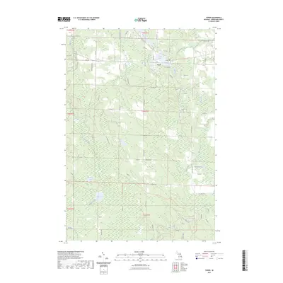 2023 Tower2023 Print · USGSThe village of Tower and the winding Black River define this Cheboygan County landscape in the early twenty-first century. Researchers can locate Forest Lawn Cem and trace the drainage of Milligan Creek past Huckleberry Hollow and Dorsy Lake.
 - 2023 Map of Hangore Heights, 2023 Print
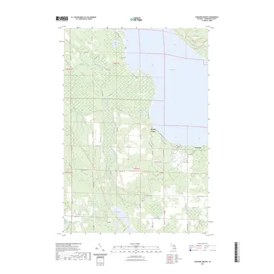 2023 Hangore Heights2023 Print · USGSBlack Lake and the wetlands of Cheboygan County are mapped here in the early twenty-first century. Genealogists and local researchers can pinpoint Waverly Cem, Reuther's Graves, and the settlement of Hangore Heights along the shore.
End of results
Showing maps 1-6 of 6
Top cities near Waverly Township
Top neighborhoods of Waverly Township
Frequently asked questions
- What are the different types of historical maps available for Waverly Township?
- What is the oldest map of Waverly Township?
- Where can I purchase historical maps of Waverly Township for my home or office?
- Where can I download high-res historical maps of Waverly Township?
- Are there historical topographic maps available for Waverly Township?
- Is there historical aerial imagery available for Waverly Township?
- Where are historical maps of Waverly Township sourced from?