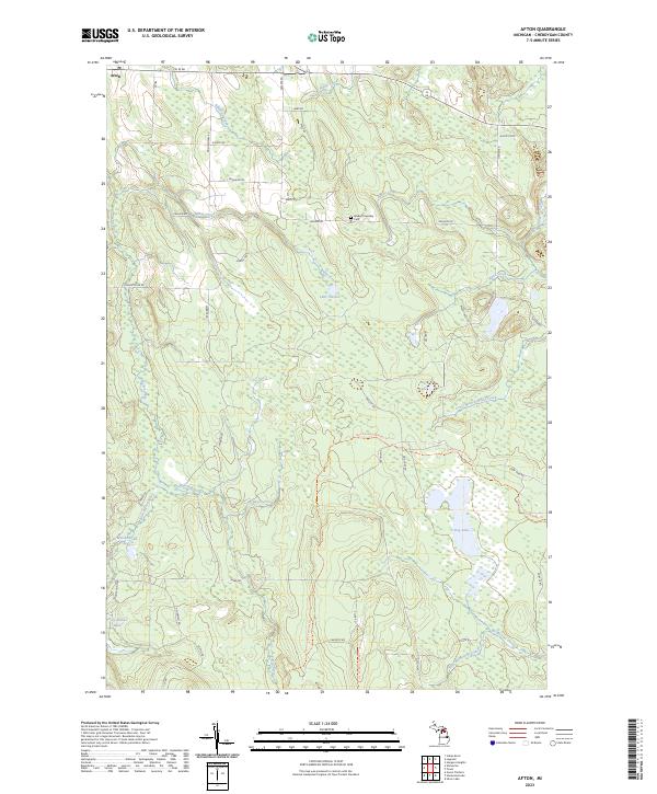
2023 Map of Afton
USGS Topo · Published 2023About this map
Afton stands at the northwestern corner of this landscape, serving as a primary point of settlement in a region defined by complex hydrography and wooded terrain. The Pigeon River and Little Pigeon River dominate the drainage patterns, carving through the central and western sections of the quadrangle. Significant water bodies such as Lake Sixteen, Dog Lake, and the distinctly named Holy Smoke Lake dot the map, indicating a glacial landscape rich in wetlands.
Find a feature on this map
55 named features on this map. Tap any name to fly to it.
Don’t see what you’re looking for? This feature index may not catch every label — zoom into the map to look around manually.
Map Details
Editions of this 2023 Afton Map
This is the sole edition of this map. No revisions or reprints were ever made.
Other maps of this area

1954 · Gaylord
USGS Topo · 1:62,500

1954 · Hetherton
USGS Topo · 1:62,500

1955 · Cheboygan
USGS Topo · 1:250,000

1957 · Tower
USGS Topo · 1:62,500

1957 · Wolverine
USGS Topo · 1:62,500

1958 · Cheboygan
USGS Topo · 1:250,000

1982 · Petoskey
USGS Topo · 1:100,000

1986 · Silver Lake
USGS Topo · 1:24,000
1986 · Legrand
USGS Topo · 1:24,000
1986 · Tower
USGS Topo · 1:24,000