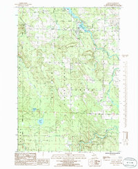
1986 Map of Tower
USGS Topo · Published 1986About this map
The Mackinaw State Forest dominates this northern Michigan landscape, where the Black River flows through the settlement of Tower. This 1980s survey captures the region's transition from historical industrial activities to a managed wilderness. Evidence of earlier transport and utility infrastructure is preserved through the Old RR Grade and the Power House located near Tower Pond. These features illustrate the river's role in local power generation and the movement of timber or goods before the tracks were removed.
Find a feature on this map
24 named features on this map. Tap any name to fly to it.
Don’t see what you’re looking for? This feature index may not catch every label — zoom into the map to look around manually.
Map Details
Editions of this 1986 Tower Map
This is the sole edition of this map. No revisions or reprints were ever made.
Other maps of this area

1954 · Hetherton
USGS Topo · 1:62,500

1955 · Atlanta
USGS Topo · 1:62,500

1955 · Cheboygan
USGS Topo · 1:250,000

1957 · Tower
USGS Topo · 1:62,500

1957 · Onaway
USGS Topo · 1:62,500

1958 · Cheboygan
USGS Topo · 1:250,000

1982 · Petoskey
USGS Topo · 1:100,000
1986 · Onaway
USGS Topo · 1:24,000

1986 · Silver Lake
USGS Topo · 1:24,000
1986 · Legrand
USGS Topo · 1:24,000