
1986 Map of Silver Lake
USGS Topo · Published 1986About this map
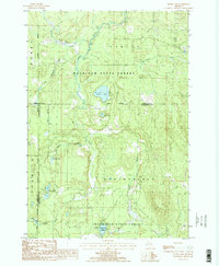
Mackinaw State Forest dominates this northern Michigan landscape, where the confluence of several counties—Cheboygan, Otsego, and Montmorency—creates a complex network of administrative boundaries amidst a dense hydrology. The area is defined by the winding course of the Black River and its tributaries, including McMasters Creek and Stewart Creek. The central portion of the map is punctuated by glacial water bodies such as Silver Lake and Dollar Lake, while the southern reaches are marked by the significant Foch Lakes Flooding area. Of particular interest to local historians is the Old Railroad Grade cutting through the forest, a clear indicator of the region's logging heritage. Additionally, the presence of an Oil Well and Gas Well suggests the mid-1980s expansion of natural resource extraction within these protected state lands.
Find a feature on this map
19 named features on this map. Tap any name to fly to it.
Don’t see what you’re looking for? This feature index may not catch every label — zoom into the map to look around manually.
Map Details
Editions of this 1986 Silver Lake Map
2 editions found
Other maps of this area

1954 · Hetherton
USGS Topo · 1:62,500

1955 · Atlanta
USGS Topo · 1:62,500

1955 · Cheboygan
USGS Topo · 1:250,000

1957 · Tower
USGS Topo · 1:62,500

1957 · Onaway
USGS Topo · 1:62,500

1958 · Cheboygan
USGS Topo · 1:250,000

1982 · Petoskey
USGS Topo · 1:100,000
1986 · Onaway
USGS Topo · 1:24,000
1986 · Saunders Creek
USGS Topo · 1:24,000
1986 · Tower
USGS Topo · 1:24,000