2020s Maps of Baldwin Township, Michigan
Explore 6 historic maps of Baldwin Township from the 2020s. These maps offer a rare glimpse into what life looked like during the 2020s — showing old roads, neighborhoods, homes, and landmarks that have changed or disappeared over time.
Whether you're researching your family's past, planning a metal detecting trip, or studying how Baldwin Township's landscape evolved across the 2020s, these high-resolution maps are a powerful tool for exploring the history of this region.
- Focus on a specific era: All maps on this page are from the 2020s, giving you a focused view of this time period.
- See what’s changed: Compare century-old streets, trails, and buildings to today's modern landscape using overlays and satellite layers.
- Research with precision: Use these maps for genealogy, historical research, land use analysis, or educational projects.
- View, download, or print: Maps are fully viewable online in high resolution, and can be downloaded or printed for your own records.
Start exploring Baldwin Township's history through authentic maps from the 2020s. This is your window into the past.
Baldwin Township, MI maps
(6)- 2023 Map of Rapid River, 2023 Print
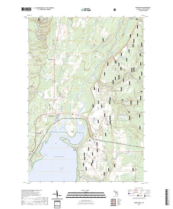 2023 Rapid River2023 Print · USGSThe northern reaches of Little Bay de Noc are captured here in the early twenty-first century, showing the confluence of the Rapid River and Whitefish River. Genealogists and local historians can locate the Rapid River Cem, the isolated McLeod Grave, and old settlement sites like Garth and Masonville.
 - 2023 Map of Baker Creek, 2023 Print
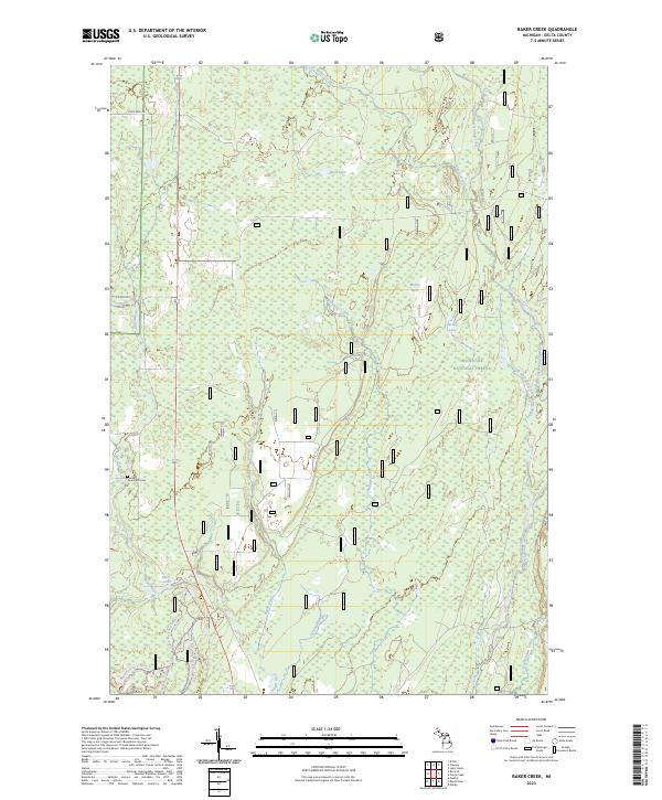 2023 Baker Creek2023 Print · USGSThe Delta County timberlands of the Upper Peninsula are documented here in a contemporary era of conservation and recreation. Researchers can locate the Dutch Mill Cem and trace the paths of the Whitefish Wild and Scenic River and Rapid River Falls.
 - 2023 Map of Cornell, 2023 Print
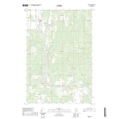 2023 Cornell2023 Print · USGSDelta County's river-driven landscape is captured here in the 2020s, showing the enduring rural character of the central Upper Peninsula. Genealogists can locate Saint Nicholas Cem while researchers trace the paths of Bobs Creek and the Escanaba River.
 - 2023 Map of Perkins, 2023 Print
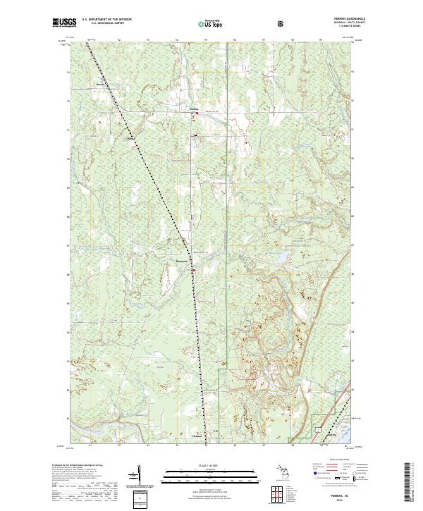 2023 Perkins2023 Print · USGSUpper Peninsula timber and river lands come into focus in this contemporary survey of central Delta County. Genealogists and local historians can trace the rural layout of settlements like Perkins, Brampton, and Kipling, or locate burials at Perkins Cem.
 - 2023 Map of Woodlawn, 2023 Print
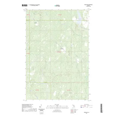 2023 Woodlawn2023 Print · USGSThe borderlands of Delta, Marquette, and Menominee counties are captured here in the early 2020s, showcasing a remote Upper Peninsula landscape. Researchers can trace the winding Ford River and find local landmarks like Hendricks and the Boney Falls Basin.
 - 2023 Map of Rock SE, 2023 Print
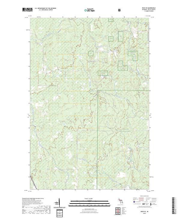 2023 Rock SE2023 Print · USGSUpper Peninsula timberlands and river systems are documented here in the early twenty-first century. Researchers can trace historical routes like Old M-35 or follow the winding courses of the Tacoosh River and Rapid River through the Hiawatha Nat For.
End of results
Showing maps 1-6 of 6
Top cities near Baldwin Township
- Escanaba historical maps
- Gladstone historical maps
- Wells historical maps
- Brampton historical maps
- Cornell historical maps
Top neighborhoods of Baldwin Township
Frequently asked questions
- What are the different types of historical maps available for Baldwin Township?
- What is the oldest map of Baldwin Township?
- Where can I purchase historical maps of Baldwin Township for my home or office?
- Where can I download high-res historical maps of Baldwin Township?
- Are there historical topographic maps available for Baldwin Township?
- Is there historical aerial imagery available for Baldwin Township?
- Where are historical maps of Baldwin Township sourced from?