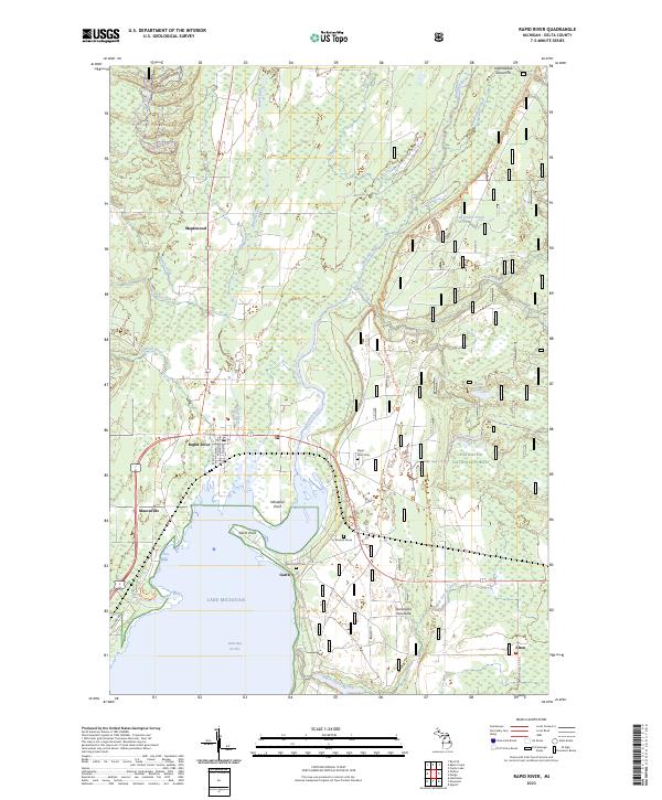
2023 Map of Rapid River
USGS Topo · Published 2023About this map
Little Bay de Noc forms the dramatic southern anchor of this Upper Peninsula landscape, where the confluence of the Rapid River and Whitefish River meets the waters of Lake Michigan. The settlement of Rapid River serves as the local hub, supported by smaller historical communities like Masonville and Garth, the latter situated near the protective reach of Garth Point. The area's commitment to natural preservation and recreation is evident through the inclusion of the Whitefish Wild and Scenic River corridor and the expansive Hiawatha National Forest. Significant local history and genealogy markers are present, such as the Rapid River Cem and the individual McLeod Grave on the Stonington Peninsula. Traditional industry is noted at the Haymeadow Gravel Pit, while the modern recreational landscape is defined by the Bay De Noc - Grand Island Trl and the Rapid River Ski Trl winding through the northern timberlands.
Find a feature on this map
40 named features on this map. Tap any name to fly to it.
Don’t see what you’re looking for? This feature index may not catch every label — zoom into the map to look around manually.
Map Details
Editions of this 2023 Rapid River Map
This is the sole edition of this map. No revisions or reprints were ever made.
Other maps of this area

1932 · Gladstone NE
USGS Topo · 1:31,680

1932 · Rapid River NE
USGS Topo · 1:31,680

1932 · Trenary SW
USGS Topo · 1:31,680

1932 · Gladstone SE
USGS Topo · 1:31,680

1932 · Rapid River NW
USGS Topo · 1:31,680

1932 · Trenary SE
USGS Topo · 1:31,680

1932 · Rock SE
USGS Topo · 1:31,680

1932 · Rapid River SE
USGS Topo · 1:31,680

1932 · Rapid River SW
USGS Topo · 1:31,680

1954 · Escanaba
USGS Topo · 1:250,000