
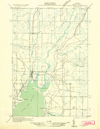
1932 Map of Rapid River NW
USGS Topo · Published 1932About this map
Little Bay De Noc defines the southern edge of this 1932 field survey, where the Rapid River and Whitefish River converge into the bay's northern reaches. The settlement of Rapid River serves as the central hub, situated at the junction of the Minneapolis Sault Ste Marie railroad and major early motor routes including U S Highway No 2 and 41. This era captures the transition from a rail-dependent economy to one increasingly shaped by highway access, with small crossroads like Maplewood and Masonville dotting the landscape.
Find a feature on this map
35 named features on this map. Tap any name to fly to it.
Don’t see what you’re looking for? This feature index may not catch every label — zoom into the map to look around manually.
Map Details
Editions of this 1932 Rapid River NW Map
2 editions found
Other maps of this area

1932 · Gladstone NE
USGS Topo · 1:31,680

1932 · Rapid River NE
USGS Topo · 1:31,680

1932 · Trenary SW
USGS Topo · 1:31,680

1932 · Gladstone SE
USGS Topo · 1:31,680

1932 · Trenary SE
USGS Topo · 1:31,680

1932 · Rock SE
USGS Topo · 1:31,680

1932 · Rapid River SE
USGS Topo · 1:31,680

1932 · Rapid River SW
USGS Topo · 1:31,680

1954 · Escanaba
USGS Topo · 1:250,000

1957 · Escanaba
USGS Topo · 1:250,000