Old Maps of Ogontz, Ensign Township for Genealogy
Trace your family roots with 12 historic maps of Ogontz. These high-res maps reveal old neighborhoods, homesites, landmarks, and streets — helping you uncover where your ancestors lived and how the area evolved over time.
- Explore historic neighborhoods: Identify where your relatives may have lived in the 1800s or 1900s.
- Compare maps over time: Trace the changes in streets, buildings, and landmarks for multi-generational research.
- Perfect for genealogy & ancestry research: Used by family historians and researchers to map out lineage and migration.
These maps are an incredible resource for exploring your personal connection to Ogontz's past.
Ogontz, Ensign Township maps
(12)- 1932 Map of Rapid River SE
 1932 Rapid River SE1932 Print · USGSThe northern shores of Big Bay de Noc appear in the early 1930s as a quiet landscape of coastal marshes and timberlands. Local researchers can trace family roots at Grange Hall, visit the Silver Dale Sch, or locate old camps like Camp Ruh and Indian Town Lake.
 - 1954 Map of Escanaba, 1967 Print
 1954 Escanaba1967 Print · USGSThe Upper Peninsula and Door County shorelines meet here in the mid-fifties, showing the vital maritime and timber networks of the Great Lakes. Researchers can trace historic rail lines, old fire lookouts like the Stonington Fire Tower, and island settlements such as Washington Island.2 unique versions available
 - 1957 Map of Escanaba
 1957 Escanaba1957 Print · USGSThe Upper Peninsula and Door County shorelines meet in the mid-fifties, capturing a landscape of timber, iron, and maritime trade. Genealogists and local historians can trace the Chicago & North Western RR through settlements like Hermansville or locate St Vitals Church and the Potawatome Indian Reservation.
 - 1958 Map of Escanaba
 1958 Escanaba1958 Print · USGSNorthern Lake Michigan maritime commerce and timberlands are captured here in the mid-fifties. Genealogists and historians can trace rail networks like the Escanaba and Lake Superior or locate island settlements such as Detroit Harbor and Fish Creek.
 - 1958 Map of Rapid River, 1960 Print
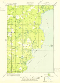
 1958 Rapid River1960 Print · USGSUpper Peninsula timberlands and shores meet in the late fifties along the dual bays of Lake Michigan. Researchers can trace family roots at Garth Cem and Lakewood Cem or locate old community hubs like Ensign and the Stonington Community Hall.2 unique versions available
 - 1983 Map of Manistique
 1983 Manistique1983 Print · USGSThe northern shores of Lake Michigan and the Garden Peninsula appear here in the early eighties. Historians can trace the Soo Line rail corridor and explore coastal settlements like Nahma, Fayette, and the harbor town of Manistique.
 - 1985 Map of Ogontz
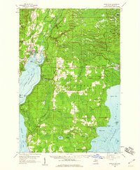
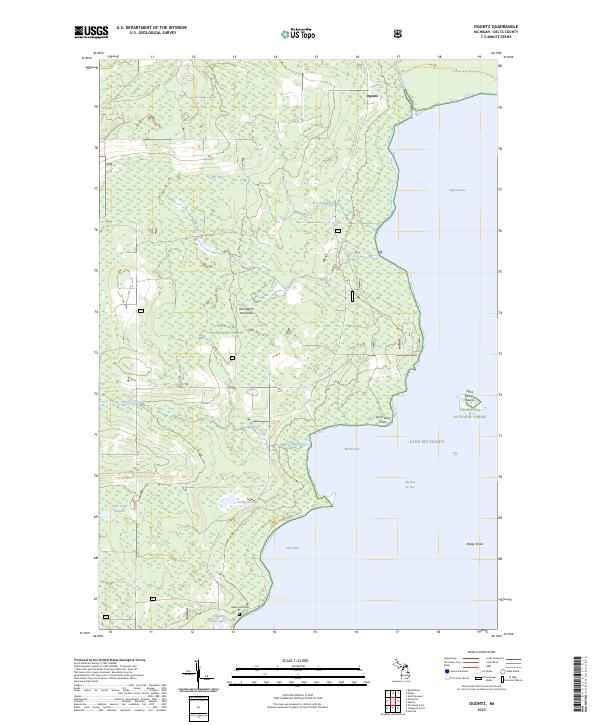
 1985 Ogontz1985 Print · USGSThe Delta County coastline along Big Bay De Noc is captured here during the mid-eighties, showing a remote stretch of the Hiawatha National Forest. Researchers can locate the settlement of Ogontz, trace the path of Martin Creek, or find natural landmarks like Little Lake Sixteen.
 - 2011 Map of Ogontz, 2011 Print
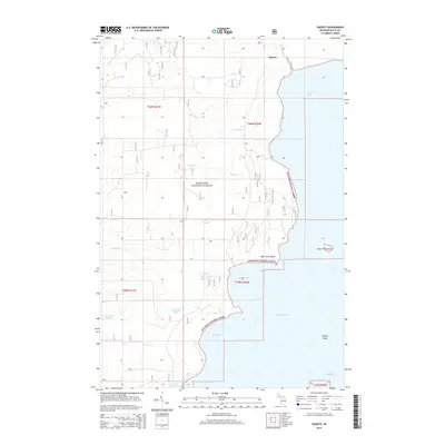
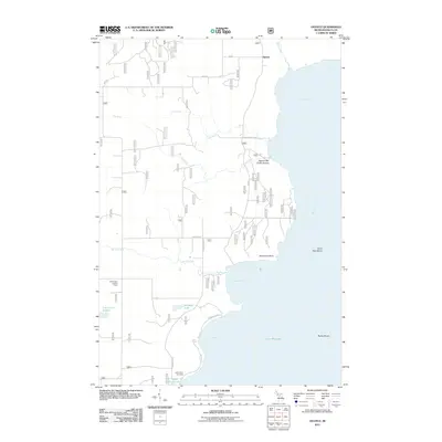 2011 Ogontz2011 Print · USGSCovers Ogontz, including Bay De Noc Township, Nahma Township, and other nearby areas
 - 2014 Map of Ogontz, 2014 Print
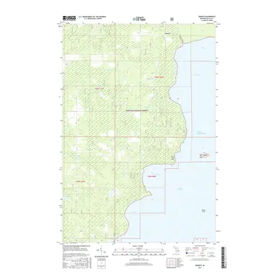
 2014 Ogontz2014 Print · USGSCovers Ogontz, including Bay De Noc Township, Nahma Township, and other nearby areas
 - 2017 Map of Ogontz, 2017 Print
 2017 Ogontz2017 Print · USGSCovers Ogontz, including Bay De Noc Township, Nahma Township, and other nearby areas
 - 2019 Map of Ogontz, 2019 Print
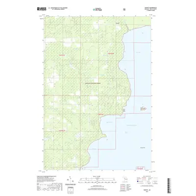 2019 Ogontz2019 Print · USGSCovers Ogontz, including Bay De Noc Township, Nahma Township, and other nearby areas
 - 2023 Map of Ogontz, 2023 Print
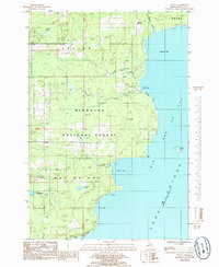
 2023 Ogontz2023 Print · USGSThe Stonington Peninsula remains a landscape of forest and water in the early twenty-first century. Researchers can trace family roots at Indian Town Cem or explore the jagged coastline of Big Bay de Noc and Ogontz Bay.
End of results
Showing maps 1-12 of 12
Top cities near Ogontz
Frequently asked questions
- What are the different types of historical maps available for Ogontz?
- What is the oldest map of Ogontz?
- Where can I purchase historical maps of Ogontz for my home or office?
- Where can I download high-res historical maps of Ogontz?
- Are there historical topographic maps available for Ogontz?
- Is there historical aerial imagery available for Ogontz?
- Where are historical maps of Ogontz sourced from?