Old Maps of Eaton County, Michigan for Metal Detecting
Plan your next treasure hunt with 146 historic maps of Eaton County. Find old homesites, ghost towns, trails, and gathering spots that may be lost to time — perfect for identifying promising metal detecting locations.
- Locate forgotten sites: Uncover places like long-lost settlements, abandoned rail lines, or gathering spots.
- Plan better hunts: Use map overlays combined with LiDAR or satellite views to narrow in on historically rich areas.
- Made for detectorists: Thousands of hobbyists use these maps to discover relics, coins, and hidden history.
Use these historic maps to boost your research and find new opportunities beneath the surface of Eaton County.
Eaton County, MI maps
(146)- 1910 Map of Lansing, 1958 Print
 1910 Lansing1958 Print · USGSThe state capital and its surrounding agrarian townships are captured here during a period of significant growth at the start of the 1910s. Genealogists can trace hundreds of family farms and local landmarks including Dolly Varden School, Grovenberg Church, and the Pere Marquette rail lines.
 - 1912 Map of Lansing
 1912 Lansing1912 Print · USGSLansing and the surrounding townships are captured in 1912 as the region's rural character met the growing industrial city. Genealogists can trace family footprints through dozens of country school sites like Dolly Varden School or settlements such as Dimondale and Canada Settlement.4 unique versions available
 - 1916 Map of Ionia, 1958 Print
 1916 Ionia1958 Print · USGSIonia and the surrounding rural townships are shown during a period of transition in the early twentieth century. Genealogists can locate numerous rural schoolhouses like Welch School and Limerick School, or trace the tracks of the Pere Marquette railroad through Saranac.2 unique versions available
 - 1918 Map of Battle Creek
 1918 Battle Creek1918 Print · USGSThe Battle Creek area thrived as a rail and industrial hub during the First World War. Genealogists can trace family footprints across rural schoolhouses like Little Brick School and settlements like Ceresco or Bellevue.4 unique versions available
 - 1918 Map of Ionia
 1918 Ionia1918 Print · USGSIonia County and northern Barry County appear here at the end of the Great War, as the river-and-rail economy peaked. Genealogists can trace family footprints across dozens of country school sites like Bushnell School and named corners such as Tremaine Corners.2 unique versions available
 - 1919 Map of Springport, 1958 Print
 1919 Springport1958 Print · USGSSouthern Michigan at the close of the Great War is a landscape of rural schoolhouses and historic turnpikes. Genealogists can locate family landmarks like Chapel Cemetery or trace the early paths of the Old Plank Road and Michigan Central Railroad.3 unique versions available
 - 1921 Map of Springport
 1921 Springport1921 Print · USGSCentral Michigan's agricultural heartland at the end of the Great War reveals a landscape of dispersed farmsteads and numerous small school districts. Genealogists can trace family lands near Onondaga, Kinneville, and Chapel Cemetery, or locate vanished schoolhouses like Knight School and Fisk School.2 unique versions available
 - 1921 Map of Marshall, 1965 Print
 1921 Marshall1965 Print · USGSSouthern Michigan in the early 1920s is defined by its busy rail corridors and countless rural school districts. Researchers can trace the development of Marshall and Albion or locate vanished landmarks like the County Infirmary and Town Line Church.2 unique versions available
 - 1923 Map of Marshall
 1923 Marshall1923 Print · USGSSouthern Michigan in the early twenties reveals a landscape of growing towns and busy rail corridors. Genealogists can trace rural family roots through dozens of local schoolhouses and centers like Lee Center, Partello, and Town Line Church.4 unique versions available
 - 1927 Map of De Witt
 1927 De Witt1927 Print · USGSClinton County and its neighbors are captured here in the 1920s, showing a landscape of small farming townships and river-fed settlements. Researchers can trace dozens of rural school sites like Bengal Center School and local landmarks like Oak Ridge Cemetery or the Wilsey Church.3 unique versions available
 - 1943 Map of Battle Creek
 1943 Battle Creek1943 Print · USGSBattle Creek and the surrounding Calhoun County countryside are shown during the early years of the Second World War. Genealogists and local historians can locate dozens of country schoolhouses like Cobblestone Sch and trace the Grand Trunk Railway through Bellevue and Ceresco.
 - 1943 Map of Marshall
 1943 Marshall1943 Print · USGSCentral Michigan during the early 1940s is defined by its busy rail corridors and small school districts. Genealogists can trace family names at locations like Hockinberry Sch, Olivet, and the Starr Commonwealth Sch.
 - 1943 Map of Ionia, 1944 Print
 1943 Ionia1944 Print · USGSCentral Michigan’s rural landscape during the wartime era shows a dense network of country schoolhouses and river-valley institutions. Genealogists and local historians can trace family-named landmarks like Henderleider Sch and Saranac along the Pere Marquette rail line.
 - 1945 Map of Portland, 1946 Print
 1945 Portland1946 Print · USGSCentral Michigan river valleys thrive in the 1940s as agricultural and transit hubs. Genealogists can locate dozens of family-named schoolhouses and cemeteries like Eagle Cem, while tracing the Pere Marquette rail line and Wagar Dam.3 unique versions available
 - 1947 Map of Bellevue, 1955 Print
 1947 Bellevue1955 Print · USGSThe town of Bellevue and its surrounding townships are shown here just after the war, centered on the railroad and river. Genealogists can trace family landmarks like Follett Cem, Base Line Ch, and several district schools.
 - 1949 Map of Charlotte
 1949 Charlotte1949 Print · USGSEaton County enters the post-war era as a thriving rail hub where the Michigan Central and Grand Trunk lines meet. Genealogists and historians can trace dozens of rural schoolhouses and family cemeteries, from Shaytown to the County Farm.3 unique versions available
 - 1950 Map of Battle Creek
 1950 Battle Creek1950 Print · USGSBattle Creek and its surrounding townships thrive in the early post-war years as a vital hub of Michigan industry and aviation. Genealogists and historians can trace family roots through numerous country schools like Cobblestone Sch and cemeteries such as Oak Hill Cem.3 unique versions available
 - 1950 Map of Nashville, 1967 Print
 1950 Nashville1967 Print · USGSThe Thornapple River valley in the mid-twentieth century shows a landscape of rail-connected villages and rural school districts. Genealogists can locate family landmarks like Woodlawn Cem, McKelvey Sch, and the New York Central rail line.
 - 1951 Map of Nashville
 1951 Nashville1951 Print · USGSThe rural landscape of Barry and Eaton Counties in the early 1950s reveals a dense network of family-named landmarks and country schools. Genealogists can trace local roots through numerous sites like Woodland Cem, Quail Trap Sch, and the settlement of Coats Grove.2 unique versions available
 - 1958 Map of Grand Rapids, 1973 Print
 1958 Grand Rapids1973 Print · USGSSouthern Michigan at the peak of the postwar era shows a landscape of burgeoning cities and new interstate highways. Trace family roots and regional growth in Grand Rapids, Battle Creek, and the glacial lake country around Gun Lake or Gull Lake.2 unique versions available
 - 1961 Map of Grand Rapids
 1961 Grand Rapids1961 Print · USGSSouthern Michigan at the dawn of the 1960s reveals a region shaped by major river systems and a robust rail network. Trace mid-century industrial growth and land use from Grand Rapids to the Fort Custer Military Reservation and Gun Lake.
 - 1961 Map of Bellevue, 1962 Print
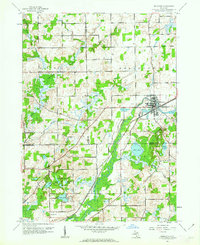 1961 Bellevue1962 Print · USGSThe village of Bellevue and the surrounding township borders are captured here in the early sixties as a bustling rail-and-river crossroads. Genealogists and local historians can trace rural family landmarks like the Base Line Ch, Bell Cem, and the old Boughton Sch.3 unique versions available
 - 1962 Map of Grand Rapids
 1962 Grand Rapids1962 Print · USGSMid-century Southern Michigan is mapped here at a time of massive growth, showing the expanding urban footprints of Grand Rapids and Lansing. Researchers can trace the legacy of the Grand Trunk Western RR, find historic boundaries of the Fort Custer Military Reservation, or locate sporting camps around Gun Lake.2 unique versions available
 - 1965 Map of Lansing South, 1967 Print
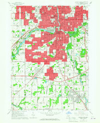 1965 Lansing South1967 Print · USGSGreater Lansing is captured in a period of significant mid-century expansion along the Grand River and Red Cedar River corridors. Genealogists and local historians can trace family plots in Mt Hope Cemetery or locate old neighborhood landmarks like St Mary Sch and the settlement of Millett.3 unique versions available
 - 1965 Map of Wacousta, 1967 Print
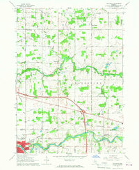 1965 Wacousta1967 Print · USGSMid-Michigan's agricultural and riverfront communities are captured here in the mid-1960s, showing the early growth of Grand Ledge and Wacousta. Researchers can trace old family sites near South Riley Cem, identify rural schoolhouses like Kincaid Sch, and locate regional transport hubs from Pohls Airpark to the Chesapeake and Ohio line.2 unique versions available
Showing maps 1-25 of 146
Top cities of Eaton County
- Charlotte historical maps
- Grand Ledge historical maps
- Eaton Rapids historical maps
- Potterville historical maps
- Olivet historical maps
Frequently asked questions
- What are the different types of historical maps available for Eaton County?
- What is the oldest map of Eaton County?
- Where can I purchase historical maps of Eaton County for my home or office?
- Where can I download high-res historical maps of Eaton County?
- Are there historical topographic maps available for Eaton County?
- Is there historical aerial imagery available for Eaton County?
- Where are historical maps of Eaton County sourced from?