Old Maps of Flint Charter Township, Michigan
Explore 44 old maps of Flint Charter Township, spanning from 1919 to today. These high-resolution historic maps reveal how streets, neighborhoods, landmarks, and natural features evolved over time — perfect for genealogy, metal detecting, research, and local history exploration.
What you can do with these maps:
- See how Flint Charter Township changed over time: Compare historical maps to modern-day views to trace roads, homesites, rail lines & more.
- View detailed metadata: Each map includes creators, publishers, year, scale, and archive source.
- Overlay maps with satellite & LiDAR: Visualize the past alongside modern tools to explore terrain & human change.
- Trusted historical sources: Maps sourced from the USGS, Library of Congress, and other archives.
- Access maps your way: View online, download high-res files, or order prints for personal or research use.
Start exploring old maps of Flint Charter Township to uncover forgotten places, hidden landmarks, and the deep history beneath your feet.
Flint Charter Township, MI maps
(44)- 1919 Map of Burt, 1959 Print
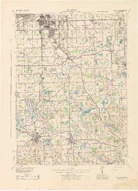
 1919 Burt1959 Print · USGSThe rural landscape between Saginaw and Flint is captured here in the years following the Great War. Genealogists can locate dozens of country schoolhouses like Marr School and Deneen School, or trace the path of the Michigan United Electric Railway.
 - 1920 Map of Flint
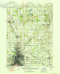 1920 Flint1920 Print · USGSFlint and the surrounding Genesee County townships appear in this post-war survey during a period of intense industrial and civic growth. Genealogists and historians can trace numerous rural school sites like Beecher School and major rail lines including the Pere Marquette.2 unique versions available
 - 1920 Map of Holly, 1964 Print
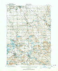 1920 Holly1964 Print · USGSOakland and Genesee counties at the height of the rail era show a landscape of interconnected small towns and lakeside settlements. Trace the legacy of early transit via the United Electric Railway or locate family landmarks like Groveland Mills and Hadley Cemetery.
 - 1921 Map of Burt
 1921 Burt1921 Print · USGSSaginaw and Genesee Counties are captured here at the end of the Great War, showing a landscape of tight-knit farming communities and early electric transit. Researchers can trace family roots through dozens of named sites like St Michaels Church, Marr School, and the Michigan Electric Railway.2 unique versions available
 - 1922 Map of Holly
 1922 Holly1922 Print · USGSSoutheast of the industrial rise of Flint in the early 1920s, this region reveals a landscape of lakeside settlements and small-town village life. Genealogists can locate family-named sites like Ainsworth Corners, Gravel Lake Cemetery, and dozens of rural schoolhouses including Atherton School and Howe School.3 unique versions available
 - 1922 Map of Durand
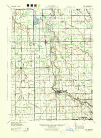
 1922 Durand1922 Print · USGSShiawassee and Genesee counties come alive in the early 1920s as a bustling junction of rail and river. Researchers can trace the sprawling Grand Trunk lines through Durand or locate family roots near the Crapo Farm and Unity Grange.4 unique versions available
 - 1922 Map of Flint
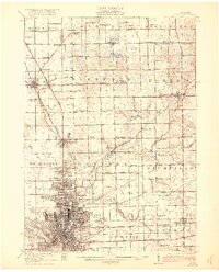 1922 Flint1922 Print · USGSGenesee County comes to life in the early twenties, showing the industrial rise of the vehicle city alongside its rural townships. Researchers can trace family sites near Gracelawn Cemetery or locate old schoolhouses like Boutwell School and Holden School.3 unique versions available
 - 1943 Map of Holly
 1943 Holly1943 Print · USGSThe Shiawassee River valley and its surrounding lake country are shown here in the early 1940s as a thriving network of rail towns and rural schools. Genealogists and local historians can trace family locations near Fenton, Holly, and the small settlement at Groveland Mills.
 - 1943 Map of Burt
 1943 Burt1943 Print · USGSThe rural borders of Saginaw and Genesee counties come alive in the 1940s as the Flint River winds past growing farm towns. Genealogists and historians can trace dozens of family-named schoolhouses and crossroads, from St Michaels Ch to the rail hubs of Burt and Montrose.
 - 1943 Map of Durand
 1943 Durand1943 Print · USGSMid-century Shiawassee and Genesee Counties are mapped here during a period of agricultural stability and rail expansion. Genealogists can trace family farm locations near Crapo Farm or locate rural schools like Doane Sch and Church Sch.
 - 1943 Map of Flint, 1944 Print
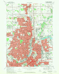
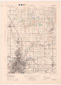 1943 Flint1944 Print · USGSGenesee County and the city of Flint appear in transition during the mid-forties, balancing a booming urban core with a sprawling network of rural township schools. Genealogists and local historians can trace hundreds of property sites near Kearsley Res or locate early academic landmarks like Wildcat Sch and Hopkins Sch.
 - 1954 Map of Detroit
 1954 Detroit1954 Print · USGSThe Detroit metro and its Ontario neighbors are shown at the height of the mid-century industrial era, just as the suburbs were rapidly expanding. Researchers can trace the massive rail networks of the Wabash Railroad or locate landmarks like Grosse Ile and Selfridge Air Force Base.
 - 1954 Map of Flint, 1968 Print
 1954 Flint1968 Print · USGSThe industrial corridor and fertile Thumb region of Michigan come alive in this mid-century survey. Genealogists and historians can trace the rail networks of the Grand Trunk, locate established settlements like Bad Axe and Sandusky, or explore the 1950s shoreline along Saginaw Bay.4 unique versions available
 - 1958 Map of Flint
 1958 Flint1958 Print · USGSThe Michigan Thumb and the Saginaw Valley are captured here during the height of the post-war industrial era. Researchers can trace the complex rail networks of the Grand Trunk Western or locate mid-century landmarks like Lakeport State Park and the port at Bay City.2 unique versions available
 - 1961 Map of Detroit, 1973 Print
 1961 Detroit1973 Print · USGSThe international border between Michigan and Ontario was a bustling industrial corridor in the early sixties. Researchers can trace the transit networks and riverfront infrastructure connecting Detroit to Windsor via the Detroit-Windsor Tunnel and major air hubs like Willow Run Airport.2 unique versions available
 - 1965 Map of Detroit
 1965 Detroit1965 Print · USGSThe industrial corridor between Michigan and Ontario is captured here at mid-century, showing the dense rail and river networks of the Great Lakes. Local historians can trace the paths of the Grand Trunk Western RR and locate key landmarks like Selfridge Air Force Base and Grosse Ile.
 - 1969 Map of Flushing, 1971 Print
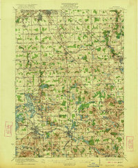
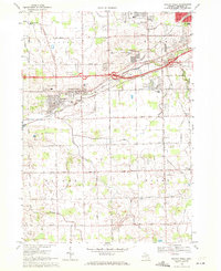
 1969 Flushing1971 Print · USGSFlushing and the Flint River valley are captured here during a period of significant mid-century suburban expansion in Genesee County. Genealogists and local historians can locate several burial grounds like Flushing Cemetery and trace the path of the Old Indian Treaty Rdy.
 - 1969 Map of Flint South, 1971 Print
 1969 Flint South1971 Print · USGSThe southern suburbs of Flint and the township of Grand Blanc are captured during a period of rapid residential expansion in the late sixties. Genealogists and local historians can trace family sites at Bristol Cem, Evergreen Cem, and Fenton Road Chapel.3 unique versions available
 - 1969 Map of Flint North, 1971 Print
 1969 Flint North1971 Print · USGSFlint and Mount Morris are captured during a period of significant urban development in the late sixties. Researchers can find a wealth of local landmarks, from Gracelawn Cemetery and Atwood Stadium to neighborhood sites like Beecher High Sch.2 unique versions available
 - 1969 Map of Swartz Creek, 1971 Print
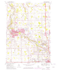
 1969 Swartz Creek1971 Print · USGSSwartz Creek and the surrounding Genesee County townships are shown here in the late sixties as suburban growth meets traditional Michigan farmland. Researchers can trace family roots at Mt Hope Cem or locate historic local schools like Woodland Sch and Morrish Sch.2 unique versions available
 - 1975 Map of Flushing, 1976 Print
 1975 Flushing1976 Print · USGSMid-Michigan suburban growth meets historical boundaries in this mid-seventies survey of the area surrounding the Flint River. Genealogists and local historians can trace the Old Indian Treaty Line and locate numerous community landmarks like Daltons Airport and Old Sunset Hills Cem.
 - 1984 Map of Flint, 1985 Print
 1984 Flint1985 Print · USGSThe industrial corridor between Flint and Saginaw is captured here during the mid-1980s, showcasing a landscape of growing suburbs and preserved wildlands. Researchers can trace the Grand Trunk Western RR or locate local landmarks like St Johns Ch and Flint Memorial Park Cem.
 - 1985 Map of Pontiac
 1985 Pontiac1985 Print · USGSSoutheast Michigan in the mid-1980s shows a landscape of growing suburban corridors and expansive public parklands. Genealogists and local historians can trace the footprint of rail lines like the Grand Trunk Western or locate family sites near Oakwood Cem and White Chapel Cem.2 unique versions available
 - 1990 Map of Flint, 1991 Print
 1990 Flint1991 Print · USGSThe Flint and Saginaw corridors are captured here in the early nineties, showing a landscape defined by heavy industry and rural expanses. Genealogists and historians can trace the rail lines of the Penn Central RR, visit Flint Memorial Park Cem, or explore the limits of Zilwaukee.
 - 2011 Map of Flint North, 2011 Print
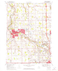
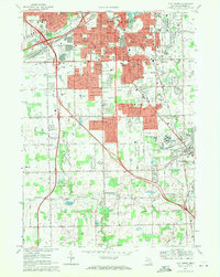
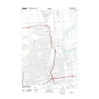 2011 Flint North2011 Print · USGSCovers Flint Charter Township, including Flint, Burton, and other nearby areas
Showing maps 1-25 of 44
Top cities near Flint Charter Township
- Flint historical maps
- Burton historical maps
- Springfield Charter Township historical maps
- Fenton historical maps
- Tyrone Township historical maps
- Flushing historical maps
See more
Frequently asked questions
- What are the different types of historical maps available for Flint Charter Township?
- What is the oldest map of Flint Charter Township?
- Where can I purchase historical maps of Flint Charter Township for my home or office?
- Where can I download high-res historical maps of Flint Charter Township?
- Are there historical topographic maps available for Flint Charter Township?
- Is there historical aerial imagery available for Flint Charter Township?
- Where are historical maps of Flint Charter Township sourced from?