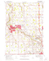
1969 Map of Flushing
USGS Topo · Published 1971About this map
The Flint River meanders through the heart of this Genesee County community, providing a focal point for the city of Flushing and its surrounding parklands. This late-1960s landscape shows a transition from structured town grids to the spreading suburban developments of the era, marked by numerous educational institutions such as Flushing High Sch and Carman High Sch. The presence of the Grand Trunk Western railroad and the Dalton Airport indicates the region's reliance on both rail and light air transport for commerce and travel.
Find a feature on this map
73 named features on this map. Tap any name to fly to it.
Don’t see what you’re looking for? This feature index may not catch every label — zoom into the map to look around manually.
Map Details
Editions of this 1969 Flushing Map
This is the sole edition of this map. No revisions or reprints were ever made.
Other maps of this area

1919 · Burt
USGS Topo · 1:62,500

1920 · Flint
USGS Topo · 1:62,500

1920 · Holly
USGS Topo · 1:62,500

1921 · Burt
USGS Topo · 1:62,500

1922 · Holly
USGS Topo · 1:62,500

1922 · Durand
USGS Topo · 1:62,500

1922 · Flint
USGS Topo · 1:62,500

1943 · Holly
USGS Topo · 1:62,500

1943 · Burt
USGS Topo · 1:62,500

1943 · Durand
USGS Topo · 1:62,500
Featured Places
- Flushing, MI
- Flint Charter Township, MI
- Clayton Charter Township, MI
- Mount Morris Charter Township, MI
- Flushing Charter Township, MI