Old Maps of Gogebic County, Michigan for Academic Research
Study the evolution of Gogebic County with 330 high-resolution historic maps. Whether you're teaching, researching, or modeling changes in land use, these maps provide essential visual documentation of urban, environmental, and geographic change.
- Analyze long-term change: Track patterns in development, transportation, and natural features.
- Ideal for environmental or urban studies: Support academic projects with primary historical map data.
- Use in the classroom or lab: Educators and researchers rely on these maps to bring historical context to life.
These maps are a powerful tool for teaching, research, and visualizing how Gogebic County has changed over the decades.
Gogebic County, MI maps
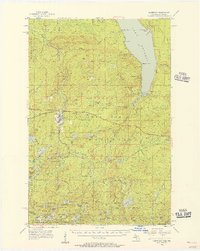
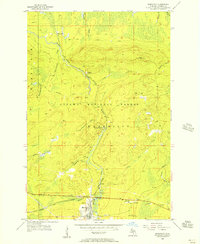
(330)- 1938 Map of Phelps, 1946 Print
 1938 Phelps1946 Print · USGSVilas County's northern lakes and timberlands come into focus during the late 1930s, showing a landscape defined by the Michigan-Wisconsin state line and new conservation camps. Genealogists and historians can trace the foundations of local life at the Augustus Adolphus Ch, Conover Cem, and the CCC Camp near Phelps.
 - 1939 Map of Trout Lake
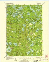
 1939 Trout Lake1939 Print · USGSNorthern Wisconsin's lake country is captured here in the late thirties as the region transitioned into a premier outdoor destination. Trace the development of Boulder Junction, the locations of a CCC Camp, and fire suppression lookouts like the Boulder Fire Tower.
 - 1943 Map of Little Girls Point
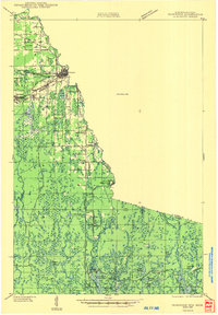
 1943 Little Girls Point1943 Print · USGSThe Lake Superior coast at the Michigan-Wisconsin border appears here in the early 1940s, showing a landscape defined by state lines and iron-range railroads. Trace the routes of the C & N W railroad near Cedar or locate the Lake View Cem in this surveyed borderland.
 - 1943 Map of Ironwood
 1943 Ironwood1943 Print · USGSThe border country between Wisconsin and Michigan comes alive in this wartime survey of the iron range and timberlands. Researchers can trace early rural life through vanished sites like the Mosinee Lumber Camp, the Chicago and Northwestern Line, and local hubs like Buskirk.2 unique versions available
 - 1943 Map of Little Girl Point
 1943 Little Girl Point1943 Print · USGSThe Lake Superior shoreline at the Wisconsin-Michigan border is shown here as it appeared in the early 1940s. Genealogists and local historians can trace the La Pointe Indian Reservation and the tracks of the Duluth South Shore and Atlantic railroad.
 - 1946 Map of Star Lake
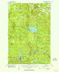
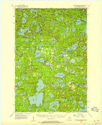
 1946 Star Lake1946 Print · USGSVilas County was a landscape of deep woods and glacial lakes in the late thirties as the timber era gave way to early tourism. Genealogists and historians can trace the Chicago and Northwestern Line rail corridor and find early landmarks like the Monahan Fire Tower and Star Lake settlement.
 - 1946 Map of Trout Lake
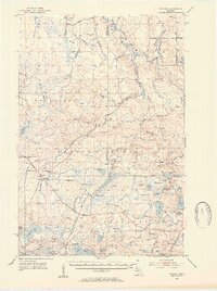
 1946 Trout Lake1946 Print · USGSVilas County and the Michigan border are captured here during the late 1930s, showcasing a landscape of dense lakes and early forest management. Local historians can trace the development of Boulder Junction, the presence of a CCC Camp, and the historic State Forest Headquarters.
 - 1949 Map of Trout Lake
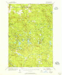
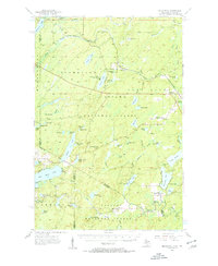
 1949 Trout Lake1949 Print · USGSThe Vilas County lake country is captured here during the post-war years, showcasing a dense network of waterways and early conservation sites. Researchers can locate the CCC Camp, the settlement of Boulder Junction, and the Boulder Fire Tower.
 - 1950 Map of Phelps
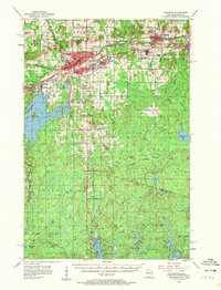
 1950 Phelps1950 Print · USGSVilas County's lake country is captured here during the mid-century, showing the development of Phelps and Land O' Lakes along the state line. Researchers can trace the Chicago and Northwestern rail line and locate the Augustus Adolphus Ch or the C C C Camp near Afterglow Lake.
 - 1950 Map of Star Lake
 1950 Star Lake1950 Print · USGSVilas County's lake-strewn borderlands are captured here at mid-century, showing a landscape defined by timber management and early rail travel. Researchers can trace the Chicago and Northwestern Ry through Conover and locate remote outposts like Camp 5 or the Monahan Fire Tower.
 - 1952 Map of Watersmeet, 1954 Print
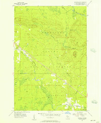
 1952 Watersmeet1954 Print · USGSThe western Upper Peninsula's rail and timber heartland is captured here in the early fifties. Researchers can locate vanished rural infrastructure like Maple Grove School, the Agate Church, and the expansive Bond Falls Flowage near Watersmeet.5 unique versions available
 - 1952 Map of Thayer, 1954 Print
 1952 Thayer1954 Print · USGSThe timberlands of the western Upper Peninsula are captured in the early fifties, centering on the railway corridor through the Ottawa National Forest. Researchers can trace the legacy of the Chicago and North Western line through Gogebic Station, Thayer, and the shores of Beatons Lake.4 unique versions available
 - 1953 Map of Ashland, 1964 Print
 1953 Ashland1964 Print · USGSNorthern Wisconsin's lakefront and timberlands are seen here in the mid-1950s, showing the intersection of industrial rail lines and vast wilderness. Genealogists and historians can trace the Soo Line through rail towns like Mellen or locate family roots in the Apostle Islands and Bad River Indian Reservation.3 unique versions available
 - 1954 Map of Kenton, 1956 Print
 1954 Kenton1956 Print · USGSThe Upper Peninsula rail corridors and timberlands are well-defined in the mid-1950s, centering on the crossing of the Duluth South Shore and Atlantic. Researchers can locate historic sites like the Kenton Cemetery, Holmes Dam, and the old Lookout Tower.3 unique versions available
 - 1955 Map of Marenisco, 1957 Print
 1955 Marenisco1957 Print · USGSThe Michigan-Wisconsin borderlands and the deep woods of the Upper Peninsula are captured here in the mid-fifties. Genealogists and local historians can trace the rail-and-timber era through Marenisco, the Chicago and North Western line, and fire towers like Copps Lookout Tower.3 unique versions available
 - 1955 Map of Starlake, 1957 Print
 1955 Starlake1957 Print · USGSThe Wisconsin-Michigan border country is shown here in the mid-fifties, dominated by the dense waters of the Northwoods. Researchers can trace the Chicago and North Western line or locate local landmarks like Covenant Ch and Starlake.4 unique versions available
 - 1955 Map of Boulder Junction, 1957 Print
 1955 Boulder Junction1957 Print · USGSThe Northwoods of Vilas County are captured here in the mid-fifties, showing the lake-heavy terrain of Boulder Junction and Arbor Vitae. Researchers can trace old lakeside sites like the Boy Scout Camp, the Lookout Tower, and the local Notre Dame Church.5 unique versions available
 - 1955 Map of Ironwood, 1957 Print
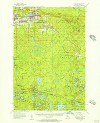
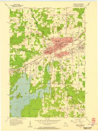 1955 Ironwood1957 Print · USGSIronwood and Hurley stand at the center of the Gogebic Range during the mid-fifties, where Michigan mining meets Wisconsin timber. Genealogists can locate family homes near Sleight Sch, trace the Cary Mine operations, or find rural landmarks like the Finnish Ch and Van Buskirk.5 unique versions available
 - 1955 Map of Marenisco, 1957 Print
 1955 Marenisco1957 Print · USGSUpper Peninsula timber country and rail history are well-preserved here in the mid-fifties, centered on the logging town of Marenisco. Researchers can trace the Chicago and North Western line, locate the Marenisco Landing Field, or find family-named landmarks like Theilers and Ethelwood.2 unique versions available
 - 1955 Map of Bessemer, 1957 Print
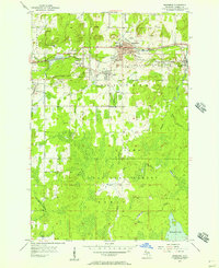 1955 Bessemer1957 Print · USGSIronwood's industrial outskirts and the Gogebic Range mines are at their mid-century peak here in the mid-1950s. Genealogists and researchers can trace the neighborhoods of Anvil, Yale, and Ramsay alongside local landmarks like Washington Sch and the Old Tilden Mine.2 unique versions available
 - 1955 Map of Wakefield, 1957 Print
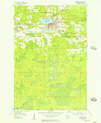 1955 Wakefield1957 Print · USGSWakefield and the iron-rich Gogebic Range are shown here during the mid-1950s as mining operations shaped the landscape. Genealogists and industrial historians can trace the neighborhoods around Sunday Lake, find the Lakeside Cem, and locate mines like the Sunday Lake Mine.2 unique versions available
 - 1955 Map of Wakefield, 1957 Print
 1955 Wakefield1957 Print · USGSThe iron country of the Upper Peninsula is frozen in time during the mid-fifties, showing the industrial core of the Gogebic Range. Genealogists and historians can trace the early layout of Wakefield and its surrounding mining hubs like Ramsay and Verona before the landscape of the Sunday Lake Mine was further altered.3 unique versions available
 - 1955 Map of Wakefield NE, 1957 Print
 1955 Wakefield NE1957 Print · USGSUpper Peninsula timberlands and rail corridors are captured in the mid-1950s within the Ottawa National Forest. Researchers can trace the Chicago and North Western line through forest settlements like Hartley and Dunham or locate the peak of Wolf Mountain.2 unique versions available
 - 1955 Map of Ironwood, 1961 Print
 1955 Ironwood1961 Print · USGSThe Gogebic Range iron district comes to life in this mid-century study of the Michigan-Wisconsin borderlands. Trace the industrial rail networks and mines like Newport Mine alongside the Finnish Ch and vanished local schools.2 unique versions available
 - 1956 Map of Beechwood, 1957 Print
 1956 Beechwood1957 Print · USGSUpper Peninsula timberlands meet the Wisconsin Northwoods in the 1950s, a landscape defined by rail-line outposts and forestry stations. Researchers can find old rural school sites like Elvoy Sch, the Beechwood Ch, and remote rail stops at Elmwood and Basswood.4 unique versions available
Showing maps 1-25 of 330
Top cities of Gogebic County
Frequently asked questions
- What are the different types of historical maps available for Gogebic County?
- What is the oldest map of Gogebic County?
- Where can I purchase historical maps of Gogebic County for my home or office?
- Where can I download high-res historical maps of Gogebic County?
- Are there historical topographic maps available for Gogebic County?
- Is there historical aerial imagery available for Gogebic County?
- Where are historical maps of Gogebic County sourced from?