Old Maps of Tula, Wakefield Township for Metal Detecting
Plan your next treasure hunt with 13 historic maps of Tula. Find old homesites, ghost towns, trails, and gathering spots that may be lost to time — perfect for identifying promising metal detecting locations.
- Locate forgotten sites: Uncover places like long-lost settlements, abandoned rail lines, or gathering spots.
- Plan better hunts: Use map overlays combined with LiDAR or satellite views to narrow in on historically rich areas.
- Made for detectorists: Thousands of hobbyists use these maps to discover relics, coins, and hidden history.
Use these historic maps to boost your research and find new opportunities beneath the surface of Tula.
Tula, Wakefield Township maps
(13)- 1956 Map of Thomaston, 1957 Print
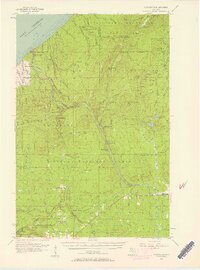 1956 Thomaston1957 Print · USGSThe Upper Peninsula wilderness in the mid-fifties is captured here, showing the heavy industrial influence of the Chicago and North Western railroad. Researchers can trace the timber-era rail sidings at Tula and Manley Siding or locate the Underwood Lookout Tower.4 unique versions available
 - 1958 Map of Iron River, 1968 Print
 1958 Iron River1968 Print · USGSThe Upper Peninsula in the late fifties is captured here as a landscape of timber, iron, and rail. Genealogists and historians can trace rail stops like Mass Station or explore the coastlines of Lake Gogebic and Keweenaw Bay.3 unique versions available
 - 1960 Map of Iron River
 1960 Iron River1960 Print · USGSThe Upper Peninsula’s western reaches are shown in the late fifties, featuring the industrial infrastructure of the Copper Country and the vast Ottawa National Forest. Researchers can trace the rail lines of the Milwaukee Road through settlements like Bruce Crossing and the White Pine Mine.
 - 1961 Map of Iron River
 1961 Iron River1961 Print · USGSThe Upper Peninsula and northern Wisconsin are shown here in the early 1960s, a landscape defined by the iron range and vast timberlands. Researchers can trace the legacy of mining and rail transport through Caspian, the Lac Du Flambeau Indian Reservation, and the Milwaukee Road.
 - 1967 Map of Iron River, 1968 Print
 1967 Iron River1968 Print · USGSThe Upper Peninsula and northern Wisconsin borderlands are shown here in the late sixties, a landscape of deep woods and iron-country rail lines. Genealogists and historians can trace the lakeside settlements of L'Anse and Ontonagon or follow the Soo Line through towns like Michigamme and Nestoria.
 - 1979 Map of Ontonagon, 1991 Print
 1979 Ontonagon1991 Print · USGSThe Western Upper Peninsula coastline and copper country are captured here during the late twentieth century. Genealogists and historians can trace the rail-and-river network connecting settlements like White Pine, Lake Mine, and Bruce Crossing.
 - 1981 Map of Thomaston
 1981 Thomaston1981 Print · USGSGogebic County in the early eighties shows a landscape of timber management and mining infrastructure. You can trace the path of the Soo Line through settlements like Thomaston and Connorville or locate natural landmarks such as Gabbro Falls and Minnewawa Falls.
 - 1999 Map of Tula, 2004 Print
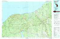
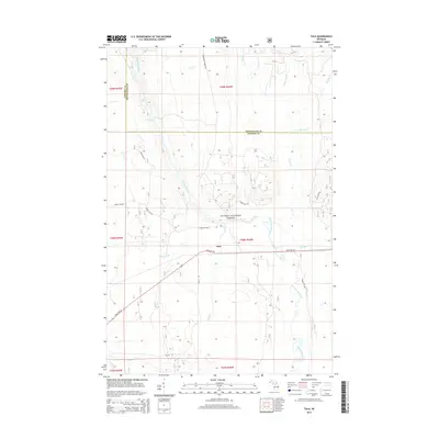
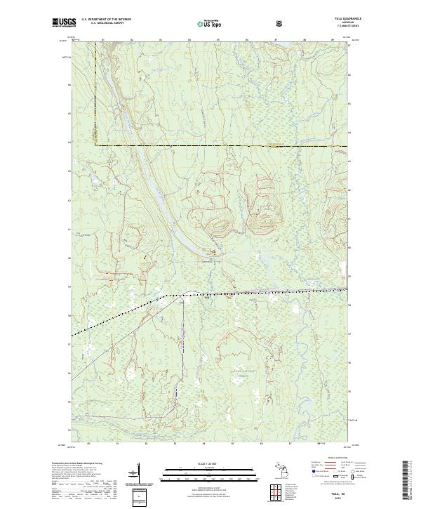
 1999 Tula2004 Print · USGSThe Upper Peninsula wilderness comes into focus at the close of the twentieth century, highlighting the dense timberlands and river systems of the western region. Genealogists and researchers can trace local landmarks like Tula, Jack Spur, and the waters of the Presque Isle River.
 - 2011 Map of Tula, 2011 Print
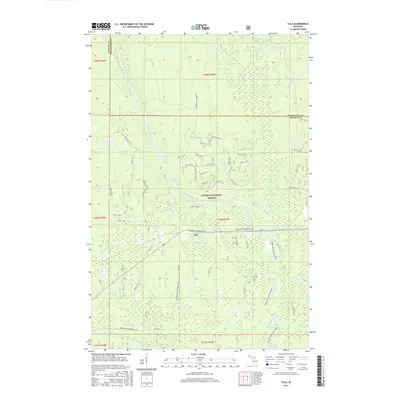
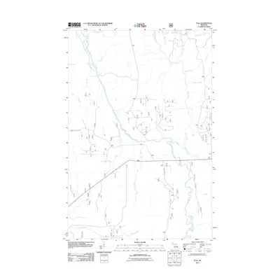 2011 Tula2011 Print · USGSCovers Tula, including Carp Lake Township, Wakefield Township, and other nearby areas
 - 2014 Map of Tula, 2014 Print
 2014 Tula2014 Print · USGSCovers Tula, including Carp Lake Township, Wakefield Township, and other nearby areas
 - 2017 Map of Tula, 2017 Print
 2017 Tula2017 Print · USGSCovers Tula, including Carp Lake Township, Wakefield Township, and other nearby areas
 - 2019 Map of Tula, 2019 Print
 2019 Tula2019 Print · USGSCovers Tula, including Carp Lake Township, Wakefield Township, and other nearby areas
 - 2023 Map of Tula, 2023 Print
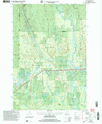
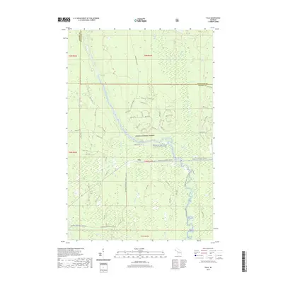
 2023 Tula2023 Print · USGSGogebic County's forested interior is documented here in the early twenty-first century, centered on the settlement of Tula. Researchers can trace the courses of the Presque Isle River and its falls, or explore the maze of forest trails like Jack Spur Rd.
End of results
Showing maps 1-13 of 13
Top cities near Tula
Frequently asked questions
- What are the different types of historical maps available for Tula?
- What is the oldest map of Tula?
- Where can I purchase historical maps of Tula for my home or office?
- Where can I download high-res historical maps of Tula?
- Are there historical topographic maps available for Tula?
- Is there historical aerial imagery available for Tula?
- Where are historical maps of Tula sourced from?