1980s Maps of Grand Traverse County, Michigan
Explore 20 historic maps of Grand Traverse County from the 1980s. These maps offer a rare glimpse into what life looked like during the 1980s — showing old roads, neighborhoods, homes, and landmarks that have changed or disappeared over time.
Whether you're researching your family's past, planning a metal detecting trip, or studying how Grand Traverse County's landscape evolved across the 1980s, these high-resolution maps are a powerful tool for exploring the history of this region.
- Focus on a specific era: All maps on this page are from the 1980s, giving you a focused view of this time period.
- See what’s changed: Compare century-old streets, trails, and buildings to today's modern landscape using overlays and satellite layers.
- Research with precision: Use these maps for genealogy, historical research, land use analysis, or educational projects.
- View, download, or print: Maps are fully viewable online in high resolution, and can be downloaded or printed for your own records.
Start exploring Grand Traverse County's history through authentic maps from the 1980s. This is your window into the past.
Grand Traverse County, MI maps
(20)- 1983 Map of Maple City, 1984 Print
 1983 Maple City1984 Print · USGSLeelanau County's rural heartland is captured here in the early eighties, showcasing a landscape of dense state forests and scattered farmsteads. Genealogists can trace family names through numerous sites like St Rita Cem, Kasson Cem, and the settlement at Maple City.2 unique versions available
 - 1983 Map of Buckley, 1984 Print
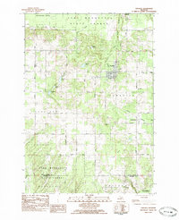
 1983 Buckley1984 Print · USGSWexford and Grand Traverse counties meet in this early 1980s landscape of timber and small-town settlements. Genealogists and local historians can trace the rural layout of Buckley and Monroe Center, or locate family sites near St Marys Cem and the Red School.
 - 1983 Map of Traverse City SE, 1984 Print
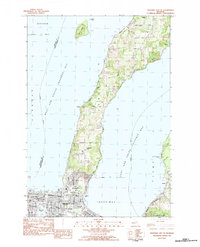 1983 Traverse City SE1984 Print · USGSTraverse City and the surrounding peninsula are documented here in the early eighties as the region balanced its maritime heritage with modern growth. Genealogists and local historians can trace legacy sites like St Josephs Cem, Oakwood Cemetery, and local landmarks such as Vog Sch and the Great Lakes Maritime Academy.
 - 1983 Map of Traverse City, 1984 Print
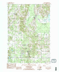
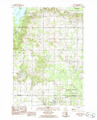
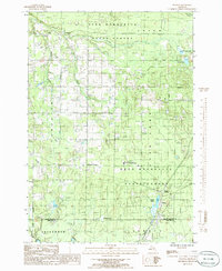
 1983 Traverse City1984 Print · USGSTraverse City and the surrounding bay country are captured in the early eighties as the region balanced its timber heritage with growing conservation. Genealogists and local historians can trace the rail lines of the Ann Arbor RR through settlements like Kingsley and Fife Lake.2 unique versions available
 - 1983 Map of Elk Rapids, 1984 Print
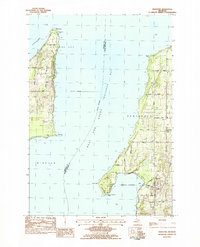
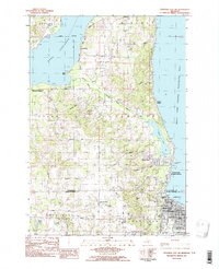
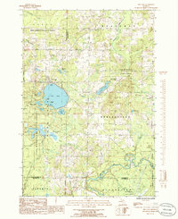
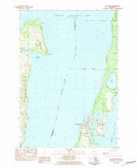 1983 Elk Rapids1984 Print · USGSGrand Traverse Bay and the narrow channels of the Elk River chain define this coastal region in the early eighties. Genealogists and local historians can trace the foundations of Elk Rapids and Old Mission, finding local landmarks like Maple Grove Cem and Lakeland Sch.
 - 1983 Map of Mapleton, 1984 Print
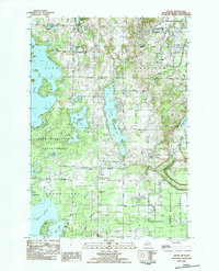
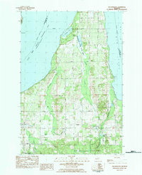
 1983 Mapleton1984 Print · USGSThe Old Mission Peninsula and the shores of the West Arm of Grand Traverse Bay are captured here in the early 1980s. Local historians can trace established homesteads near Mapleton or locate the St Josephs Ch and Bowers Harbor Cem near the water.
 - 1983 Map of Grawn, 1984 Print
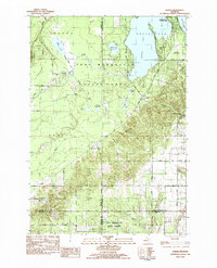
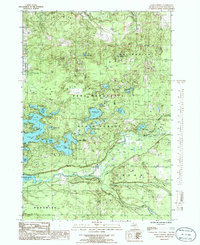
 1983 Grawn1984 Print · USGSGrand Traverse County in the early eighties reveals a landscape of deep glacial lakes and forest tracts near the edge of Traverse City. Trace the Michigan Northern rail line through Grawn, locate family plots at Maple Grove Cem, or find the secluded Carmelite Monastery.
 - 1983 Map of Karlin, 1984 Print
 1983 Karlin1984 Print · USGSNorthern Michigan’s forest and lake country is captured here during the early eighties, showcasing the intersection of four counties. You can trace family history at Karlin or locate rural landmarks like the De Lorme Cem, Grant Ch, and Pavlovic Corner.2 unique versions available
 - 1983 Map of Lake Ann, 1984 Print
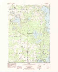 1983 Lake Ann1984 Print · USGSBenzie and Grand Traverse counties appear here in the early 1980s, showcasing a landscape defined by glacial lakes and state forests. Researchers can trace local lineage through Lake Ann Cem and Inland Corners or explore the grounds of the Interlochen Center for the Arts.2 unique versions available
 - 1983 Map of Kingsley, 1984 Print
 1983 Kingsley1984 Print · USGSGrand Traverse County in the early eighties shows a landscape of rural townships and state forest land. Genealogists can locate family sites near Evergreen Cem, trace the Michigan Northern Railroad, or find the local Gleaner Hall.
 - 1983 Map of Traverse City SW, 1984 Print
 1983 Traverse City SW1984 Print · USGSThe southern Leelanau Peninsula comes alive in the early 1980s, documenting the corridor between West Arm Grand Traverse Bay and the inland waters. Genealogists and local researchers can trace legacy family sites at Heimforth Cem and find vanished rail history along the Leelanau Transit Company RR Grade.2 unique versions available
 - 1983 Map of Torch River, 1984 Print
 1983 Torch River1984 Print · USGSNorthern Michigan’s inland waterways are captured in the early 1980s as they flow through Antrim and Kalkaska counties. Local researchers can trace family landmarks like St Mary Cem, Clearwater Chapel, and the riverside settlement of Rapid City.
 - 1983 Map of Mayfield, 1984 Print
 1983 Mayfield1984 Print · USGSGrand Traverse County enters the 1980s as a hub of aviation and lakefront recreation. Researchers can trace the development of Traverse City and find rural landmarks like Mayfield, Blair Townhall, and the Vocational Sch.2 unique versions available
 - 1983 Map of Williamsburg, 1984 Print
 1983 Williamsburg1984 Print · USGSGrand Traverse County in the early eighties shows a mix of quiet bayside living and the managed wilds of the Pere Marquette State Forest. Genealogists and local historians can trace family locations along Lautner Road or locate historical burials at Circle Hill Cem and Township Cem.
 - 1984 Map of Charlevoix, 1985 Print
 1984 Charlevoix1985 Print · USGSNorthern Michigan’s coastal peninsulas and deep inland lakes are captured here in the mid-eighties, showing the region's unique maritime and rail connectivity. Researchers can trace historic family-named landmarks and infrastructure like Woolsey Memorial Airport, Barnard Ch, and the Chesapeake and Ohio RR.2 unique versions available
 - 1985 Map of Walton, 1986 Print
 1985 Walton1986 Print · USGSNorthern Michigan forest lands and river valleys are captured here in the mid-eighties. Researchers can trace the Old RR Grade and locate local landmarks like Mc Manus Corner and the Walton Junction settlement.
 - 1985 Map of Jacks Landing, 1986 Print
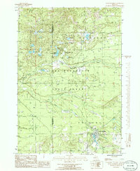
 1985 Jacks Landing1986 Print · USGSGrand Traverse County in the mid-eighties shows a landscape of dense state forests and glacial lakes shaped by the Boardman River. Local historians can trace early recreational footprints at Jacks Landing, the Muncie Lakes complex, and along the banks of Brown Bridge Pond.2 unique versions available
 - 1985 Map of South Boardman, 1986 Print
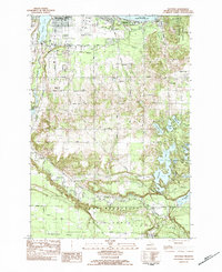
 1985 South Boardman1986 Print · USGSSouth Boardman and the surrounding Pere Marquette State Forest are documented here in the mid-eighties as a region defined by its complex river systems and glacial lakes. Researchers can locate the local Cem and Boardman Park, or trace the paths of the South Branch Boardman River and Taylor Creek.2 unique versions available
 - 1985 Map of Fife Lake, 1986 Print
 1985 Fife Lake1986 Print · USGSThe Fife Lake region in the mid-1980s shows a landscape of glacial lakes and extensive timberlands managed by the Pere Marquette State Forest. Genealogists and local historians can trace the shoreline of Fife Lake, locate the community of Houseman, and follow the southern bend of the Manistee River.
 - 1989 Map of Traverse City, 1990 Print
 1989 Traverse City1990 Print · USGSNorthern Michigan’s lake-country and forest lands are captured in the late eighties as seasonal tourism and timber hubs expanded. Genealogists and historians can trace the routes of the Ann Arbor RR, the boundaries of Camp Grayling, and settlements like Elk Rapids and Manton.
End of results
Showing maps 1-20 of 20
Top cities of Grand Traverse County
- Garfield Township historical maps
- Traverse City historical maps
- East Bay Township historical maps
- Long Lake Township historical maps
- Blair Township historical maps
- Green Lake Township historical maps
See more
Frequently asked questions
- What are the different types of historical maps available for Grand Traverse County?
- What is the oldest map of Grand Traverse County?
- Where can I purchase historical maps of Grand Traverse County for my home or office?
- Where can I download high-res historical maps of Grand Traverse County?
- Are there historical topographic maps available for Grand Traverse County?
- Is there historical aerial imagery available for Grand Traverse County?
- Where are historical maps of Grand Traverse County sourced from?