2020s Maps of Traverse City, Michigan
Explore 4 historic maps of Traverse City from the 2020s. These maps offer a rare glimpse into what life looked like during the 2020s — showing old roads, neighborhoods, homes, and landmarks that have changed or disappeared over time.
Whether you're researching your family's past, planning a metal detecting trip, or studying how Traverse City's landscape evolved across the 2020s, these high-resolution maps are a powerful tool for exploring the history of this region.
- Focus on a specific era: All maps on this page are from the 2020s, giving you a focused view of this time period.
- See what’s changed: Compare century-old streets, trails, and buildings to today's modern landscape using overlays and satellite layers.
- Research with precision: Use these maps for genealogy, historical research, land use analysis, or educational projects.
- View, download, or print: Maps are fully viewable online in high resolution, and can be downloaded or printed for your own records.
Start exploring Traverse City's history through authentic maps from the 2020s. This is your window into the past.
Traverse City, MI maps
(4)- 2023 Map of Traverse City SE, 2023 Print
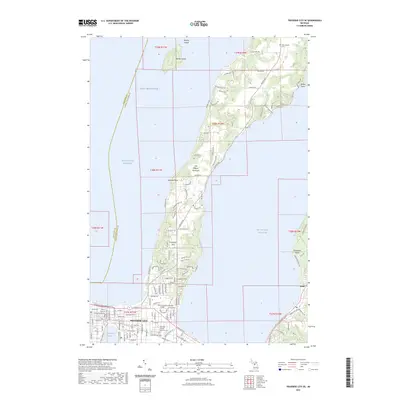 2023 Traverse City SE2023 Print · USGSTraverse City and the base of the Old Mission Peninsula are captured here in the early twenty-first century as the region's shoreline and urban core continue to evolve. Genealogists and researchers can locate Oakwood Cem, the historic Grand Traverse County Courthouse, and the campus of Northwestern Michigan College.
 - 2023 Map of Traverse City SW, 2023 Print
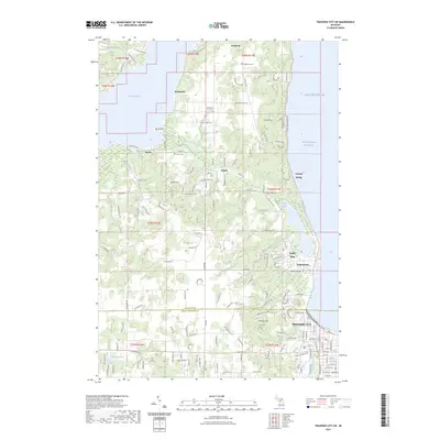 2023 Traverse City SW2023 Print · USGSThe Leelanau Peninsula shoreline meets the growing edge of TRAVERSE CITY in this detailed recent survey. Genealogists and local researchers can locate established burying grounds like Heimforth Cem and Bingham Cem or trace the drainage of Rice Creek and Cedar Creek toward the bay.
 - 2023 Map of Grawn, 2023 Print
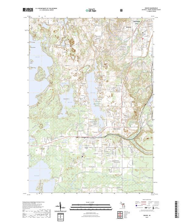 2023 Grawn2023 Print · USGSGrand Traverse County's lake-rich landscape south of Traverse City is shown here in the 2020s. Researchers can locate civic landmarks like Blair Town Hall and family sites near Maple Grove Cem or the community of Grawn.
 - 2023 Map of Mayfield, 2023 Print
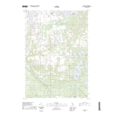 2023 Mayfield2023 Print · USGSGrand Traverse County is captured here in the early 2020s, showing the intersection of rural river valleys and northern Michigan urban expansion. Researchers can trace the Boardman River corridor from Mayfield past Arbutus Lake to the outskirts of Traverse City.
End of results
Showing maps 1-4 of 4
Top cities near Traverse City
- Garfield Township historical maps
- Garfield Charter Township historical maps
- East Bay Township historical maps
- East Bay Charter Township historical maps
- Long Lake Charter Township historical maps
- Long Lake Township historical maps
See more
Top neighborhoods of Traverse City
- Fernwood historical maps
- Base of Old Mission historical maps
- Indian Woods historical maps
- Oak Park historical maps
- Triangle Neighborhood historical maps
- Boardman Neighborhood historical maps
See more
Frequently asked questions
- What are the different types of historical maps available for Traverse City?
- What is the oldest map of Traverse City?
- Where can I purchase historical maps of Traverse City for my home or office?
- Where can I download high-res historical maps of Traverse City?
- Are there historical topographic maps available for Traverse City?
- Is there historical aerial imagery available for Traverse City?
- Where are historical maps of Traverse City sourced from?