1960s Maps of Pittsford Township, Michigan
Explore 4 historic maps of Pittsford Township from the 1960s. These maps offer a rare glimpse into what life looked like during the 1960s — showing old roads, neighborhoods, homes, and landmarks that have changed or disappeared over time.
Whether you're researching your family's past, planning a metal detecting trip, or studying how Pittsford Township's landscape evolved across the 1960s, these high-resolution maps are a powerful tool for exploring the history of this region.
- Focus on a specific era: All maps on this page are from the 1960s, giving you a focused view of this time period.
- See what’s changed: Compare century-old streets, trails, and buildings to today's modern landscape using overlays and satellite layers.
- Research with precision: Use these maps for genealogy, historical research, land use analysis, or educational projects.
- View, download, or print: Maps are fully viewable online in high resolution, and can be downloaded or printed for your own records.
Start exploring Pittsford Township's history through authentic maps from the 1960s. This is your window into the past.
Pittsford Township, MI maps
(4)- 1962 Map of Hudson, 1963 Print
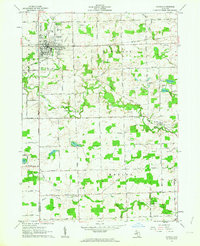 1962 Hudson1963 Print · USGSHudson and its surrounding townships thrive in the early sixties as a center of rail commerce and agriculture along the New York Central line. Genealogists and local historians can locate many family landmarks, from the Whitney Cem and Brown Cem to the early rural settlements of Medina and Prattville.3 unique versions available
 - 1962 Map of Pittsford, 1963 Print
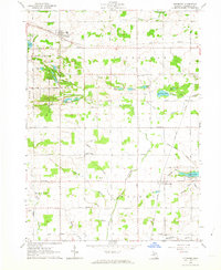 1962 Pittsford1963 Print · USGSHillsdale County agriculture and small-town life are preserved here in the early sixties, centered on the New York Central rail line. Local researchers can trace family roots through landmarks like Leonardson Cem, South Pittsford Ch, and Prattville Sch.
 - 1962 Map of Wheatland, 1963 Print
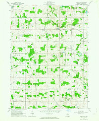 1962 Wheatland1963 Print · USGSHillsdale County was a patchwork of small family farms and rural crossroads in the early sixties. Genealogists and local historians can trace family roots through landmarks like Fowler Cem, Churchs Corners, and the New York Central Railroad.2 unique versions available
 - 1962 Map of Addison, 1984 Print
 1962 Addison1984 Print · USGSIn the early 1960s, this area of Lenawee County featured a blend of rural agriculture and lakeside recreation. Researchers can find old family cemeteries like Addison Cem and Hand-Hillside Cem, or trace the path of the old railroad grade near the Addison Millpond.
End of results
Showing maps 1-4 of 4
Top cities near Pittsford Township
- Hillsdale historical maps
- Somerset historical maps
- Rollin Township historical maps
- Rollin historical maps
- Hudson historical maps
- Morenci historical maps
See more
Top neighborhoods of Pittsford Township
Frequently asked questions
- What are the different types of historical maps available for Pittsford Township?
- What is the oldest map of Pittsford Township?
- Where can I purchase historical maps of Pittsford Township for my home or office?
- Where can I download high-res historical maps of Pittsford Township?
- Are there historical topographic maps available for Pittsford Township?
- Is there historical aerial imagery available for Pittsford Township?
- Where are historical maps of Pittsford Township sourced from?