Old Maps of Hazel, Laird Township for Genealogy
Trace your family roots with 13 historic maps of Hazel. These high-res maps reveal old neighborhoods, homesites, landmarks, and streets — helping you uncover where your ancestors lived and how the area evolved over time.
- Explore historic neighborhoods: Identify where your relatives may have lived in the 1800s or 1900s.
- Compare maps over time: Trace the changes in streets, buildings, and landmarks for multi-generational research.
- Perfect for genealogy & ancestry research: Used by family historians and researchers to map out lineage and migration.
These maps are an incredible resource for exploring your personal connection to Hazel's past.
Hazel, Laird Township maps
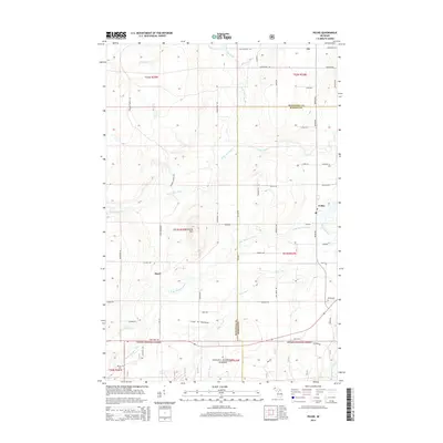
(13)- 1954 Map of Pelkie, 1956 Print
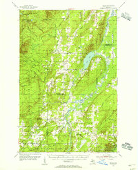 1954 Pelkie1956 Print · USGSThe Baraga County backcountry and Finnish farming settlements of the mid-1950s are preserved here in striking detail. Researchers can trace family roots through sites like Elo Cem and Pelkie Cem or locate old community landmarks like Limestone Mountain.3 unique versions available
 - 1958 Map of Iron River, 1968 Print
 1958 Iron River1968 Print · USGSThe Upper Peninsula in the late fifties is captured here as a landscape of timber, iron, and rail. Genealogists and historians can trace rail stops like Mass Station or explore the coastlines of Lake Gogebic and Keweenaw Bay.3 unique versions available
 - 1960 Map of Iron River
 1960 Iron River1960 Print · USGSThe Upper Peninsula’s western reaches are shown in the late fifties, featuring the industrial infrastructure of the Copper Country and the vast Ottawa National Forest. Researchers can trace the rail lines of the Milwaukee Road through settlements like Bruce Crossing and the White Pine Mine.
 - 1961 Map of Iron River
 1961 Iron River1961 Print · USGSThe Upper Peninsula and northern Wisconsin are shown here in the early 1960s, a landscape defined by the iron range and vast timberlands. Researchers can trace the legacy of mining and rail transport through Caspian, the Lac Du Flambeau Indian Reservation, and the Milwaukee Road.
 - 1967 Map of Iron River, 1968 Print
 1967 Iron River1968 Print · USGSThe Upper Peninsula and northern Wisconsin borderlands are shown here in the late sixties, a landscape of deep woods and iron-country rail lines. Genealogists and historians can trace the lakeside settlements of L'Anse and Ontonagon or follow the Soo Line through towns like Michigamme and Nestoria.
 - 1985 Map of Pelkie
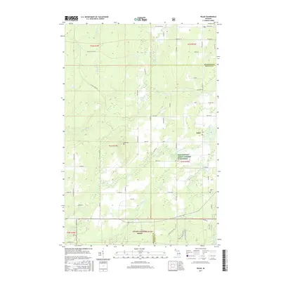
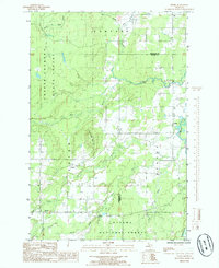 1985 Pelkie1985 Print · USGSUpper Peninsula life in the mid-1980s is captured here as small communities like Pelkie and Alston thrive near the confluence of the Sturgeon River. Researchers can trace old routes like the West Grade or locate landmarks like Limestone Mountain.
 - 1991 Map of L'Anse
 1991 L'Anse1991 Print · USGSUpper Peninsula life in the early nineties centered on the waters of Keweenaw Bay and the timber-rich highlands of the Huron Mountains. Genealogists and researchers can trace the rail-and-road connections between L'Anse, Baraga, and smaller communities like Pequaming and Assinins.2 unique versions available
 - 1999 Map of Pelkie, 2004 Print
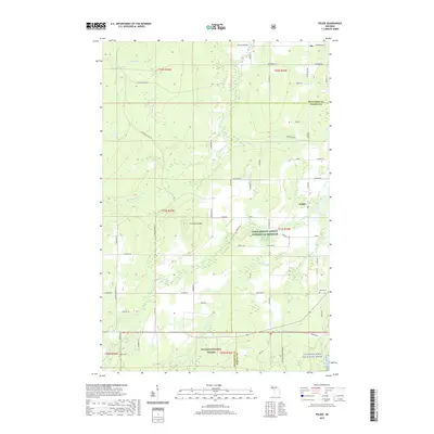
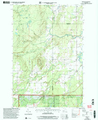 1999 Pelkie2004 Print · USGSUpper Peninsula timber country and river valleys are captured here at the close of the century, near the Baraga and Houghton county line. Researchers can locate the rural crossroads of Pelkie, Hazel, and Alston or trace the drainage of the Otter River and Sturgeon River.
 - 2011 Map of Pelkie, 2011 Print
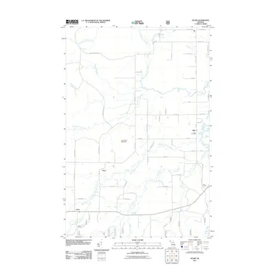 2011 Pelkie2011 Print · USGSCovers Hazel, including Baraga Township, Pelkie, and other nearby areas
 - 2014 Map of Pelkie, 2014 Print
 2014 Pelkie2014 Print · USGSCovers Hazel, including Baraga Township, Pelkie, and other nearby areas
 - 2017 Map of Pelkie, 2017 Print
 2017 Pelkie2017 Print · USGSCovers Hazel, including Baraga Township, Pelkie, and other nearby areas
 - 2019 Map of Pelkie, 2019 Print
 2019 Pelkie2019 Print · USGSCovers Hazel, including Baraga Township, Pelkie, and other nearby areas
 - 2023 Map of Pelkie, 2023 Print
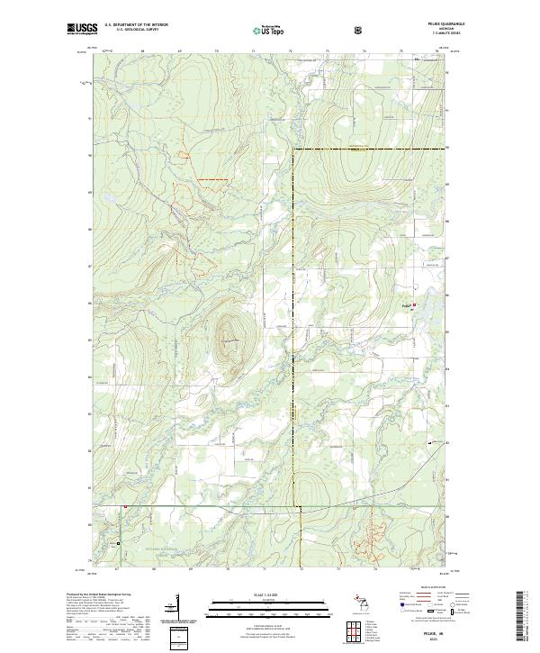 2023 Pelkie2023 Print · USGSThe Upper Peninsula settlements of Pelkie, Elo, and Alston are captured in the 2020s as they bridge their timber and farming roots. Researchers can trace family history at Pelkie Cem or explore the wooded slopes of Limestone Mtn.
End of results
Showing maps 1-13 of 13
Top cities near Hazel
Frequently asked questions
- What are the different types of historical maps available for Hazel?
- What is the oldest map of Hazel?
- Where can I purchase historical maps of Hazel for my home or office?
- Where can I download high-res historical maps of Hazel?
- Are there historical topographic maps available for Hazel?
- Is there historical aerial imagery available for Hazel?
- Where are historical maps of Hazel sourced from?