Old Maps of Schoolcraft Township, Michigan for Metal Detecting
Plan your next treasure hunt with 44 historic maps of Schoolcraft Township. Find old homesites, ghost towns, trails, and gathering spots that may be lost to time — perfect for identifying promising metal detecting locations.
- Locate forgotten sites: Uncover places like long-lost settlements, abandoned rail lines, or gathering spots.
- Plan better hunts: Use map overlays combined with LiDAR or satellite views to narrow in on historically rich areas.
- Made for detectorists: Thousands of hobbyists use these maps to discover relics, coins, and hidden history.
Use these historic maps to boost your research and find new opportunities beneath the surface of Schoolcraft Township.
Schoolcraft Township, MI maps
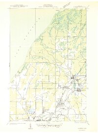
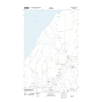
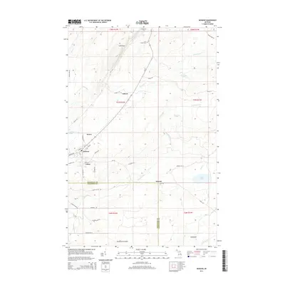
(44)- 1938 Map of Gay
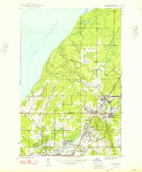
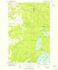
 1938 Gay1938 Print · USGSThe eastern Keweenaw shoreline comes to life in the late 1930s as a landscape of timber and copper transit. Genealogists can locate the footprint of Gay and Traverse Bay while tracing the winding paths of the Tobacco River and Copper Range Highway No 562.
 - 1941 Map of Ahmeek
 1941 Ahmeek1941 Print · USGSThe Keweenaw copper district thrived in the early 1940s, when mining towns were connected by a dense web of steam rail. Genealogists and historians can trace the foundations of Allouez, Wolverine, and the Ahmeek Mine as they stood before mid-century changes.
 - 1941 Map of Mohawk
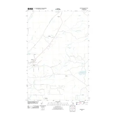
 1941 Mohawk1941 Print · USGSThe Keweenaw Peninsula's copper country comes into focus just before World War II, showing a landscape shaped by mining and rail. Researchers can trace the industrial corridor from Mohawk to Hebards via the Keweenaw Central Railroad and find the Gratiot Mine.
 - 1946 Map of Mohawk, 1967 Print
 1946 Mohawk1967 Print · USGSThe copper country of the Keweenaw Peninsula is captured here in the mid-1940s as mining and rail operations defined the local economy. Genealogists and industrial historians can trace the footprint of the Gratiot Mine, the Calumet and Hecla RR, and company towns like Mohawk and Fulton.3 unique versions available
 - 1946 Map of Ahmeek, 1971 Print
 1946 Ahmeek1971 Print · USGSThe Keweenaw copper district comes alive in the 1940s, showing the dense network of mining locations and company towns. Trace the industrial operations of the Ahmeek Mine and Red Jacket Mine alongside settlements like Bumbletown and Copper City.3 unique versions available
 - 1946 Map of Laurium, 1974 Print
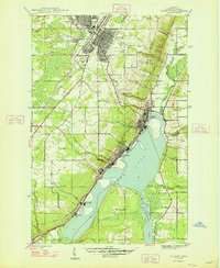
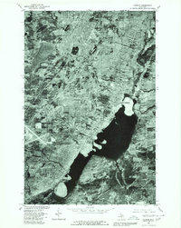
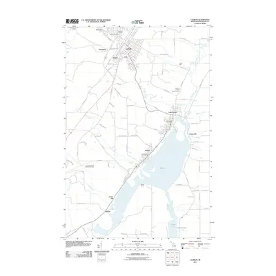
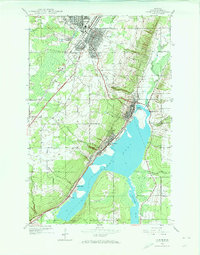 1946 Laurium1974 Print · USGSThe Michigan Copper Country comes into sharp focus during the late 1940s, highlighting the industrial shoreline of Torch Lake. Genealogists and historians can trace the rail networks of the Mineral Range Railroad and locate vanished local landmarks like Quincy Mill and Osceola Sch.2 unique versions available
 - 1947 Map of Ahmeek
 1947 Ahmeek1947 Print · USGSKeweenaw's Copper Country is seen here at a post-war peak of industrial settlement and mining activity. Researchers can trace the extensive Calumet and Hecla rail network and locate historic sites like Ahmeek Mine and Centennial Heights.2 unique versions available
 - 1948 Map of Laurium
 1948 Laurium1948 Print · USGSThe Michigan Copper Country is frozen in time during the late 1940s, showing the heavy industrial footprint of the Keweenaw Peninsula. Genealogists can trace family footprints from Calumet to Lake Linden, locating old schools like Osceola Sch and the lakeside Quincy Mill.2 unique versions available
 - 1948 Map of Mohawk
 1948 Mohawk1948 Print · USGSCopper mining and rail transport dominate the Keweenaw Peninsula in the late 1940s as industry follows the mineral-rich ridges. Genealogists and historians can trace the street grids of Mohawk and Fulton or locate industrial sites like the Gratiot Mine and the Hecla and Torch Lake RR.2 unique versions available
 - 1954 Map of Gay, 1955 Print
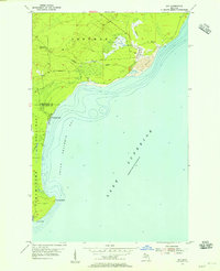 1954 Gay1955 Print · USGSCoastal Keweenaw County comes to life in the mid-fifties, showing the industrial interface between the copper mines and the Great Lakes. Trace the massive Tailings deposits at Gay and the transport path of the Copper Range along the shore.3 unique versions available
 - 1954 Map of Rice Lake, 1955 Print
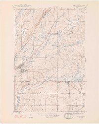
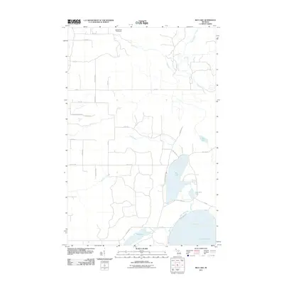
 1954 Rice Lake1955 Print · USGSThe Keweenaw Peninsula’s watery interior comes into focus in the mid-fifties, showing the rugged lake-and-creek systems of the northern Copper Country. You can trace the shoreline of Little Traverse Bay or locate the site of Minnetonka Camp near Rice Lake.4 unique versions available
 - 1958 Map of Hancock, 1967 Print
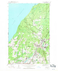
 1958 Hancock1967 Print · USGSThe Keweenaw Peninsula and Isle Royale are seen here during the mid-twentieth century as mining and maritime hubs. Trace the dense town layouts of Hancock and Calumet, or locate remote coastal markers like the Eagle Harbor Lighthouse and Rock of Ages Light.2 unique versions available
 - 1960 Map of Hancock
 1960 Hancock1960 Print · USGSThe Keweenaw Peninsula and Isle Royale are captured in detail during the late 1950s. Researchers can trace copper-mining era settlements like Calumet and Laurium, or locate remote maritime landmarks such as the Isle Royale Lighthouse.
 - 1961 Map of Hancock
 1961 Hancock1961 Print · USGSThe Keweenaw Peninsula and Isle Royale are shown here at the start of the 1960s, featuring the region's historic copper mining and maritime infrastructure. Genealogists and researchers can trace local families through settlements like Atlantic Mine and Painesdale, or locate remote landmarks including Rock of Ages Light and Eagle Harbor.
 - 1966 Map of Hancock, 1987 Print
 1966 Hancock1987 Print · USGSThe Keweenaw Peninsula and Isle Royale are captured in the mid-1960s during a pivotal era for Michigan’s Copper Country. Trace the industrial footprint of the SOO LINE through Calumet or locate historic maritime landmarks like Fort Wilkins and Rock of Ages Light.
 - 1978 Map of Mohawk
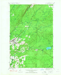
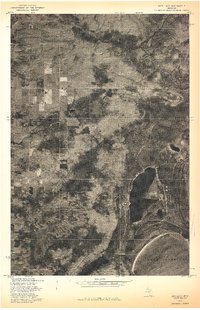
 1978 Mohawk1978 Print · USGSUpper Peninsula mining history comes into focus in the late 1970s as aerial photography reveals the layout of these Keweenaw copper country towns. Genealogists and historians can trace the clearings and homes around Mohawk and Fulton in their late twentieth-century context.
 - 1978 Map of Rice Lake
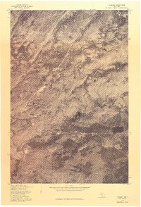
 1978 Rice Lake1978 Print · USGSThe Keweenaw Peninsula shoreline meets the deep woods of Houghton County in the late seventies. Researchers can study the unmapped timber and wetland patterns around Rice Lake and the Lake Superior coast.
 - 1978 Map of Laurium, 1980 Print
 1978 Laurium1980 Print · USGSThe Keweenaw Peninsula’s copper-mining heartland is seen in detail during the late 1970s, from the upland streets of Calumet to the industrial shores of Torch Lake. Genealogists and historians can trace the property lines and neighborhoods of Laurium, Lake Linden, and the lakeside community of Mason.
 - 1985 Map of Hancock
 1985 Hancock1985 Print · USGSThe Keweenaw Peninsula in the mid-1980s reveals a landscape shaped by copper and the Great Lakes. You can trace the industrial legacy of the region through the Quincy Mine, the Old RR Grade, and old cemeteries like Forest Hill Cem.3 unique versions available
 - 2011 Map of Ahmeek, 2011 Print
 2011 Ahmeek2011 Print · USGSCovers Schoolcraft Township, including Allouez, Calumet, and other nearby areas
 - 2011 Map of Mohawk, 2011 Print
 2011 Mohawk2011 Print · USGSCovers Schoolcraft Township, including Fulton, Traverse, and other nearby areas
 - 2011 Map of Laurium, 2011 Print
 2011 Laurium2011 Print · USGSCovers Schoolcraft Township, including Laurium, Osceola, and other nearby areas
 - 2011 Map of Rice Lake, 2011 Print
 2011 Rice Lake2011 Print · USGSCovers Schoolcraft Township, including Torch Lake Township, Sherman Township, and other nearby areas
 - 2011 Map of Gay, 2011 Print
 2011 Gay2011 Print · USGSCovers Schoolcraft Township, including Torch Lake Township, Traverse Bay, and other nearby areas
 - 2014 Map of Mohawk, 2014 Print
 2014 Mohawk2014 Print · USGSCovers Schoolcraft Township, including Fulton, Traverse, and other nearby areas
Showing maps 1-25 of 44
Top cities near Schoolcraft Township
- Houghton historical maps
- Laurium historical maps
- Osceola historical maps
- Chassell historical maps
- Allouez historical maps
- Lake Linden historical maps
See more
Top neighborhoods of Schoolcraft Township
- Rice Lake historical maps
- Gregoryville historical maps
- Traverse Bay historical maps
- Lake Linden historical maps
Frequently asked questions
- What are the different types of historical maps available for Schoolcraft Township?
- What is the oldest map of Schoolcraft Township?
- Where can I purchase historical maps of Schoolcraft Township for my home or office?
- Where can I download high-res historical maps of Schoolcraft Township?
- Are there historical topographic maps available for Schoolcraft Township?
- Is there historical aerial imagery available for Schoolcraft Township?
- Where are historical maps of Schoolcraft Township sourced from?