2020s Maps of Keene Township, Michigan
Explore 4 historic maps of Keene Township from the 2020s. These maps offer a rare glimpse into what life looked like during the 2020s — showing old roads, neighborhoods, homes, and landmarks that have changed or disappeared over time.
Whether you're researching your family's past, planning a metal detecting trip, or studying how Keene Township's landscape evolved across the 2020s, these high-resolution maps are a powerful tool for exploring the history of this region.
- Focus on a specific era: All maps on this page are from the 2020s, giving you a focused view of this time period.
- See what’s changed: Compare century-old streets, trails, and buildings to today's modern landscape using overlays and satellite layers.
- Research with precision: Use these maps for genealogy, historical research, land use analysis, or educational projects.
- View, download, or print: Maps are fully viewable online in high resolution, and can be downloaded or printed for your own records.
Start exploring Keene Township's history through authentic maps from the 2020s. This is your window into the past.
Keene Township, MI maps
(4)- 2023 Map of Saranac, 2023 Print
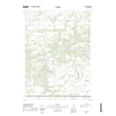 2023 Saranac2023 Print · USGSSaranac and the surrounding Ionia County farmland are shown in this contemporary study of the Grand River valley. Trace local roots at Saranac Cem and White Cem, or explore the rural landscape around Berlin Center and Sessions Lake.
 - 2023 Map of Smyrna, 2023 Print
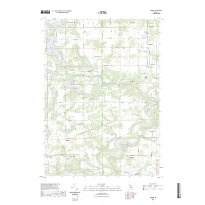 2023 Smyrna2023 Print · USGSThe river valleys of Ionia and Kent counties are captured here in the early twenty-first century, showing a landscape of small towns and inland lakes. Researchers can trace local heritage through numerous sites like Smyrna Cemetery, Moseley, and the Boulder Canyon Airport.
 - 2023 Map of Belding, 2023 Print
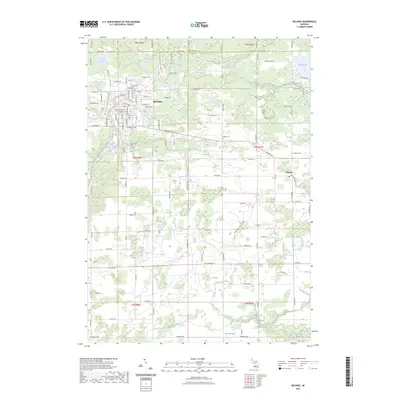 2023 Belding2023 Print · USGSBelding and its surrounding townships are shown here at the start of the 2020s, centered on the winding Flat River. Researchers can trace local heritage through several burial sites like Old Belding Cem and find the small settlement of Orleans.
 - 2023 Map of Lowell, 2023 Print
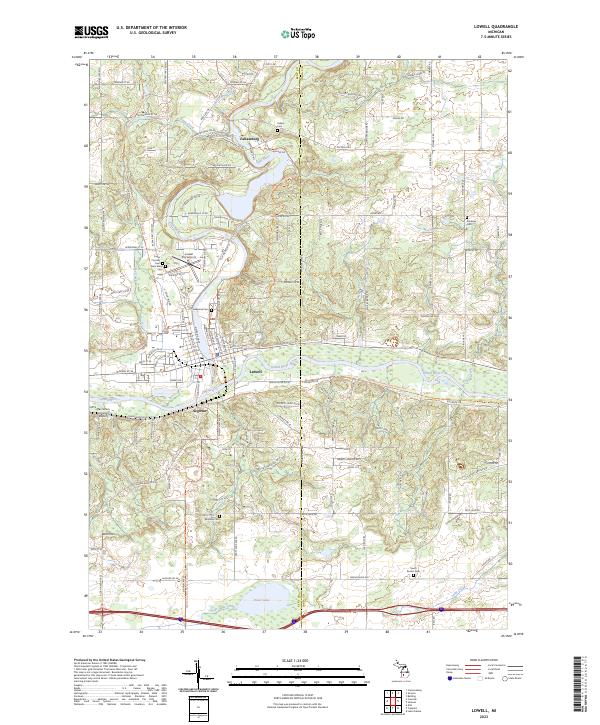 2023 Lowell2023 Print · USGSThe riverfront town of Lowell and the nearby hamlet of Fallassburg are captured at the confluence of the Grand River and Flat River in the early 2020s. Genealogists can trace local roots through several burial grounds, including McBride Cemetery and Oakwood Cemetery.
End of results
Showing maps 1-4 of 4
Top cities near Keene Township
- Cascade Charter Township historical maps
- Ada Township historical maps
- Cannon Township historical maps
- Ionia historical maps
- Greenville historical maps
- Lowell Charter Township historical maps
See more
Frequently asked questions
- What are the different types of historical maps available for Keene Township?
- What is the oldest map of Keene Township?
- Where can I purchase historical maps of Keene Township for my home or office?
- Where can I download high-res historical maps of Keene Township?
- Are there historical topographic maps available for Keene Township?
- Is there historical aerial imagery available for Keene Township?
- Where are historical maps of Keene Township sourced from?