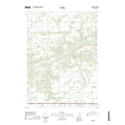
2023 Map of Saranac
USGS Topo · Published 2023About this map
The Grand River snakes through the heart of this Ionia County landscape, serving as the central topographical anchor for the village of Saranac. This modern survey reveals a community defined by its watercourses and a mesh of rural road networks, where the river valley is framed by Toles Creek, Red Creek, and Lake Creek. The settlement pattern shows a shift from the concentrated village center to the outlying crossroads at Berlin Center, illustrating the persistent agricultural and residential balance of the region.
Find a feature on this map
80 named features on this map. Tap any name to fly to it.
Don’t see what you’re looking for? This feature index may not catch every label — zoom into the map to look around manually.
Map Details
Editions of this 2023 Saranac Map
This is the sole edition of this map. No revisions or reprints were ever made.
Other maps of this area

1916 · Ionia
USGS Topo · 1:62,500

1918 · Ionia
USGS Topo · 1:62,500

1918 · Lowell
USGS Topo · 1:62,500

1943 · Ionia
USGS Topo · 1:62,500

1943 · Lowell
USGS Topo · 1:62,500

1954 · Midland
USGS Topo · 1:250,000

1958 · Midland
USGS Topo · 1:250,000

1958 · Grand Rapids
USGS Topo · 1:250,000

1959 · Midland
USGS Topo · 1:250,000

1961 · Grand Rapids
USGS Topo · 1:250,000