1958 Map of Midland
USGS Topo · Published 1958About this map
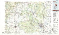
Midland and Mount Pleasant anchor this mid-century survey of Central Michigan, a landscape shaped by the convergence of heavy timber heritage and the rise of the energy and education sectors. The map documents the extensive river systems that once drove the logging era, including the Muskegon River and Tittabawassee River, now surrounded by a mature grid of agricultural lands and emerging college towns like those housing Central Michigan University and Ferris State University.
Find a feature on this map
469 named features on this map. Tap any name to fly to it.
Don’t see what you’re looking for? This feature index may not catch every label — zoom into the map to look around manually.
Map Details
Editions of this 1958 Midland Map
This is the sole edition of this map. No revisions or reprints were ever made.
Historical Maps of Grand Rapids Through Time
5 maps found