Old Maps of Mastodon Township, Michigan
Explore 70 old maps of Mastodon Township, spanning from 1899 to today. These high-resolution historic maps reveal how streets, neighborhoods, landmarks, and natural features evolved over time — perfect for genealogy, metal detecting, research, and local history exploration.
What you can do with these maps:
- See how Mastodon Township changed over time: Compare historical maps to modern-day views to trace roads, homesites, rail lines & more.
- View detailed metadata: Each map includes creators, publishers, year, scale, and archive source.
- Overlay maps with satellite & LiDAR: Visualize the past alongside modern tools to explore terrain & human change.
- Trusted historical sources: Maps sourced from the USGS, Library of Congress, and other archives.
- Access maps your way: View online, download high-res files, or order prints for personal or research use.
Start exploring old maps of Mastodon Township to uncover forgotten places, hidden landmarks, and the deep history beneath your feet.
Mastodon Township, MI maps
(70)- 1899 Map of Sagola
 1899 Sagola1899 Print · USGSIron and Dickinson counties were defined by the expansion of the rail-and-river economy in the late nineteenth century. Genealogists and historians can trace the early layouts of Channing, Sagola, and Mansfield alongside the winding Michigamme River.3 unique versions available
 - 1899 Map of Crystal Falls
 1899 Crystal Falls1899 Print · USGSIron County mining and timber operations are at their peak at the close of the century. Genealogists and industrial historians can trace early rail spurs to the Mastodon Mine, Shafer Mine, and the developing town of Crystal Falls.2 unique versions available
 - 1939 Map of Iron Mountain, 1963 Print
 1939 Iron Mountain1963 Print · USGSThe Menominee River borderlands at the end of the 1930s show a landscape of hydroelectric power and deep-woods settlements. Genealogists and historians can trace rural school districts like Golden Rule Sch and early industrial sites such as the Henry Ford Dam.
 - 1941 Map of Florence
 1941 Florence1941 Print · USGSFlorence and the surrounding lake country appear in this early 1940s survey just as modern highways began to bypass the old rail corridors. Local researchers can trace rural schoolhouse locations like Fern Sch and landmarks like the Rainbow Firetower.
 - 1941 Map of Iron Mountain
 1941 Iron Mountain1941 Print · USGSThe Menominee River borderlands thrive with hydroelectric power and iron mining during the late thirties. Genealogists can trace family footprints at Woodlawn Cem or find early rural schoolhouses like Golden Rule Sch and Hauserman Sch.
 - 1944 Map of Crystal Falls, 1956 Print
 1944 Crystal Falls1956 Print · USGSIron County mining settlements and railroads are captured in this mid-century survey of the Upper Peninsula. Genealogists can trace family connections to industrial sites like Tobin Mine and company housing at Shafer Location or Western Location.
 - 1944 Map of Fortune Lakes, 1958 Print
 1944 Fortune Lakes1958 Print · USGSIron County, Michigan, was a landscape of remote timber and rail-bound mining settlements during the mid-1940s. Genealogists and historians can trace the residents of Alpha and Pentoga or locate the specialized mining outposts at Dunn Location and New Bridge Location.2 unique versions available
 - 1946 Map of Crystal Falls
 1946 Crystal Falls1946 Print · USGSMining locations and rail lines dominate the Iron County landscape during the mid-forties. Genealogists and historians can trace the specific neighborhoods of Western Location and Odgers Location or locate the industrial footprints of the Shafer Mine and Tobin Mine.2 unique versions available
 - 1946 Map of Fortune Lakes
 1946 Fortune Lakes1946 Print · USGSIron County's lake country is captured here just after the war, showing the intersection of industrial mining life and growing public recreation. Researchers can trace old rail lines and worker settlements like New Bristol Location and Dunn Location near Bewabic Park.2 unique versions available
 - 1947 Map of Naults
 1947 Naults1947 Print · USGSThe Brule River borderland was a remote frontier of rail and timber in the late 1940s. Genealogists and historians can trace the settlement at Naults and the route of the Chicago and Northwestern railroad through the Mastodon area.
 - 1947 Map of Iron Mountain
 1947 Iron Mountain1947 Print · USGSAs the post-war industrial era took hold, this borderland map reveals a landscape of hydroelectric dams and iron-town settlements along the Menominee River. Genealogists and local historians can locate several rural schoolhouses, including Golden Rule Sch and Roach Sch, and trace the path of the Chicago and Northwestern Railroad.
 - 1947 Map of Stager
 1947 Stager1947 Print · USGSThe Brule River forms the state boundary in the late 1940s, marking a landscape of wild waterways and essential rail lines. Trace the local rail history at Stager or explore the rugged river bends of the Brule River and the Horse Race Rapids.
 - 1947 Map of Lake Mary
 1947 Lake Mary1947 Print · USGSIron County, Michigan, is shown here shortly after the war, where the industrial legacy of the Northwoods meets its sprawling river system. Researchers can trace the Old Railroad Grade past Mansfield or locate School No 2 near the banks of the Michigan River.2 unique versions available
 - 1949 Map of Commonwealth
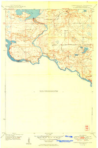 1949 Commonwealth1949 Print · USGSThe riverine border between Wisconsin and Michigan is captured here just after the war, showing a landscape of hydroelectric power and state forestry. Researchers can trace the Brule Island Dam and locate the rural South Mastodon Sch near Peavy Pond.
 - 1954 Map of Iron Mountain, 1964 Print
 1954 Iron Mountain1964 Print · USGSUpper Michigan and Northeastern Wisconsin are shown in detail during the mid-fifties, when the logging and mining economies still moved by rail. Trace the rail lines of the Soo Line to remote stops like Koepenick Station or explore the Iron Range near Iron Mountain.2 unique versions available
 - 1955 Map of Randville, 1957 Print
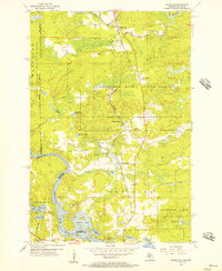 1955 Randville1957 Print · USGSThe Michigan-Wisconsin borderlands come alive in the mid-1950s as the rail-and-timber economy defines the landscape. Trace the Milwaukee Road through settlements like Randville and Merriman or locate early lakeside landmarks near Badwater Lake.3 unique versions available
 - 1956 Map of Sagola, 1957 Print
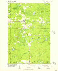 1956 Sagola1957 Print · USGSThe settlement of Sagola stands as a mid-century logging and rail crossroads in the Upper Peninsula. Trace the route of the Chicago Milwaukee St Paul and Pacific railroad through the Sturgeon River State Forest past Tobey Lake and the local Lookout Tower.
 - 1956 Map of Sagola, 1957 Print
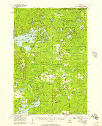 1956 Sagola1957 Print · USGSUpper Peninsula timber and rail history converge in the mid-fifties at the junction of the Chicago and North Western Railway. Trace the footprints of logging and mining settlements at Channing, Mansfield Location, and the McMillan Camp.
 - 1956 Map of Lake Mary, 1957 Print
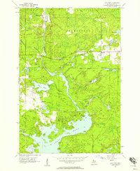 1956 Lake Mary1957 Print · USGSIron County's timber and river lands are captured here in the mid-fifties, just as the region's industrial footprint was evolving. Genealogists and historians can trace the Railroad Grade near Mansfield and locate the historic Mansfield Location.3 unique versions available
 - 1958 Map of Iron River, 1968 Print
 1958 Iron River1968 Print · USGSThe Upper Peninsula in the late fifties is captured here as a landscape of timber, iron, and rail. Genealogists and historians can trace rail stops like Mass Station or explore the coastlines of Lake Gogebic and Keweenaw Bay.3 unique versions available
 - 1959 Map of Iron Mountain
 1959 Iron Mountain1959 Print · USGSThe northwoods of Wisconsin and the Michigan border are captured here in the mid-fifties, showing a landscape defined by timber, water, and rail. Researchers can trace historic junctions like Hiles Junction, the expansive Nicolet National Forest, and lakefront settlements from Rhinelander to Tomahawk.2 unique versions available
 - 1960 Map of Iron River
 1960 Iron River1960 Print · USGSThe Upper Peninsula’s western reaches are shown in the late fifties, featuring the industrial infrastructure of the Copper Country and the vast Ottawa National Forest. Researchers can trace the rail lines of the Milwaukee Road through settlements like Bruce Crossing and the White Pine Mine.
 - 1961 Map of Iron River
 1961 Iron River1961 Print · USGSThe Upper Peninsula and northern Wisconsin are shown here in the early 1960s, a landscape defined by the iron range and vast timberlands. Researchers can trace the legacy of mining and rail transport through Caspian, the Lac Du Flambeau Indian Reservation, and the Milwaukee Road.
 - 1962 Map of Florence West, 1964 Print
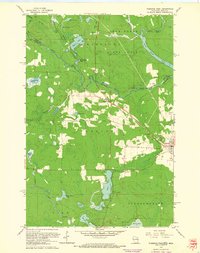 1962 Florence West1964 Print · USGSThe Wisconsin-Michigan borderlands come alive in this early 1960s survey of the iron-rich Northwoods. You can trace the Chicago and North Western rail line past old Mines and settlements like Tyran or Ridgetop.2 unique versions available
 - 1962 Map of Florence East, 1964 Print
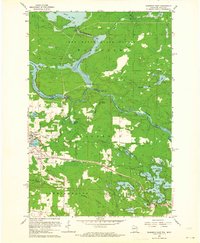 1962 Florence East1964 Print · USGSFlorence and the surrounding iron range townships appear at a peak of industrial activity in the early sixties. Trace the Chicago and North Western rail lines serving the Mines and the Hematite and Commonwealth settlements.
Showing maps 1-25 of 70
Top cities near Mastodon Township
- Iron Mountain historical maps
- Kingsford historical maps
- Crystal Falls historical maps
- Aurora historical maps
- Mastodon historical maps
- Florence historical maps
See more
Top neighborhoods of Mastodon Township
- Stager historical maps
- Dunn Location historical maps
- Naults historical maps
- Panola historical maps
- Mastodon historical maps
- Alpha historical maps
Frequently asked questions
- What are the different types of historical maps available for Mastodon Township?
- What is the oldest map of Mastodon Township?
- Where can I purchase historical maps of Mastodon Township for my home or office?
- Where can I download high-res historical maps of Mastodon Township?
- Are there historical topographic maps available for Mastodon Township?
- Is there historical aerial imagery available for Mastodon Township?
- Where are historical maps of Mastodon Township sourced from?