
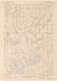
1947 Map of Lake Mary
USGS Topo · Published 1947About this map
Mansfield Location and the nearby settlement of Mansfield anchor this 1947 survey of Iron County, Michigan. The landscape is defined by the winding course of the Michigan River, which feeds into the expansive Peavy Pond to the south. This era shows a transition in land use, as an Old Railroad Grade cuts across the northern section, marking the legacy of earlier industrial transit through the timber and mining country.
Find a feature on this map
24 named features on this map. Tap any name to fly to it.
Don’t see what you’re looking for? This feature index may not catch every label — zoom into the map to look around manually.
Map Details
Editions of this 1947 Lake Mary Map
2 editions found
Other maps of this area

1899 · Sagola
USGS Topo · 1:62,500

1899 · Crystal Falls
USGS Topo · 1:62,500

1939 · Iron Mountain
USGS Topo · 1:48,000

1941 · Florence
USGS Topo · 1:48,000

1941 · Iron Mountain
USGS Topo · 1:48,000

1944 · Crystal Falls
USGS Topo · 1:24,000

1945 · Kelso Junction
USGS Topo · 1:24,000

1946 · Crystal Falls
USGS Topo · 1:31,680

1947 · Iron Mountain
USGS Topo · 1:48,000

1947 · Stager
USGS Topo · 1:24,000