Old Maps of Jackson County, Michigan for Hiking & Exploration
Hike through history with 138 historic maps of Jackson County. Explore old trails, ghost towns, and forgotten backroads — perfect for outdoor adventurers and local explorers.
- Rediscover forgotten places: Map out old mining camps, roads, and footpaths that no longer exist on modern maps.
- Layer with modern tools: Combine with LiDAR or satellite views to plan hikes through historical terrain.
- Made for exploration: Popular among hikers, overlanders, and local history lovers.
Use these maps to find adventure and explore the hidden past of Jackson County.
Jackson County, MI maps
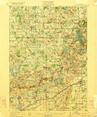
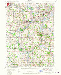
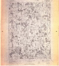
(138)- 1919 Map of Stockbridge, 1958 Print
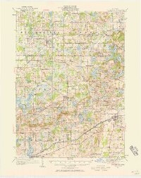 1919 Stockbridge1958 Print · USGSSouthern Michigan at the end of the Great War is a landscape of rural school districts and expanding rail lines. Genealogists and local historians can locate dozens of country schools like Stilson School, family-named landmarks such as Sackrider Hill, and the rail junction at Bullis Crossing.2 unique versions available
 - 1919 Map of Springport, 1958 Print
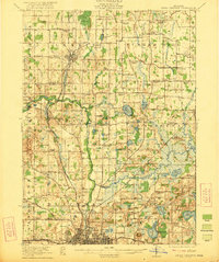
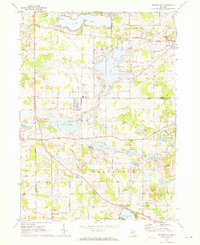
 1919 Springport1958 Print · USGSSouthern Michigan at the close of the Great War is a landscape of rural schoolhouses and historic turnpikes. Genealogists can locate family landmarks like Chapel Cemetery or trace the early paths of the Old Plank Road and Michigan Central Railroad.3 unique versions available
 - 1919 Map of Rives Junction, 1960 Print
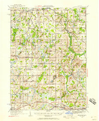
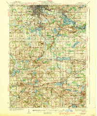
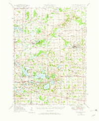
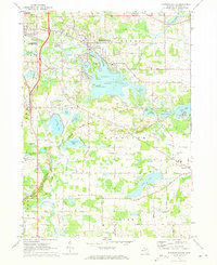
 1919 Rives Junction1960 Print · USGSThe rural landscapes of Ingham and Jackson Counties are captured here at the end of the Great War. Genealogists can trace family footprints across dozens of local school districts and settlements like Rives Junction, Bunker Hill Center, and Fitchburg.
 - 1921 Map of Rives Junction
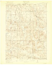
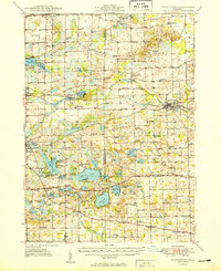
 1921 Rives Junction1921 Print · USGSJackson and its northern rural townships are captured in the early twenties, a time of small school districts and steam-powered rail travel. Genealogists can locate family landmarks such as Bunker Hill Chapel, the County Infirmary, and East Rives Cemetery.3 unique versions available
 - 1921 Map of Springport
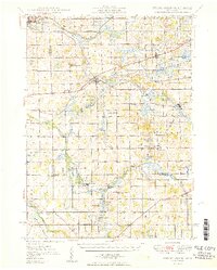
 1921 Springport1921 Print · USGSCentral Michigan's agricultural heartland at the end of the Great War reveals a landscape of dispersed farmsteads and numerous small school districts. Genealogists can trace family lands near Onondaga, Kinneville, and Chapel Cemetery, or locate vanished schoolhouses like Knight School and Fisk School.2 unique versions available
 - 1922 Map of Stockbridge
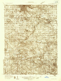
 1922 Stockbridge1922 Print · USGSSoutheastern Michigan at the start of the twenties is a land of rail-connected hamlets and countless country schools. Genealogists can trace family footprints near Stockbridge and Unadilla, or locate rural landmarks like Strobel School and Sylvan Sta.3 unique versions available
 - 1935 Map of Jackson
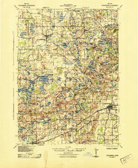
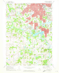
 1935 Jackson1935 Print · USGSThe rail and river networks of south-central Michigan are captured here in the mid-1930s as the area transitioned between agricultural roots and industrial growth. Genealogists can locate numerous country schools and landmarks like Putney Mill, Turkey Hall Sch, and Somerset Center.6 unique versions available
 - 1939 Map of Jackson
 1939 Jackson1939 Print · USGSJackson and its southern lake country are captured here in the late 1930s, showing a landscape of burgeoning settlements and vital rail lines. Researchers can trace the heritage of local school districts and rural crossroads like Cement City, Somerset Center, and the Turkey Hall Sch.4 unique versions available
 - 1942 Map of Stockbridge, 1943 Print
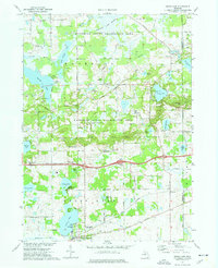
 1942 Stockbridge1943 Print · USGSSouth-central Michigan during the early Forties is revealed here as a landscape of interconnected rail towns and scattered country schoolhouses. Genealogists can locate family landmarks like Livermore School, Mausbach School, and the remote Bullis Crossing Cem near the Grand Trunk line.
 - 1948 Map of Spring Arbor, 1967 Print
 1948 Spring Arbor1967 Print · USGSJackson and Hillsdale counties are captured here just after the war, showing a rural landscape still defined by the Kalamazoo River and independent school districts. Genealogists can locate dozens of country schools like Humphrey Sch and old burial grounds such as Bath Mills Cem and Horton Cem.2 unique versions available
 - 1948 Map of Manchester, 1972 Print
 1948 Manchester1972 Print · USGSManchester and the Irish Hills region are shown here just after the war, when the New York Central rail line still connected these rural townships. Genealogists can trace dozens of local schoolhouses and churches, such as Sharon Hill Sch and North Sharon Ch.2 unique versions available
 - 1949 Map of Manchester
 1949 Manchester1949 Print · USGSSoutheast Michigan in the late 1940s reveals a patchwork of small-town centers and lakeside retreats connected by the New York Central rail line. Genealogists can trace family roots through dozens of local sites like Raymond Cem, Iron Creek Ch, and the McMahon Sch.3 unique versions available
 - 1949 Map of Spring Arbor
 1949 Spring Arbor1949 Print · USGSSouthern Michigan's rolling farm country and river valleys are captured here at the close of the 1940s. Genealogists can trace family names at the Bayn Cem or locate the many country schools like Snyder Sch and Humphrey Sch that served this community.2 unique versions available
 - 1958 Map of Grand Rapids, 1973 Print
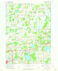
 1958 Grand Rapids1973 Print · USGSSouthern Michigan at the peak of the postwar era shows a landscape of burgeoning cities and new interstate highways. Trace family roots and regional growth in Grand Rapids, Battle Creek, and the glacial lake country around Gun Lake or Gull Lake.2 unique versions available
 - 1961 Map of Grand Rapids
 1961 Grand Rapids1961 Print · USGSSouthern Michigan at the dawn of the 1960s reveals a region shaped by major river systems and a robust rail network. Trace mid-century industrial growth and land use from Grand Rapids to the Fort Custer Military Reservation and Gun Lake.
 - 1962 Map of Grand Rapids
 1962 Grand Rapids1962 Print · USGSMid-century Southern Michigan is mapped here at a time of massive growth, showing the expanding urban footprints of Grand Rapids and Lansing. Researchers can trace the legacy of the Grand Trunk Western RR, find historic boundaries of the Fort Custer Military Reservation, or locate sporting camps around Gun Lake.2 unique versions available
 - 1970 Map of Munith, 1972 Print
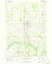
 1970 Munith1972 Print · USGSIngham and Jackson counties meet in this 1970s record of rural Michigan, showing the agricultural and lakeside communities before significant modern expansion. Genealogists can trace family footprints through historic burial grounds like Bunker Hill Cemetery and the rail-side settlement of Munith along the Grand Trunk Western line.3 unique versions available
 - 1970 Map of Gilletts Lake, 1973 Print
 1970 Gilletts Lake1973 Print · USGSJackson County's landscape east of the city is captured here in the early 1970s, showing a blend of institutional land and growing lakeside communities. Trace historic footprints at the State Prison Farm, Henrietta Station, and old family burial grounds like Coon Hill Cem.2 unique versions available
 - 1970 Map of Leslie, 1973 Print
 1970 Leslie1973 Print · USGSMid-Michigan's river-fed farm country is captured here during the early seventies, spanning the border of Ingham and Jackson Counties. Researchers can trace the Grand River through Berryville, locate family plots at Walker Cem, or follow the Old Penn Central Railroad north through Leslie.
 - 1970 Map of Jackson North, 1973 Print
 1970 Jackson North1973 Print · USGSJackson and its northern townships are shown in the early seventies as the city’s residential grid met the industrial rail lines. Genealogists can trace family sites like Draper Cem and Jones Cem or locate old schoolhouses like Parnall Sch.2 unique versions available
 - 1971 Map of Somerset Center, 1973 Print
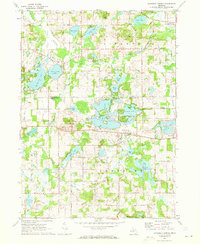 1971 Somerset Center1973 Print · USGSThe Jackson and Hillsdale county line in the early 1970s shows a landscape of small settlements and interconnected glacial lakes. Genealogists and local historians can locate Patch Cemetery, trace the Old Railroad Grade, and explore the village of Jerome.2 unique versions available
 - 1971 Map of Jackson South, 1973 Print
 1971 Jackson South1973 Print · USGSJackson and its southern suburbs were expanding during the early 1970s as new campus facilities and parks reshaped the landscape. Researchers can trace local heritage at St Johns Cemetery, Jackson Community College, and the old rail corridor of the Penn Central.3 unique versions available
 - 1971 Map of Cement City, 1973 Print
 1971 Cement City1973 Print · USGSThe Irish Hills region in the early seventies shows a community balanced between traditional rail-side industry and growing lakeside recreation. Trace family roots at Sanford Cem, locate the old Penn Central tracks, or find long-standing landmarks like St Rita Ch.2 unique versions available
 - 1971 Map of Michigan Center, 1973 Print
 1971 Michigan Center1973 Print · USGSJackson County’s lake country is captured here in the early seventies, showing the residential expansion around Michigan Center and Leoni. Genealogists and researchers can locate family sites near Roseland Memorial Gardens Cemetery, Ackerson Lake Sch, and the Penn Central rail corridor.
 - 1973 Map of Grass Lake, 1977 Print
 1973 Grass Lake1977 Print · USGSJackson County is shown in the early seventies, a landscape defined by the expansive glacial wetlands and lakes of the Waterloo State Recreation Area. Researchers can trace old family sites and rural landmarks like Mt Hope Cem, the Trist Millpond, and the settlement of Francisco.2 unique versions available
Showing maps 1-25 of 138
Top cities of Jackson County
Frequently asked questions
- What are the different types of historical maps available for Jackson County?
- What is the oldest map of Jackson County?
- Where can I purchase historical maps of Jackson County for my home or office?
- Where can I download high-res historical maps of Jackson County?
- Are there historical topographic maps available for Jackson County?
- Is there historical aerial imagery available for Jackson County?
- Where are historical maps of Jackson County sourced from?