2020s Maps of Charleston Township, Michigan
Explore 4 historic maps of Charleston Township from the 2020s. These maps offer a rare glimpse into what life looked like during the 2020s — showing old roads, neighborhoods, homes, and landmarks that have changed or disappeared over time.
Whether you're researching your family's past, planning a metal detecting trip, or studying how Charleston Township's landscape evolved across the 2020s, these high-resolution maps are a powerful tool for exploring the history of this region.
- Focus on a specific era: All maps on this page are from the 2020s, giving you a focused view of this time period.
- See what’s changed: Compare century-old streets, trails, and buildings to today's modern landscape using overlays and satellite layers.
- Research with precision: Use these maps for genealogy, historical research, land use analysis, or educational projects.
- View, download, or print: Maps are fully viewable online in high resolution, and can be downloaded or printed for your own records.
Start exploring Charleston Township's history through authentic maps from the 2020s. This is your window into the past.
Charleston Township, MI maps
(4)- 2023 Map of Adams Park, 2023 Print
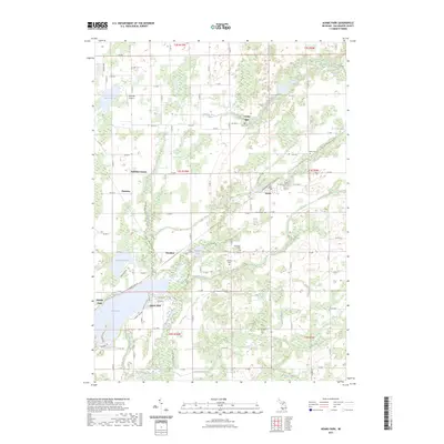 2023 Adams Park2023 Print · USGSKalamazoo County's lake-dotted countryside is captured here in the early twenty-first century, showing the enduring character of its rural townships and waterside hamlets. Genealogists and local historians can trace family roots at Cook Cem or Boughton Cem and locate homes near Indian Lake or Cooks Mill.
 - 2023 Map of Climax, 2023 Print
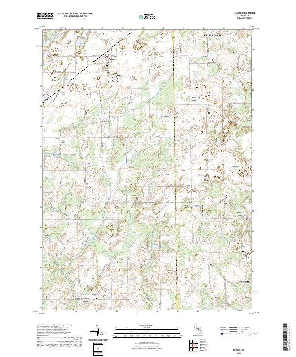 2023 Climax2023 Print · USGSKalamazoo and Calhoun counties meet here in a landscape of small farms and vital drainage systems during the early twenty-first century. Genealogists can trace family names at Prairie Home Cem, West Leroy Cem, and Gardners Corners.
 - 2023 Map of Galesburg, 2023 Print
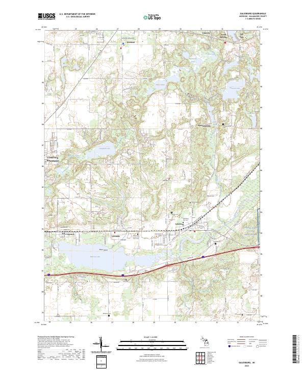 2023 Galesburg2023 Print · USGSGalesburg and the surrounding Kalamazoo County lake country are captured in this contemporary survey of the region's evolving landscape. Researchers can locate several burial sites including Kalamazoo County Poor Farm Cem, Shafter Cem, and Howlandsburg Cem.
 - 2023 Map of Augusta, 2023 Print
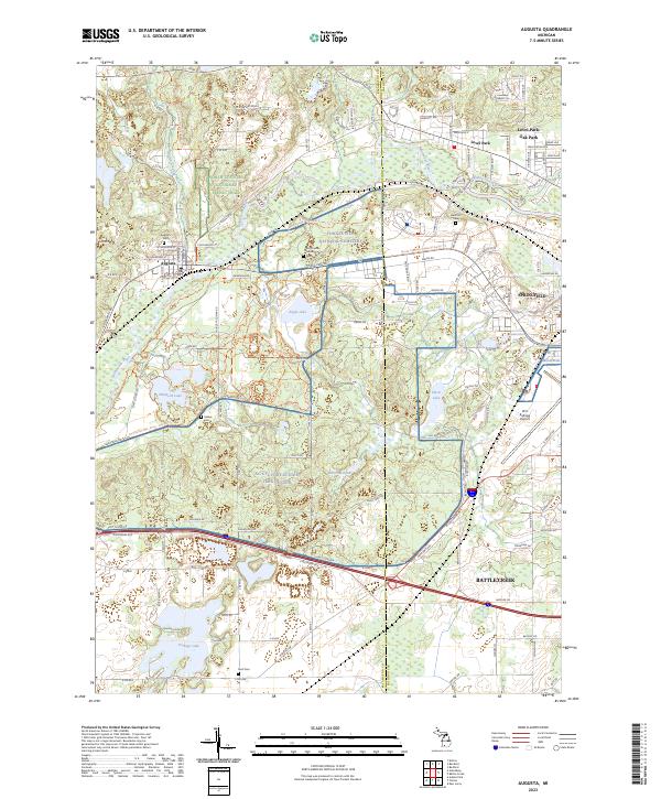 2023 Augusta2023 Print · USGSThe river valleys of Kalamazoo and Calhoun counties are shown here in the 2020s, dominated by the legacy of Fort Custer and the industry of the Battle Creek area. Researchers can locate Augusta Cem, trace the Norfolk Southern railway, or study the perimeter of the W K Kellogg Airport.
End of results
Showing maps 1-4 of 4
Top cities near Charleston Township
- Kalamazoo historical maps
- Battle Creek historical maps
- Portage historical maps
- Pavilion historical maps
- Springfield historical maps
- Prairieville historical maps
See more
Frequently asked questions
- What are the different types of historical maps available for Charleston Township?
- What is the oldest map of Charleston Township?
- Where can I purchase historical maps of Charleston Township for my home or office?
- Where can I download high-res historical maps of Charleston Township?
- Are there historical topographic maps available for Charleston Township?
- Is there historical aerial imagery available for Charleston Township?
- Where are historical maps of Charleston Township sourced from?